






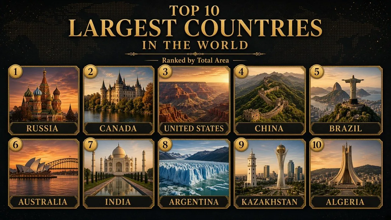
The largest countries in the world by area are Russia, Canada, the US, China and Brazil, followed by Australia, India, Argentina, Kazakhstan and Algeria. Together these ten nations cover more than half of the planet's land, yet they range from crowded India to almost empty Australia and Canada.
Size sounds like the simplest statistic in geography, but it is not. Countries measure themselves differently: some include lakes, coastal bays and territorial seas, others count only dry land, and a few include areas whose ownership is disputed. That is why one list may show China ahead of the United States while another reverses them.
This ranking uses one official source for every country so the numbers can be compared fairly: the United Nations Statistics Division's Demographic Yearbook 2024 (Table 3), which reports total surface area in square kilometres. Total area means land plus inland water such as lakes and rivers. Square-mile figures are converted from those kilometre values. Encyclopaedia Britannica's country figures are shown alongside where they differ, and World Bank land-area data (2024, based on FAO statistics) is used to show each country's share of the world's land. Population figures are 2026 projections from the IMF's World Economic Outlook database (April 2026 edition).
A note on sources: the CIA World Factbook, long the standard quick reference for country areas, was discontinued by the CIA on 4 February 2026, so it is no longer a live source. Older articles that quote it may show slightly different numbers.
The 10 Largest Countries at a Glance
| Rank | Country | Total area (km²) | Total area (mi²) | Continent | Population 2026 (IMF, millions) | People per km² |
|---|---|---|---|---|---|---|
| 1 | Russia | 17,098,246 | 6,601,670 | Europe and Asia | 143.4 | 8.4 |
| 2 | Canada | 9,984,670 | 3,855,103 | North America | 41.6 | 4.2 |
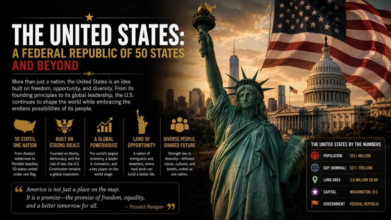
| 3 | United States | 9,833,517 | 3,796,742 | North America | 342.9 | 34.9 |
| 4 | China | 9,600,000 | 3,706,581 | Asia | 1,401.9 | 146.0 |
| 5 | Brazil | 8,510,417 | 3,285,890 | South America | 214.1 | 25.2 |
| 6 | Australia | 7,692,024 | 2,969,907 | Oceania | 28.1 | 3.7 |
| 7 | India | 3,287,263 | 1,269,219 | Asia | 1,476.6 | 449.2 |
| 8 | Argentina | 2,796,427 | 1,079,707 | South America | 47.9 | 17.1 |
| 9 | Kazakhstan | 2,724,910 | 1,052,094 | Asia (small part in Europe) | 20.6 | 7.6 |
| 10 | Algeria | 2,381,741 | 919,595 | Africa | 47.9 | 20.1 |
Sources: area from UN Demographic Yearbook 2024, Table 3; population from IMF World Economic Outlook, April 2026 (2026 projections); density calculated from those two figures.
The top ten add up to about 73.9 million km². Measured by land alone, using World Bank data, they hold roughly 54% of the world's land area. The gap after Algeria is small: the Democratic Republic of the Congo (2,345,410 km²) and Saudi Arabia (2,206,714 km²) come next in the UN table.
Total Area vs Land Area: Why Rankings Disagree
Three different measurements appear in country rankings, and mixing them causes most of the confusion.
- Total area is land plus inland water, such as lakes, reservoirs and rivers. This is the figure the UN publishes and the one used for this ranking.
- Land area is dry land only. The World Bank publishes this series, using FAO data. Countries with many lakes, such as Canada, look much smaller on this measure.
- Some national figures also include coastal waters and territorial seas. The United States is the main example, and it is the reason the US and China swap places in different lists.
The United States vs China Question
China gives its own area as about 9.6 million km², and the UN table repeats that rounded figure. Britannica lists China at 9,572,900 km².
For the United States, the UN uses 9,833,517 km². Britannica gives an even larger total of 9,866,632 km², but explains that this includes 109,645 km² of coastal water and 198,921 km² of territorial water. Remove those and the US total falls to 9,525,067 km², which is smaller than any of the figures for China.
So the order depends on whether sea areas are counted. With them, the United States is third and China fourth, as in the UN table. Without them, China is third. Britannica itself describes the US as the fourth largest country in area, after Russia, Canada and China.
Land Only: A Different Top Five
| Rank by land area | Country | Land area 2024 (km², World Bank) | Share of world land area |
|---|---|---|---|
| 1 | Russia | 16,376,870 | 12.6% |
| 2 | China | 9,388,210 | 7.2% |
| 3 | United States | 9,147,420 | 7.0% |
| 4 | Canada | 8,788,700 | 6.8% |
| 5 | Brazil | 8,358,140 | 6.4% |
| 6 | Australia | 7,688,287 | 5.9% |
| 7 | India | 2,973,190 | 2.3% |
| 8 | Argentina | 2,736,690 | 2.1% |
| 9 | Kazakhstan | 2,699,700 | 2.1% |
| 10 | Algeria | 2,381,740 | 1.8% |
Source: World Bank, indicator AG.LND.TOTL.K2 (land area), 2024 values; shares calculated against the World Bank's world total for 2023.
On land alone, Canada drops from second to fourth, because about an eighth of its total area is fresh water. China rises to second.
Disputed and Claimed Territory
Several countries on this list report areas that include territory under dispute.
- India's official figure of 3,287,263 km² covers all the territory India claims in Jammu and Kashmir and Ladakh, including areas administered by Pakistan and China.
- Argentina's UN figure (2,796,427 km²) includes islands it claims in the South Atlantic, such as the British-ruled Falkland Islands, but excludes its Antarctic claim. Britannica gives a smaller figure of 2,704,789 km².
- Russia's area figure of 17,098,246 km² does not include Crimea, which Russia annexed from Ukraine in 2014. The UN notes that Russia's population data, by contrast, include Crimea and Sevastopol.
- Australia and Argentina both claim large sectors of Antarctica. These claims are not recognised internationally and are not counted in any standard country ranking.
1. Russia
| Attribute | Details |
|---|---|
| Capital | Moscow |
| Total area | 17,098,246 km² (6,601,670 mi²), UN 2024; Britannica: 17,075,400 km² |
| Population | 143.4 million (IMF projection, 2026) |
| Continent | Europe and Asia |
| Share of world land | 12.6% (World Bank land area, 2024) |
How Big Is Russia?
Russia is in a class of its own. At just over 17 million km², it is about 1.7 times the size of Canada, the second-largest country, and larger than the whole of Antarctica. It stretches across eastern Europe and the whole of northern Asia, with a maximum east-west extent of about 9,000 km according to Britannica, and spans 11 time zones.
Landscape and Climate
Most of Russia lies at high latitudes. Arctic desert and tundra in the far north give way to the taiga, the great coniferous forest that stretches across Siberia, and then to steppe grasslands in the south. Permafrost underlies much of the country, making roads and construction difficult across much of Siberia. The Ural Mountains form the traditional boundary between European and Asian Russia.
Population and Settlement
With about 143 million people, Russia has one of the lowest population densities of any large country. Most people live in the European west, especially around Moscow and St Petersburg, while vast areas of Siberia and the Far East are almost empty.
Lesser-Known Facts
- Russia contains Lake Baikal, the world's deepest lake, and the Volga, Europe's longest river.
- Towns in northeastern Siberia such as Oymyakon and Verkhoyansk have recorded some of the coldest temperatures in the Northern Hemisphere.
- Its long Arctic coastline faces the Barents, Kara, Laptev, East Siberian and Chukchi seas.
2. Canada
| Attribute | Details |
|---|---|
| Capital | Ottawa |
| Total area | 9,984,670 km² (3,855,103 mi²), UN 2024; Britannica: 9,968,242 km² |
| Population | 41.6 million (IMF projection, 2026) |
| Continent | North America |
| Share of world land | 6.8% (World Bank land area, 2024) |
How Big Is Canada?
Canada occupies roughly the northern two-fifths of North America and is the largest country in the Western Hemisphere. It spans six time zones, from about 42° to 83° north. Its total area is second only to Russia's, but much of that total is water: Canada's countless lakes make the gap between its total area and its land area larger than that of any other country in the top ten.
Landscape and Climate
The ancient rock of the Canadian Shield, scraped by glaciers, covers much of the centre and north and is dotted with lakes. To the west lie the prairies and the Rocky Mountains; to the north the Arctic Archipelago, a maze of large islands. Long, cold winters dominate most of the country.
Population and Settlement
Canada has only about 42 million people, around 4 per km². The overwhelming majority live within about 300 km of the border with the United States, in a band that includes Toronto, Montreal and Vancouver. Much of the north is home to small Inuit and First Nations communities.
Lesser-Known Facts
- Canada and the United States share a border of 8,890 km including Alaska, the longest international border in the world.
- Canada has the longest coastline of any country, thanks to its Arctic islands.
- Nunavut, created in 1999, is Canada's newest and largest territory.
3. United States
| Attribute | Details |
|---|---|
| Capital | Washington, D.C. |
| Total area | 9,833,517 km² (3,796,742 mi²), UN 2024; Britannica: 9,866,632 km² including coastal and territorial waters |
| Population | 342.9 million (IMF projection, 2026) |
| Continent | North America |
| Share of world land | 7.0% (World Bank land area, 2024) |
How Big Is the United States?
The United States consists of 48 contiguous states in the middle of North America, plus Alaska in the far northwest and the island state of Hawaii in the Pacific. Britannica breaks its area down in unusual detail: 9,147,643 km² of land, 221,783 km² of inland water and 155,641 km² of the Great Lakes, plus coastal and territorial waters. That breakdown explains why the country ranks third in some tables and fourth in others.
Landscape and Climate
Few countries have a wider range of environments. The US runs from Arctic tundra in Alaska to tropical Hawaii, and from the Appalachian Mountains in the east across the Great Plains to the Rocky Mountains, the deserts of the Southwest and the Pacific coast ranges.
Population and Settlement
With about 343 million people, the United States is the third most populous country in the world and by far the most populous on this list after China and India. Even so, its average density of about 35 people per km² is low, because large parts of the West and Alaska are thinly settled.
Lesser-Known Facts
- Alaska alone covers 1,723,337 km², about 430 times the size of Rhode Island (4,001 km²), the smallest state.
- The country reached its present size only in the mid-20th century, when Alaska and Hawaii became states in 1959.
- Learn more about its states and system of government in Finepedia's overview of the United States.
4. China
| Attribute | Details |
|---|---|
| Capital | Beijing |
| Total area | 9,600,000 km² (3,706,581 mi²), UN 2024; Britannica: 9,572,900 km² |
| Population | 1,401.9 million (IMF projection, 2026) |
| Continent | Asia |
| Share of world land | 7.2% (World Bank land area, 2024) |
How Big Is China?
China is the largest country entirely in Asia. It occupies nearly all of the East Asian landmass, covers about one-fourteenth of the land area of Earth according to Britannica, and is almost as large as the whole of Europe. It stretches about 5,250 km from east to west.
Landscape and Climate
China's relief ranges from the highest point on Earth, on the summit of Mount Everest on the border with Nepal, to the Turpan Depression, one of the lowest places on land. The high Plateau of Tibet dominates the southwest, deserts such as the Gobi and Taklimakan fill the northwest, and the fertile, crowded plains of the east are watered by the Yangtze and the Yellow River.
Population and Settlement
China had the world's largest population for centuries until India overtook it in 2023, according to UN estimates. Most of its 1.4 billion people live in the eastern third of the country; the western plateaus and deserts are sparsely populated.
Lesser-Known Facts
- China borders 14 countries along a land frontier of about 20,000 km, and has a coastline of roughly 14,000 km.
- Despite spanning roughly five geographical time zones, the whole country officially uses a single time, Beijing Time.
- China's population trends are covered in Finepedia's article on China's demographics.
5. Brazil
| Attribute | Details |
|---|---|
| Capital | Brasília |
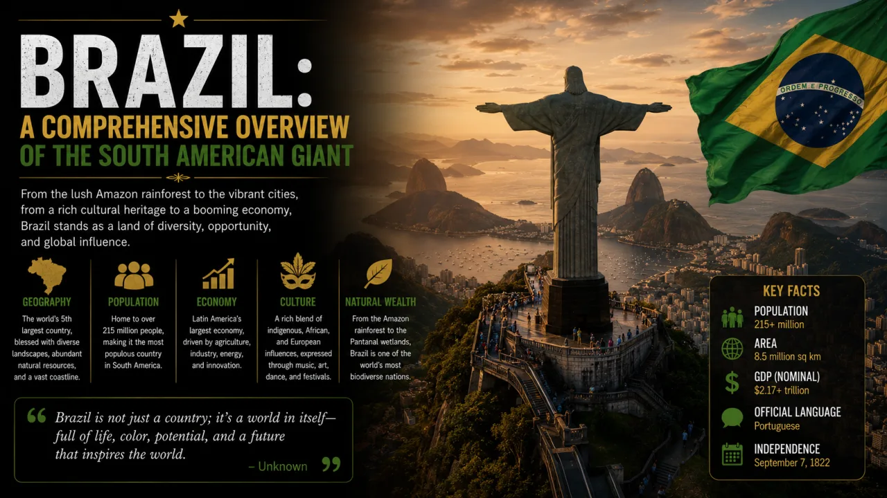
| Total area | 8,510,417 km² (3,285,890 mi²), UN 2024 |
| Population | 214.1 million (IMF projection, 2026) |
| Continent | South America |
| Share of world land | 6.4% (World Bank land area, 2024) |
How Big Is Brazil?
Brazil covers almost half of South America and is the largest country in both South America and the Southern Hemisphere. It borders ten countries, every nation in South America except Chile and Ecuador.
Landscape and Climate
The Amazon basin, the largest lowland in Latin America, covers much of the north and west. Roughly two-thirds of the Amazon River's main stream and by far the largest part of its basin lie within Brazil. The south and east rise into the Brazilian Highlands, and the Pantanal in the west is one of the world's largest tropical wetlands.
Population and Settlement
Brazil's 214 million people are concentrated along the Atlantic coast, in cities such as São Paulo and Rio de Janeiro. The capital was moved inland to the purpose-built city of Brasília in 1960 to encourage settlement of the interior. Finepedia's overview of Brazil covers the country's history and culture in more depth.
Lesser-Known Facts
- Brazil is the only country in South America whose official language is Portuguese.
- Brazil is larger than the 48 contiguous US states put together.
- Finepedia's overview of Brazil explores the country's history and culture in more depth.
6. Australia
| Attribute | Details |
|---|---|
| Capital | Canberra |
| Total area | 7,692,024 km² (2,969,907 mi²), UN 2024; Britannica: 7,688,126 km² |
| Population | 28.1 million (IMF projection, 2026) |
| Continent | Oceania |
| Share of world land | 5.9% (World Bank land area, 2024) |
How Big Is Australia?
Australia is the only country that occupies an entire continent. The mainland extends nearly 4,000 km from west to east, and the island state of Tasmania lies off its southeast corner. Its total area is about four-fifths that of the United States.
Landscape and Climate
Australia is the flattest continent and, apart from Antarctica, the driest. The arid interior known as the Outback covers most of the country, while the Great Dividing Range runs down the east and the Great Barrier Reef lies off the Queensland coast.
Population and Settlement
With about 28 million people, Australia has fewer than 4 people per km², one of the lowest densities in the world. Most Australians live in cities along the east and southeast coasts, especially Sydney and Melbourne.
Lesser-Known Facts
- Australia claims the Australian Antarctic Territory, an area larger than Australia itself, although the claim is not internationally recognised.
- The platypus and echidna, found in Australia, are the only egg-laying mammals on Earth.
- Its UN total area and its World Bank land area are almost identical, because the country has very little permanent inland water.
7. India
| Attribute | Details |
|---|---|
| Capital | New Delhi |
| Total area | 3,287,263 km² (1,269,219 mi²), UN 2024 and Britannica |
| Population | 1,476.6 million (IMF projection, 2026) |
| Continent | Asia |
| Share of world land | 2.3% (World Bank land area, 2024) |
How Big Is India?
India occupies most of South Asia and is the seventh largest country in area. It is under half as large as Australia, yet it is home to more people than any other nation. Its territory is made up of 28 states and 8 union territories.
Landscape and Climate
India has three great physical regions: the Himalayas in the north, the fertile Indo-Gangetic Plain in the middle, and the Deccan plateau in the peninsular south. It also includes two island groups: Lakshadweep in the Arabian Sea and the Andaman and Nicobar Islands in the Bay of Bengal. The monsoon dominates the climate, bringing most of the year's rain between June and September.
Population and Settlement
India became the world's most populous country in 2023, according to UN estimates. With about 1.48 billion people in 2026 on IMF figures, its average density of roughly 450 people per km² is by far the highest on this list, more than 50 times Russia's.
Lesser-Known Facts
- India shares land borders with Pakistan, China, Nepal, Bhutan, Myanmar and Bangladesh; Sri Lanka lies just across the Palk Strait to the southeast.
- For more on its states, landscapes and history, see Finepedia's article on the Republic of India.
8. Argentina
| Attribute | Details |
|---|---|
| Capital | Buenos Aires |
| Total area | 2,796,427 km² (1,079,707 mi²), UN 2024 including claimed South Atlantic islands; Britannica: 2,704,789 km² |
| Population | 47.9 million (IMF projection, 2026) |
| Continent | South America |
| Share of world land | 2.1% (World Bank land area, 2024) |
How Big Is Argentina?
Argentina covers most of the southern part of South America and is the largest Spanish-speaking country in the world by area. It is larger than Mexico and the US state of Texas put together, and it stretches from the subtropical north to the subantarctic south near Cape Horn.
Landscape and Climate
Geographers usually divide Argentina into four regions: the Andes in the west, the North with the Gran Chaco and Mesopotamia, the fertile grasslands of the Pampas, and the cold, dry plateaus of Patagonia. Aconcagua, at 6,959 m, is the highest mountain in South America.
Population and Settlement
Despite its wide-open spaces, Argentina is a highly urban country. Greater Buenos Aires is home to about a third of all Argentines, and more than 90% of the population lives in towns and cities.
Lesser-Known Facts
- Argentina's area figure changes noticeably depending on whether the South Atlantic islands it claims are counted, which is why sources differ by up to about 90,000 km².
- The country's name comes from the Latin word for silver, argentum.
9. Kazakhstan
| Attribute | Details |
|---|---|
| Capital | Astana |
| Total area | 2,724,910 km² (1,052,094 mi²), UN 2024 |
| Population | 20.6 million (IMF projection, 2026) |
| Continent | Asia, with a small area west of the Ural River in Europe |
| Share of world land | 2.1% (World Bank land area, 2024) |
How Big Is Kazakhstan?
Kazakhstan is the largest country in Central Asia and the largest landlocked country in the world. It is roughly the size of Western Europe, stretching from the Caspian Sea in the west to the Altai Mountains on the borders of China and Russia in the east.
Landscape and Climate
Most of Kazakhstan is flat steppe, semi-desert and desert, with mountains only along its southern and eastern edges. Its climate is sharply continental, with hot summers and very cold winters, especially in the north.
Population and Settlement
With about 21 million people, Kazakhstan has fewer than 8 people per km². Its largest city is Almaty in the southeast, while the capital, Astana, lies on the northern steppe.
Lesser-Known Facts
- The Baikonur Cosmodrome, from which the first human spaceflight was launched in 1961, lies in Kazakhstan and is leased to Russia.
- On some sources' figures, Kazakhstan is larger than Argentina. Britannica's figure for Argentina (2,704,789 km²) is smaller than the UN's figure for Kazakhstan, so the order of eighth and ninth depends on how Argentina is measured.
10. Algeria
| Attribute | Details |
|---|---|
| Capital | Algiers |
| Total area | 2,381,741 km² (919,595 mi²), UN 2024 |
| Population | 47.9 million (IMF projection, 2026) |
| Continent | Africa |
| Share of world land | 1.8% (World Bank land area, 2024) |
How Big Is Algeria?
Algeria is the largest country in Africa. It took that title in 2011, when South Sudan became independent and Sudan, previously Africa's largest country, was reduced in size.
Landscape and Climate
The Sahara covers most of Algeria. A narrow, fertile coastal strip along the Mediterranean is separated from the desert by the Atlas Mountains, and almost the whole population lives in this northern belt.
Population and Settlement
Algeria's 48 million people are concentrated in cities near the coast, such as Algiers and Oran. The vast southern desert is home to only small settlements and oases.
Lesser-Known Facts
- Algeria's UN total area and World Bank land area are effectively the same, because it has almost no permanent inland water.
- The Hoggar (Ahaggar) Mountains in the south rise from the middle of the Sahara.
Just Outside the Top 10
The next places in the ranking are much closer together than the top of the table, and small changes in measurement could reorder them.
| Rank | Country | Total area (km², UN 2024) | Continent |
|---|---|---|---|
| 11 | Democratic Republic of the Congo | 2,345,410 | Africa |
| 12 | Saudi Arabia | 2,206,714 | Asia |
| 13 | Mexico | 1,964,375 | North America |
| 14 | Indonesia | 1,892,410 | Asia |
Source: UN Demographic Yearbook 2024, Table 3. Sudan, usually placed around 15th, has no surface-area value in that table, so it is not ranked here.
The Democratic Republic of the Congo is only about 36,000 km² smaller than Algeria and covers most of the Congo River basin. Saudi Arabia occupies about four-fifths of the Arabian Peninsula. Indonesia is the largest country made up entirely of islands, scattered across thousands of kilometres of ocean between Asia and Australia.
What About Greenland and Antarctica?
Greenland, at 2,166,086 km² in the UN table, is the world's largest island and would rank among the top 15 countries. It is not counted because it is a self-governing territory within the Kingdom of Denmark rather than an independent country. Antarctica, at around 14 million km², is larger than every country except Russia, but under the Antarctic Treaty it belongs to no nation, and the territorial claims of seven countries are held in abeyance.
How to Picture These Sizes
Large numbers in square kilometres are hard to imagine, so comparisons help.
- Russia is larger than Antarctica and about 1.7 times the size of Canada.
- Canada, the United States and China each cover close to 10 million km², roughly the size of Europe.
- Brazil is a little larger than the 48 contiguous US states.
- India would fit into Russia about five times.
- Algeria, the smallest of the ten, is still about four times the size of France's European territory.
Map projections also distort our sense of scale. The familiar Mercator map stretches regions far from the equator, so Russia, Canada and Greenland look much larger than they are, while equatorial countries such as Brazil and the Democratic Republic of the Congo look smaller. An equal-area map or a globe gives a truer picture of how these countries compare.
India in Context
India's position as the seventh largest country hides a striking contrast. It has about 2.3% of the world's land but, on IMF figures, more people than any other country, roughly 1.48 billion in 2026.
| Measure | India | Comparison |
|---|---|---|
| Total area (UN 2024) | 3,287,263 km² | 7th in the world; about 19% of Russia |
| Population 2026 (IMF) | 1,476.6 million | 1st in the world |
| People per km² | About 449 | Russia about 8; Australia under 4 |
| Size vs Australia | 0.43 times | Australia has about 1/50th of India's population |
Two things make India's size feel larger than the number suggests. First, it is a subcontinent with enormous internal variety, from Himalayan glaciers and the Thar Desert to tropical coasts and the Western Ghats rainforests. Second, almost all of its land is usable or inhabited, unlike the Arctic expanses of Russia and Canada or the deserts of Australia and Algeria.
Readers in India sometimes see different figures for the country's area. The official figure of 3,287,263 km² includes all territory claimed by India in Jammu and Kashmir and Ladakh. Some international databases that record land only, or that exclude disputed areas, show smaller figures. India's ranking at seventh does not change on any common measure, because Argentina, in eighth place, is several hundred thousand square kilometres smaller.
Frequently Asked Questions
Which is the largest country in the world?
Russia, with a total area of 17,098,246 km² (6,601,670 mi²) according to the UN Demographic Yearbook 2024. It is about 1.7 times the size of Canada, spans 11 time zones and covers parts of both Europe and Asia.
Is the United States bigger than China?
It depends on the measurement. The UN lists the US at 9,833,517 km² and China at 9.6 million km², so the US is larger. But the US total includes coastal and territorial waters; without them, Britannica gives 9,525,067 km², which is smaller than China.
Why is Canada second by total area but fourth by land area?
Canada has an enormous number of lakes. Its total area of 9,984,670 km² includes this fresh water, but World Bank data put its land area at 8,788,700 km², behind China and the United States.
Where does India rank by area?
India is the seventh largest country, with a total area of 3,287,263 km². That is about 2.3% of the world's land, but India is home to more people than any other country, roughly 1.48 billion in 2026 according to IMF projections.
Which is the largest country in Africa?
Algeria, with 2,381,741 km². It became Africa's largest country in 2011, when South Sudan's independence reduced the size of Sudan. The Democratic Republic of the Congo is a close second at 2,345,410 km².
What is the largest landlocked country?
Kazakhstan, the ninth largest country overall at 2,724,910 km². It has a coastline only on the Caspian Sea, which is a landlocked body of water with no natural outlet to the ocean.
How much of the world's land do the 10 largest countries cover?
About 54% of the world's land area, using World Bank land-area figures for 2024. Russia alone accounts for about 12.6%.
Conclusion
The world's ten largest countries are Russia, Canada, the United States, China, Brazil, Australia, India, Argentina, Kazakhstan and Algeria. Russia is far ahead of everyone else, while the next four are bunched closely together, and the order of the United States and China changes with the definition used.
The bigger lesson is that area is not a single, fixed number. Lakes, territorial seas and disputed borders all affect the result, so it is worth checking which measure a list uses. Size also tells you little about how people live: Canada and Australia are vast and nearly empty, while India packs more people into a smaller space than any other country on Earth. Area is only one way to rank nations; Finepedia's guides to the richest countries in the world and the nations richest in natural resources look at others.
- United Nations Statistics Division, Demographic Yearbook 2024, Table 3: Population by sex, annual rate of population change, surface area and density. https://unstats.un.org/unsd/demographic-social/products/dyb/documents/DYB2024/table03.pdf
- World Bank, World Development Indicators: Land area (sq. km), AG.LND.TOTL.K2 (FAO data), accessed October 2026. https://data.worldbank.org/indicator/AG.LND.TOTL.K2
- International Monetary Fund, World Economic Outlook database, April 2026: Population (LP), 2026 projections. https://www.imf.org/external/datamapper/LP@WEO
- Encyclopaedia Britannica, country articles: Russia, Canada, United States, China, Australia, India, Argentina (Facts and Stats sections), accessed October 2026. https://www.britannica.com/place/United-States
- CIA, "Spotlighting The World Factbook as We Bid a Fond Farewell", 4 February 2026. https://www.cia.gov/stories/story/spotlighting-the-world-factbook-as-we-bid-a-fond-farewell










Log in with