






 By
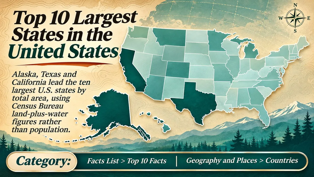
The ten largest states in the United States are ranked here by total area, land plus inland and coastal water, using Census Bureau measurements. That is a different question from population, which Finepedia already treats in a separate list of the largest states by population, and it is also different from land area alone, which rearranges a few of the lower ranks [1][2].
The figures below follow the Census Bureau's state area measurements as conventionally compiled in square miles and square kilometres, including the totals used in standard reference tables in 2026 [1][2]. Total area is the ranking statistic. Land-area columns can differ slightly between Census vintages, because the Bureau has more than one way of classifying inland, coastal and Great Lakes water, so those land figures should be read as the published companion values, not as a second official rank [1]. A few water-rich states, notably Michigan, look much larger on a total-area ranking than they do on a land-only ranking, which is why the method has to be stated at the top [2].
Key Facts
Total area means land plus water as the Census Bureau defines those categories. Ranks are for the 50 states only. The District of Columbia and the territories are not included.
Largest States by Total Area at a Glance
| Rank | State | Total area (sq mi) | Total area (km2) | Land area (sq mi) | Note |
|---|---|---|---|---|---|
| 1 | Alaska | 665,384 | 1,723,337 | 588,000 (approx., see text) | More than twice Texas; a large share is water |
| 2 | Texas | 268,596 | 695,662 | 261,232 | The largest state in the contiguous United States |
| 3 | California | 163,695 | 423,967 | 155,779 | Third in total area; first in population among these ten |
| 4 | Montana | 147,040 | 380,831 | 145,546 | The largest state wholly east of the continental divide's usual popular geography, in the northern Rockies and plains |
| 5 | New Mexico | 121,590 | 314,917 | 121,298 | Almost all land; very little inland water |
| 6 | Arizona | 113,990 | 295,234 | 113,594 | Desert and plateau, with little water area |
| 7 | Nevada | 110,572 | 286,380 | 109,781 | Basin and Range country; seventh by a clear margin |
| 8 | Colorado | 104,094 | 269,601 | 103,642 | A compact, nearly rectangular state |
| 9 | Oregon | 98,379 | 254,799 | 95,988 | Ninth in total area; tenth if only land is counted |
| 10 | Wyoming | 97,813 | 253,335 | 97,093 | Tenth in total area; ninth by land area, just ahead of Oregon |
1. Alaska
Alaska is first by a wide margin. Its total area of 665,384 square miles, about 1,723,337 square kilometres, is more than twice that of Texas and about 17.5 percent of the area of the 50 states [1][2]. A substantial part of that total is water. Published land-area figures for Alaska are in the high five hundred thousands of square miles, with tens of thousands of square miles of inland and coastal water around the islands, inlets and Arctic shore, depending on the Census vintage [1][2].
The state was admitted in 1959, which is why it also appears near the top of a list of the last states to join the Union. Size and late admission are related only in the sense that the purchase and later territory covered a huge, thinly settled land mass [3]. For this ranking, the only fact that matters is the measured area.
No other state is even close. Anyone who is used to wall maps that shrink Alaska should still treat the Census total as the correct comparison [1][2].
2. Texas
Texas is the largest state in the contiguous United States, at 268,596 square miles, or about 695,662 square kilometres [1][2]. Almost all of that total is land. The water share is modest compared with Alaska or the Great Lakes states, which is why Texas also ranks second by land area.
It is second here, not first, only because Alaska exists. Within the lower 48, Texas is the usual first answer to "largest state," and that everyday usage is correct if the speaker means the contiguous United States [2].
The contrast with California is useful. California is far more populous, but it is much smaller in area. Area and population do not travel together on this list [1][4].
Related: Top 10 Largest US States by Area
3. California
California's total area is 163,695 square miles, about 423,967 square kilometres, including a larger water share than Texas because of coastal and inland waters [1][2]. The land area, about 155,779 square miles, still places California third on both measures.
It is the only state in this ten that is also among the most populous in the country. That combination, a large area and a very large population, is unusual on a list otherwise dominated by sparsely settled Western states [4].
The state's north-south length, from the Oregon line to Mexico, is part of why the area is so large, but the official rank rests on the Census total, not on a driving distance [1].
4. Montana
Montana covers 147,040 square miles, about 380,831 square kilometres, which puts it fourth, well behind California and well ahead of New Mexico [1][2]. It is mostly land: the water area is only about 1,494 square miles.
The state stretches from the Northern Rockies to the northern Great Plains, and that geographic spread, not a single famous basin, is what adds up to fourth place. Population remains comparatively small, which is a reminder that this list is not a measure of economic weight [4].
Montana is fourth on both total area and land area. There is no method quirk hiding in the rank [1][2].
5. New Mexico
New Mexico's total area is 121,590 square miles, about 314,917 square kilometres. Only a few hundred square miles of that total are water, so the land area, about 121,298 square miles, is almost the same figure [1][2].
Related: Top 10 Largest US States by Population
That dry total is why New Mexico ranks fifth so comfortably. It is larger than Arizona, Nevada and Colorado, even though those neighbours are also large Western rectangles on the map [2].
The state is also one of the last two admitted in the contiguous United States, in 1912, a fact that belongs to the admission-date list rather than to this one [3].
6. Arizona
Arizona has a total area of 113,990 square miles, about 295,234 square kilometres, and a land area only slightly smaller [1][2]. Like New Mexico, it has little inland water compared with its desert and plateau land.
It is sixth, between New Mexico and Nevada, on both total and land area. The Grand Canyon and the Colorado River are famous features, but they do not add a Michigan-style water bonus to the official total [2].
Arizona was admitted on 14 February 1912, the last of the lower 48. Again, that is an admission fact, not an area fact [3].
7. Nevada
Nevada's total area is 110,572 square miles, about 286,380 square kilometres [1][2]. It is seventh, close behind Arizona and clearly ahead of Colorado.
The state is a classic Basin and Range landscape, with many interior basins and a large share of federally managed land, but the ranking uses the legal state boundary, not the pattern of settlement. Las Vegas and the northern cities occupy only a small part of the area [2].
Related: Top 10 Largest Countries in the World by Area
Nevada, like its neighbours, is mostly land in the Census sense. Water area does not change its place in the ten [1].
8. Colorado
Colorado covers 104,094 square miles, about 269,601 square kilometres, and is eighth [1][2]. Its boundaries are close to a rectangle of meridians and parallels, which makes the area easy to picture and comparatively compact among Western states.
The land area is about 103,642 square miles. Eighth place is stable under both methods. The high mean elevation of the state is a different record, and it is not used here [2].
Colorado sits just above the point where two states, Oregon and Wyoming, change order if water is excluded [1][2].
9. Oregon
Oregon's total area is 98,379 square miles, about 254,799 square kilometres, which is enough for ninth place when water is included [1][2]. The land area is about 95,988 square miles, slightly less than Wyoming's land area, so Oregon and Wyoming swap places on a land-only list.
The extra water is real: coastal waters and inland lakes and rivers are part of the Census total. That is the main methodological lesson in the bottom of this ten. A list that says only "largest states" without defining total versus land will quietly change ninth and tenth [1][2].
Related: Top 10 Largest Islands in the World
Oregon remains a large Pacific state either way. The swap with Wyoming is a close one, not a jump of several ranks [2].
10. Wyoming
Wyoming's total area is 97,813 square miles, about 253,335 square kilometres, which places it tenth on the total-area ranking used here [1][2]. Its land area, about 97,093 square miles, is slightly larger than Oregon's land area, so Wyoming is ninth if water is left out.
It is the smallest of the ten, but it is still larger than Michigan by total area only narrowly, and much larger than Michigan by land area. Michigan's huge Great Lakes water area puts it eleventh in total area, at about 96,714 square miles, just behind Wyoming, which is why it is mentioned here and not in the table [1][2].
Tenth place is therefore both a fact and a reminder to read the method. Change the definition, and the last two names trade, while Michigan stays just outside the ten on total area [2].
Conclusion
The ten largest U.S. states by total area, as of the Census Bureau measurements used in 2026 references, are Alaska, Texas, California, Montana, New Mexico, Arizona, Nevada, Colorado, Oregon and Wyoming [1][2]. The first eight keep their places if only land is counted. Oregon and Wyoming trade ninth and tenth.
This is not a population list and not a list of the largest economies. Several of these states have small populations relative to their area. For population ranks, use the Finepedia article that is built on that measure [4]. For admission dates, including Alaska and the last lower-48 states, use the companion list of the last states to join the Union [3]. Anyone comparing a road atlas, a school wall map and a statistical table should expect Alaska to be the one that looks wrong on the wall, because many maps inset or scale it down; the Census total is still the figure to use when the question is simply which state covers the most ground and water. The same caution applies at the other end of the ten: Oregon and Wyoming are so close that a different treatment of coastal and inland water is enough to swap them, while Michigan remains just outside the list on total area and far outside it on land area. A careful 2026 summary is therefore the ranked totals, plus a one-line note on those two method effects, rather than a single column copied without a definition, and that is the form this article is meant to be used in.
- ^ [1] U.S. Census Bureau, state area measurements and 2020 geography information (land and water area). Census Bureau: State Area Measurements
- ^ [2] "List of U.S. states and territories by area", compiling Census total, land and water area. Wikipedia. Wikipedia: states and territories by area
- ^ [3] Official state admission dates, summarized in "List of U.S. states by date of admission to the Union". Wikipedia / official enabling acts. Wikipedia: admission dates
- ^ [4] U.S. Census Bureau population estimates and the Finepedia population ranking of states. Census Bureau


















Discussion
Log in with