






 By
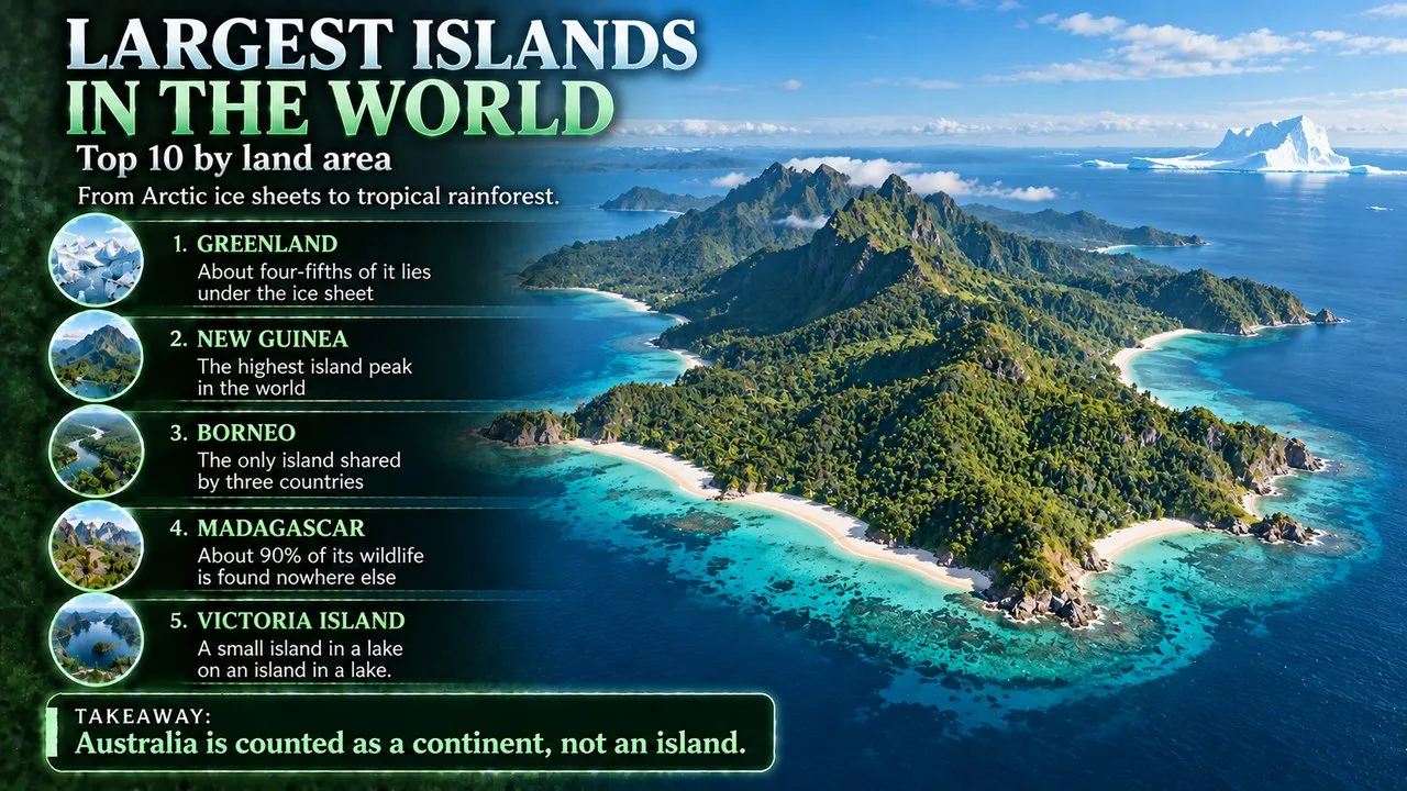
The largest islands in the world are led by Greenland, a frozen Arctic land of about 2.1 million square kilometres, followed by New Guinea, Borneo, Madagascar and Baffin Island.[1] Together the top 10 include an ice-covered territory of Denmark, rainforests shared by three countries, one of the richest wildlife islands on Earth and Japan's crowded main island.[2][4][5][8] This Finepedia list, updated in October 2026, ranks the top 10 largest islands in the world by area and explains where each one is, who lives there and what makes it stand out.
Introduction
Islands range from rocks barely big enough to stand on to landmasses larger than many countries. The ten biggest are vast enough to hold mountain ranges, rainforests, ice sheets and whole nations. Some, such as Greenland and Ellesmere Island, are almost empty of people, while others, such as Honshu and Great Britain, are home to tens of millions.[1][8][10]
The list below takes each island in turn, from largest to smallest. For every entry it gives the size and location of the island, the people who live there and the landscape or wildlife that makes it distinctive, using the island's own encyclopedia entry as the main source.[1]
How This List Is Ranked
An island is a piece of land, distinct from a continent, completely surrounded by water.[12] Mainland Australia is surrounded by water too, but it is more than three times the size of Greenland and is usually counted as a continent, so it is left out, as are the other continental landmasses.[1]
Islands are ranked by the area of the main island alone, using the figures in Wikipedia's list of islands by area.[1] Different sources measure coastlines, glaciers and offshore islets in different ways, so the figures on individual island pages sometimes differ from the list. New Guinea's own page, for example, gives 785,753 square kilometres, while the list gives 773,751.[1][3] These differences do not change the order of the top 10.
Key Facts
| Rank | Island | Area (km2) | Country or countries |
|---|---|---|---|
| 1 | Greenland | 2,108,459 | Denmark (autonomous territory) |
| 2 | New Guinea | 773,751 | Indonesia, Papua New Guinea |
| 3 | Borneo | 723,154 | Brunei, Indonesia, Malaysia |
| 4 | Madagascar | 592,521 | Madagascar |
| 5 | Baffin Island | 507,205 | Canada |
| 6 | Sumatra | 428,134 | Indonesia |
| 7 | Honshu | 228,296 | Japan |
| 8 | Victoria Island | 219,191 | Canada |
| 9 | Great Britain | 218,635 | United Kingdom |
| 10 | Ellesmere Island | 197,790 | Canada |
1. Greenland
Greenland is the world's largest island and lies between the Arctic and Atlantic oceans, east of the Canadian Arctic Archipelago.[2] The main island covers about 2,108,459 square kilometres, and the total including minor offshore islands is 2,166,086 square kilometres.[1][2] It shares a small 1.2 km border with Canada on Hans Island, and Kaffeklubben Island off its northern coast is the world's northernmost undisputed point of land.[2]
Greenland is an autonomous territory of the Kingdom of Denmark, and its capital and largest city is Nuuk.[2] With a population of 56,583 in 2022, it is the least densely populated country in the world, and most people live on the southwest coast.[2] Denmark granted home rule after a 1979 referendum, and the 2008 self-government referendum transferred more power to the Greenlandic government, while Denmark keeps control of citizenship, monetary policy, security and foreign affairs.[2]
The Greenland ice sheet covers 1,755,637 square kilometres, 81 percent of the territory, and has a volume of about 2,850,000 cubic kilometres.[2] The island has been inhabited at intervals for at least 4,500 years by circumpolar peoples from what is now Canada.[2] According to the Icelandic sagas, Erik the Red named it Greenland, supposedly hoping the pleasant name would attract settlers, and Norse settlers lived there for about 400 years before disappearing in the late 15th century.[2]
2. New Guinea
New Guinea is the world's second-largest island and lies in Melanesia in the southwestern Pacific.[3] It is separated from Australia by the 150 km wide Torres Strait; the two sit on the same continental shelf and were joined as the landmass of Sahul when sea levels were low during the Pleistocene.[3] The eastern half is the main land mass of Papua New Guinea, and the western half, Western New Guinea, is part of Indonesia.[3]
About fifteen million people live on the island, in almost a thousand tribal groups speaking a near-equal number of languages, making New Guinea the most linguistically diverse area in the world.[3] Its two major cities are Port Moresby and Jayapura.[3] The Spanish explorer Yñigo Ortiz de Retez gave the island its name in 1545.[3]
Related: Top 10 Largest Countries in the World by Area
New Guinea has the third-largest remaining rainforest in the world and the highest plant biodiversity of any island.[3] The western half contains the highest mountains in Oceania, topped by Puncak Jaya at 4,884 metres.[3] Of its 284 mammal species, 195, or 69 percent, are endemic, and its shape is often compared to that of a bird-of-paradise, a bird native to the island.[3]
3. Borneo
Borneo lies at the geographic centre of Maritime Southeast Asia, north of Java, west of Sulawesi and east of Sumatra, and the equator divides it roughly in half.[4] It is the only island on this list shared by three countries: Indonesia, whose part is known as Kalimantan, Malaysia and Brunei.[4] Its own page gives its area as 748,168 square kilometres, with a population of 23,053,723 in the 2020 censuses.[4]
Borneo has been inhabited for tens of thousands of years and is home to hundreds of Indigenous communities, many traditionally grouped under the term "Dayak".[4] By the first millennium CE its trading settlements were linked to regional sea networks, and in the 15th century the Sultanate of Brunei held influence over much of the coast.[4]
Borneo has seven ecoregions, including some of the oldest tropical rainforests in the world.[4] Its rainforest is one of the few remaining natural habitats of the endangered Bornean orangutan, which declined by 148,500 individuals between 1999 and 2015.[4] Its highest point is Mount Kinabalu in Sabah, Malaysia, at 4,095 metres.[4]
4. Madagascar
Madagascar lies in the Indian Ocean off the southeastern coast of Africa and is the world's fourth-largest island and the second-largest island country.[5] Its capital and largest city is Antananarivo.[5] After the breakup of Gondwana, Madagascar split from Africa about 180 million years ago and from the Indian subcontinent about 90 million years ago.[5] This long isolation let its plants and animals evolve in seclusion, and more than 90 percent of its wildlife is endemic, making it one of the world's 17 megadiverse countries.[5] As of 2012 there were officially 103 species and subspecies of lemur, and at least 17 lemur species, all larger than the surviving ones, have become extinct since humans arrived.[5]
Austronesian peoples first settled the island permanently around 500 to 700 CE, probably arriving by outrigger canoe from present-day Indonesia, and Bantu groups from East Africa joined them around the ninth century.[5] There are 18 or more classified peoples of Madagascar, the most numerous being the Merina of the central highlands.[5] France annexed the island in 1897, and Madagascar gained independence in 1960.[5]
5. Baffin Island
Baffin Island, in the Canadian territory of Nunavut, is the largest island in Canada, the second-largest in the Americas after Greenland and the fifth-largest in the world, with an area of 507,204.95 square kilometres.[6] Its population was 13,039 in the 2021 census.[6] Iqaluit, the capital of Nunavut, lies on Frobisher Bay at the island's southern tip.[6]
The Inuktitut name for the island, Qikiqtaaluk, means "very big island".[6] It has been inhabited for more than 3,000 years, first by the pre-Dorset, then the Dorset and then the Thule people, ancestors of the Inuit, who have lived there for the last thousand years.[6] The English seaman Martin Frobisher landed in 1576, and Norse explorers are believed to have called the island Helluland, "stone land".[6]
Related: Top 10 Nations with the Longest Coastlines
The highest peak is Mount Odin, at least 2,143 metres high, and Mount Asgard in Auyuittuq National Park reaches 2,011 metres.[6] The Mary River iron ore mine began operating in 2015.[6]
6. Sumatra
Sumatra is the largest island entirely within Indonesia.[7] Its own page gives 482,286.55 square kilometres, a figure that includes adjacent islands such as Nias, the Mentawai Islands, Bangka and Belitung; the main island alone is about 428,134 square kilometres.[1][7] The Strait of Malacca separates it from the Malay Peninsula, and the Sunda Strait separates it from Java.[7]
About 62,259,500 people lived on Sumatra in mid-2025, making it the fifth-most populous island in the world, and Medan is its largest city.[7] The Bukit Barisan mountains, with several active volcanoes, run along almost its entire length.[7]
Many of Sumatra's animals are critically endangered, including the Sumatran tiger, Sumatran elephant, Sumatran rhinoceros and Sumatran orangutan.[7] Lake Toba is the site of a supervolcanic eruption around 74,000 years ago that temporarily changed Earth's climate.[7] The island was heavily affected by the 1883 Krakatoa eruption and by the 2004 Indian Ocean earthquake and tsunami, which struck Aceh province on 26 December 2004.[7]
7. Honshu
Honshu is the largest of Japan's four main islands, lying between the Pacific Ocean to the east and the Sea of Japan to the west.[8] It is roughly 1,300 km long and 50 to 230 km wide.[8] Its name means "main province", and it was historically known as Akitsushima, "dragonfly island".[8]
Honshu had 100.7 million people in 2025, 81.9 percent of Japan's population, making it the second-most populous island in the world after Java.[8] About 30 percent of its people live in the Greater Tokyo Area on the Kantō Plain, and the island includes past capitals such as Kyoto, Nara and Kamakura.[8] Most of Japan's industry runs in a belt along its southern coast from Tokyo to Nagoya, Kyoto, Osaka, Kobe and Hiroshima.[8]
Honshu contains Japan's highest mountain, Mount Fuji, and its largest lake, Lake Biwa.[8] The island is mountainous and volcanic and has frequent earthquakes, such as the Great Kantō earthquake of 1923 and the earthquake of March 2011.[8]
Related: Top 10 Island Countries Worth Visiting
8. Victoria Island
Victoria Island lies in the Arctic Archipelago and straddles the boundary between Nunavut and the Northwest Territories.[9] At 219,191.31 square kilometres it is Canada's second-largest island and the eighth-largest in the world, just double the size of Newfoundland and slightly larger than Great Britain.[9]
Its 2,168 people live in two settlements, Cambridge Bay in Nunavut and Ulukhaktok in the Northwest Territories.[9] The island is named after Queen Victoria.[9] In 1839 Peter Warren Dease and Thomas Simpson followed its southeast coast and called it "Victoria Land", and in 1851 John Rae charted its entire south coast.[9] Its southern waterways form part of the disputed Northwest Passage, which Canada claims as internal waters.[9] The island's highest point is 655 metres, in the Shaler Mountains in the north-central region.[9]
9. Great Britain
Great Britain lies in the North Atlantic off the north-west coast of continental Europe and contains England, Scotland and Wales.[10] It is the largest of the British Isles and the largest European island.[10] Its own page gives an area of 209,331 square kilometres, while the list of islands by area gives 218,634.50; either way it ranks ninth.[1][10]
Great Britain was connected to mainland Europe by a land bridge now called Doggerland until about 9,000 years ago, and modern humans have lived there for around 30,000 years.[10] In 2011 it had about 61 million people, making it the third-most-populous island in the world after Java and Honshu, and the most populated island outside Asia.[10] Since 1993 it has been joined to continental Europe by the Channel Tunnel, the longest undersea rail tunnel in the world.[10]
10. Ellesmere Island
Ellesmere Island is Canada's northernmost and third-largest island and the tenth-largest in the world, at 197,790.33 square kilometres.[11] It is 830 km long and is part of the Queen Elizabeth Islands.[11] Cape Columbia on its north coast is the northernmost point of land in Canada.[11]
In 2021 only 144 people lived on Ellesmere, in three settlements: Alert, Eureka and Grise Fiord.[11] The Inuit of Baffin Island and northern Greenland called it Umingmak Nuna, "land of muskoxen".[11] The Arctic Cordillera makes it the most mountainous island in the Arctic Archipelago, and more than a fifth of it is protected as Quttinirpaaq National Park.[11] As of 2025, the north geomagnetic pole was located on the island.[11]
What the Largest Islands Have in Common
Islands can be continental, split from a continent by plate tectonics, or oceanic, never part of a continent.[12] Continental islands share plants and animals with the land they split from, but the longer they have been separate, the more their wildlife diverges.[12] Madagascar shows this most clearly: after about 90 million years apart, more than 90 percent of its wildlife is endemic.[5]
Related: Top 10 Least Densely Populated Countries
Several islands on the list were joined to the mainland during the last ice age, when sea levels were lower. New Guinea was part of Sahul with Australia, Borneo was part of Sundaland connected to mainland Asia, and Great Britain was joined to Europe by Doggerland.[3][4][10] Four of the ten, Greenland, Baffin, Victoria and Ellesmere, lie in the Arctic, where few people live.[2][6][9][11] By contrast, Honshu, Great Britain and Sumatra are among the most populous islands on Earth.[7][8][10]
Records at a Glance
- Largest island: Greenland, about 2,108,459 square kilometres for the main island.[1]
- Greenland's ice sheet: 81 percent of its area.[2]
- Least densely populated country: Greenland, with 56,583 people in 2022.[2]
- Most linguistically diverse area: New Guinea, with almost a thousand languages.[3]
- Only island shared by three countries in the top 10: Borneo.[4]
- Madagascar's endemic wildlife: more than 90 percent.[5]
- Most populous island in the top 10: Honshu, 100.7 million in 2025.[8]
- Smallest population in the top 10: Ellesmere Island, 144 in 2021.[11]
- Australia: more than three times the size of Greenland, counted as a continent.[1]
Frequently Asked Questions
What is the largest island in the world?
Greenland, with a main island area of about 2.1 million square kilometres.[1]
Why is Australia not on the list?
Mainland Australia is usually classed as a continent rather than an island, so it is listed with the continental landmasses for comparison.[1]
What is the second largest island in the world?
New Guinea, shared by Indonesia and Papua New Guinea.[3]
Which large island is shared by three countries?
Borneo, divided between Indonesia, Malaysia and Brunei.[4]
What is the largest island in Europe?
Great Britain, the ninth-largest island in the world.[10]
Which is the most populated large island?
Of the top 10, Honshu has the most people, 100.7 million in 2025, though Java is more populous still.[8]
Why do island areas differ between sources?
Sources measure coastlines, glaciers and nearby islets differently. Sumatra's own figure, for example, includes adjacent islands.[1][7]
Conclusion
The ten largest islands in the world cover a remarkable range of places. Greenland, Baffin, Victoria and Ellesmere are mostly ice, tundra and mountains, with only a few thousand people between them outside Greenland's southwest coast.[2][6][9][11] New Guinea, Borneo and Sumatra hold some of the largest remaining tropical rainforests and many species found nowhere else, while Madagascar's long isolation has made it one of the most biologically distinct places on Earth.[3][4][5][7]
At the other extreme, Honshu and Great Britain are among the most densely settled islands, with great cities, industry and long political histories.[8][10] The exact areas vary from source to source, depending on how coastlines, glaciers and nearby islets are counted, but the order of the top 10 stays the same.[1] Whether ranked by size, people or wildlife, these islands show how much of the world's geography and history has been shaped by land surrounded by sea.
See also
- ^ [1] "List of islands by area". Wikipedia. Wikipedia
- ^ [2] "Greenland". Wikipedia. Wikipedia
- ^ [3] "New Guinea". Wikipedia. Wikipedia
- ^ [4] "Borneo". Wikipedia. Wikipedia
- ^ [5] "Madagascar". Wikipedia. Wikipedia
- ^ [6] "Baffin Island". Wikipedia. Wikipedia
- ^ [7] "Sumatra". Wikipedia. Wikipedia
- ^ [8] "Honshu". Wikipedia. Wikipedia
- ^ [9] "Victoria Island (Canada)". Wikipedia. Wikipedia
- ^ [10] "Great Britain". Wikipedia. Wikipedia
- ^ [11] "Ellesmere Island". Wikipedia. Wikipedia
- ^ [12] "Island". Wikipedia. Wikipedia

















Discussion
Log in with