









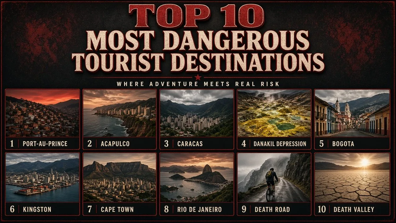
The most dangerous tourist destinations in the world range from gang-held Port-au-Prince and Acapulco to Bolivia's Death Road and the Danakil Depression.
Most trips carry small, everyday risks: a lost wallet, an upset stomach or a missed connection. A handful of places are different. In some, armed groups control whole neighbourhoods and kidnapping is a business. In others, the danger comes from the land itself, with heat that can kill in hours or a road that drops into a gorge with no barrier at the edge. Many of these places are also beautiful, historic and genuinely loved by the people who live there, which is exactly why travellers keep going.
This guide ranks ten high-risk places that still draw visitors, as of October 2026. For each one you will find a Quick Facts table, a short history, what makes it risky, why it matters and a few facts that surprise most readers. Safety levels change fast, so always check your own government's latest travel advice before booking anything.
How We Ranked the Most Dangerous Tourist Destinations
There is no official world ranking of dangerous holiday spots, and crime figures from different countries are rarely comparable. Instead, this list weighs three things:
- The current U.S. Department of State travel advisory for the country or region, checked in October 2026. Level 4 means "Do not travel", Level 3 means "Reconsider travel", Level 2 means "Exercise increased caution" and Level 1 means normal precautions.
- The type of danger visitors actually face, from kidnapping and armed robbery to extreme heat and vertical drops.
- Whether the place still attracts tourists. A war zone with no visitors is dangerous, but it is not a tourist destination, so active battlefields are left out.
Ranks 1 to 8 are places where the main threat is crime, unrest or a mix of crime and natural hazards. Ranks 9 and 10 are destinations where nature, not people, is the hazard. Within each group, places with stricter official warnings rank higher.
Most Dangerous Tourist Destinations in the World at a Glance
| No. | Destination | Country | Main danger | U.S. advisory (Oct 2026) |
|---|---|---|---|---|
| 1 | Port-au-Prince | Haiti | Gang violence, kidnapping, stray gunfire | Level 4: Do not travel |
| 2 | Acapulco | Mexico | Cartel violence, kidnapping, hurricanes | Level 4 for Guerrero state |
| 3 | Caracas | Venezuela | Violent crime, kidnapping, weak health care | Level 3: Reconsider travel |
| 4 | Danakil Depression | Ethiopia | Extreme heat, toxic gases, regional conflict | Level 3 for Ethiopia |
| 5 | Bogotá | Colombia | Robbery, drugging, express kidnapping | Level 3: Reconsider travel |
| 6 | Kingston | Jamaica | Gun crime in some districts, storms | Level 2: Increased caution |
| 7 | Cape Town | South Africa | Armed robbery, gang violence on the Cape Flats | Level 2: Increased caution |
| 8 | Rio de Janeiro | Brazil | Street robbery, shootouts near favelas | Level 2: Increased caution |
| 9 | North Yungas Road | Bolivia | Sheer drops, landslides, fog | Level 2: Increased caution |
| 10 | Death Valley | United States | Lethal summer heat, remote terrain | Not applicable (U.S. national park) |
1. Port-au-Prince, Haiti
| Attribute | Details |
|---|---|
| Location | Capital of Haiti, on the Gulf of Gonâve, Caribbean |
| Former draws | Iron Market, Champ de Mars, art galleries, gateway to the Citadelle Laferrière |
| Main danger | Armed gangs, kidnapping for ransom, random gunfire |
| Official advice | U.S. Level 4: Do not travel (issued July 2026) |
| Special status | National state of emergency in force since March 2024 |
Origins and History
Port-au-Prince was founded by French colonists in 1749 and became the capital of the world's first Black-led republic after Haiti won independence in 1804. For much of the 20th century it was a lively Caribbean city known for its painters, its music and its crowded markets. The magnitude 7.0 earthquake of 12 January 2010 destroyed large parts of the city, including the National Palace and the cathedral, and the country never fully recovered. The assassination of President Jovenel Moïse in July 2021 left a power vacuum that armed groups were quick to fill.
Why It Is So Dangerous
- Armed gangs control or contest large parts of the capital and the roads leading out of it.
- The U.S. State Department says kidnapping is widespread, with ransom demands that typically run from tens of thousands to hundreds of thousands of dollars.
- Fighting between armed groups has caused stray-bullet deaths among people who had nothing to do with the violence.
- Vigilante groups have attacked and killed people, including U.S. citizens, on the basis of rumours that they belonged to gangs.
- U.S. airlines are barred from flying to Port-au-Prince under an aviation notice, and hospitals lack trained staff and basic supplies.
Significance
Port-au-Prince shows how quickly a city can move from difficult to off-limits. A decade ago, adventurous travellers still passed through on their way to the north coast and the mountain fortress of the Citadelle Laferrière, a UNESCO World Heritage Site since 1982. Today even embassy staff are not allowed to leave their compound for non-essential reasons, and some Haitian gangs are designated as terrorist organisations by the U.S. government.
Interesting Facts
- The Citadelle Laferrière, built after independence to guard against a French return, is one of the largest fortresses in the Americas.
- Haitian naive painting, much of it sold in Port-au-Prince galleries, became internationally collected from the 1940s onward.
- There is no functional national emergency phone line in Haiti, according to U.S. consular guidance.
2. Acapulco, Mexico
| Attribute | Details |
|---|---|
| Location | Pacific coast, state of Guerrero, southern Mexico |
| Famous for | La Quebrada cliff divers, Acapulco Bay, Hollywood-era glamour |
| Main danger | Cartel and gang violence, kidnapping, extortion |
| Official advice | Guerrero state is U.S. Level 4: Do not travel (May 2026) |
| Natural hazard | Hurricane Otis struck as a Category 5 storm in October 2023 |
Origins and History
Acapulco was a Spanish colonial port for more than 250 years, the Mexican end of the Manila galleon trade that carried silver to Asia and silks and spices back. In the 1950s and 1960s it reinvented itself as the playground of film stars and politicians. John and Jacqueline Kennedy honeymooned there in 1953, and the bay's high-rise hotels became a symbol of jet-set Mexico. From the late 2000s, rival criminal groups fighting over drug routes and local extortion rackets turned the resort into one of the most violent cities in the country.
Why It Is So Dangerous
- The U.S. State Department lists the whole state of Guerrero as Level 4 and bars its own employees from visiting any part of it, including Acapulco, Zihuatanejo, Taxco and Ixtapa.
- Armed groups maintain roadblocks in parts of the state and may use violence against travellers.
- U.S. citizens and permanent residents have been kidnapped in Guerrero.
- Most killings target people linked to criminal groups, but shootings have also hurt bystanders.
- The coast is exposed to Pacific hurricanes. Hurricane Otis grew from a tropical storm to a Category 5 hurricane in less than a day before hitting Acapulco on 25 October 2023, killing dozens of people and wrecking most of the hotel zone.
Significance
Acapulco is the clearest example of a famous holiday name that has slipped down the list of safe choices. Domestic tourists from Mexico City still visit in large numbers, especially on holiday weekends, and many hotels have reopened since Otis. Foreign visitors, however, have largely shifted to Mexican resorts with lower official risk ratings, such as the Yucatán and Campeche, which the State Department rates Level 1.
In Popular Culture
Elvis Presley starred in the 1963 musical Fun in Acapulco, and the city appeared in countless travel posters and films of the 1950s and 1960s. The cliff divers of La Quebrada, who leap from rocks about 35 metres high into a narrow inlet, have performed for visitors since the 1930s.
Interesting Facts
- Acapulco's divers time each jump to an incoming wave, because the water in the inlet is only a few metres deep between swells.
- The Fort of San Diego, rebuilt after a 1776 earthquake, now houses a museum on the Manila galleon trade.
- U.S. guidance warns travellers in Mexico about "virtual kidnapping" calls, where criminals convince families a relative has been abducted when they are actually safe.
3. Caracas, Venezuela
| Attribute | Details |
|---|---|
| Location | Capital of Venezuela, in a mountain valley about 900 metres above sea level |
| Famous for | El Ávila (Waraira Repano) National Park, birthplace of Simón Bolívar, modernist university campus |
| Main danger | Armed robbery, kidnapping, poor access to medical care |
| Official advice | U.S. Level 3: Reconsider travel (June 2026) |
| World Heritage | Ciudad Universitaria de Caracas, listed by UNESCO in 2000 |
Origins and History
Founded in 1567 as Santiago de León de Caracas, the city grew rich on oil in the 20th century and built some of Latin America's most daring modern architecture. Its university campus, designed by architect Carlos Raúl Villanueva with works by artists such as Alexander Calder, is a UNESCO World Heritage Site. Economic collapse in the 2010s, hyperinflation and a mass exodus of residents left public services badly weakened and crime deeply rooted.
Why It Is So Dangerous
- Violent crime, including armed robbery and murder, has been a defining problem for years. For 2015, a Mexican citizens' council that publishes an annual ranking of city homicide rates placed Caracas first in the world.
- Kidnapping, including short "express" kidnappings in which victims are driven between cash machines, is listed as a specific risk.
- The U.S. advisory also flags health risks, because hospitals often lack medicines and equipment.
- Landslides and flooding are a hazard in the hillside neighbourhoods that surround the valley.
Significance
Caracas sits next to one of the finest city parks in South America. El Ávila rises more than 2,000 metres above the valley floor and can be reached by cable car, and the coast is only a short drive away over the mountains. Visitors who do go tend to travel with local contacts, use pre-booked drivers and avoid moving around after dark.
Interesting Facts
- Simón Bolívar, who led much of South America to independence from Spain, was born in Caracas in 1783.
- The Teleférico de Caracas cable car climbs from the city to the top of El Ávila.
- El Sistema, the youth orchestra programme that produced conductor Gustavo Dudamel, was founded in Caracas in 1975.
4. Danakil Depression, Ethiopia
| Attribute | Details |
|---|---|
| Location | Afar region, north-eastern Ethiopia, near the Eritrean border |
| Famous for | Dallol's neon-coloured hot springs, Erta Ale lava lake, salt caravans |
| Lowest point | About 125 metres below sea level |
| Main danger | Extreme heat, toxic volcanic gases, remoteness, regional conflict |
| Official advice | Ethiopia is U.S. Level 3; areas within 30 km of the Eritrean border are Level 4, but this excludes the Danakil itself |
Origins and History
The Danakil Depression lies where three tectonic plates are pulling apart, slowly opening a new ocean basin. The Afar people have mined salt from its flats for centuries, cutting slabs by hand and carrying them out by camel. Western explorers only reached the area in the 20th century, and organised tours to the Dallol springs and the Erta Ale volcano began in the 2000s.
Why It Is So Dangerous
- Dallol recorded an average annual temperature of 34.6 °C between 1960 and 1966, one of the highest averages ever measured for a settled place.
- The springs at Dallol contain acidic, mineral-rich water, and pockets of carbon dioxide and other gases can collect in low ground.
- Erta Ale is an active shield volcano, and visitors hike to its summit at night to watch the lava. In January 2012, an armed attack near the volcano killed five foreign tourists.
- The area is far from hospitals, and roads can be cut by floods in the rainy season.
- The wider Afar region has seen armed conflict, and the Hayli Gubbi volcano, also in Afar, erupted on 23 November 2025 and sent ash as far as India and northern China.
Significance
Few places on Earth look as alien as the Danakil. The yellow, green and orange mineral terraces of Dallol have been compared to the surface of Jupiter's moon Io, and scientists study its brines as a model for life in extreme environments. Visitors usually go with licensed operators from the town of Mekele or the Afar regional capital, Semera, and local authorities generally require guides and escorts.
Interesting Facts
- Salt slabs cut in the Danakil are still carried by camel caravans to highland markets.
- Erta Ale means "smoking mountain" in the Afar language.
- The depression is part of the Afar Triangle, where fossils of early human relatives, including the skeleton known as Lucy, have been found.
5. Bogotá, Colombia
| Attribute | Details |
|---|---|
| Location | Capital of Colombia, on a high Andean plateau about 2,640 metres above sea level |
| Famous for | Gold Museum, La Candelaria old town, Monserrate, street art |
| Main danger | Armed robbery, drugging, express kidnapping |
| Official advice | Colombia is U.S. Level 3: Reconsider travel (March 2026) |
| Extra hazard | Altitude sickness for some visitors |
Origins and History
Bogotá was founded by Spanish conquistador Gonzalo Jiménez de Quesada in 1538 on land long settled by the Muisca people, whose goldwork inspired the El Dorado legend. During the drug wars of the 1980s and 1990s, the city suffered bombings and very high murder rates. Big investments in policing, public transport and public space in the 2000s made it far safer, and it is now a major tourist and business hub. Crime against visitors, however, remains common.
Why It Is So Dangerous
- The U.S. advisory says violent crime, including murder, assault and robbery, is common in many parts of Colombia.
- Ride-by robberies of phones and bags, often by thieves on motorbikes, are frequent.
- U.S. guidance warns that criminals use dating apps to lure foreigners, and that many U.S. citizens have been drugged, robbed and in some cases killed after meeting "dates".
- U.S. citizens have been killed during robberies in taxis hailed on the street, which is why app-based or dispatched cars are advised.
- The thin air at more than 2,600 metres causes headaches and breathlessness in some new arrivals.
Significance
Bogotá is a reminder that "dangerous" is rarely the whole story. It has world-class museums, a lively food scene and a vast Sunday car-free route, the Ciclovía, that opens more than 100 kilometres of roads to cyclists. Most visitors have trouble-free trips by keeping valuables out of sight, avoiding street taxis and never leaving drinks unattended.
Interesting Facts
- The Gold Museum holds one of the world's largest collections of pre-Hispanic gold objects.
- Monserrate, the mountain above the city, rises to about 3,150 metres and is topped by a church reached by cable car or funicular.
- Bogotá's TransMilenio bus rapid transit system, opened in 2000, became a model for cities around the world.
6. Kingston, Jamaica
| Attribute | Details |
|---|---|
| Location | Capital of Jamaica, on the island's south-east coast |
| Famous for | Bob Marley Museum, Devon House, Port Royal, reggae history |
| Main danger | Gun crime concentrated in certain districts |
| Official advice | Jamaica is U.S. Level 2: Exercise increased caution (June 2026) |
| Natural hazard | Hurricanes; Hurricane Melissa struck Jamaica as a Category 5 storm in October 2025 |
Origins and History
Kingston was laid out in 1692 after an earthquake sank much of Port Royal, the pirate haven across the harbour once called the "wickedest city on Earth". It became Jamaica's capital in 1872 and the birthplace of ska, rocksteady and reggae. Political rivalries in the 1970s armed street gangs in poorer neighbourhoods, and that legacy of gun violence still shapes parts of the city today.
Why It Is So Dangerous
- Jamaica has long had one of the highest murder rates in the Americas, although killings have fallen in recent years.
- Most violence is concentrated in specific inner-city communities, which visitors rarely enter.
- The government has repeatedly declared states of emergency in some parishes to tackle gang crime.
- The island lies in the Atlantic hurricane belt, and Hurricane Melissa caused severe damage in late October 2025, mainly in western Jamaica.
Significance
Kingston has a different reputation from the resort towns of Montego Bay, Negril and Ocho Rios on the north and west coasts. Yet it is the cultural heart of the island and the place music fans come to see where Bob Marley lived and recorded. Visitors who stick to well-known areas such as New Kingston, Hope Road and the waterfront usually report no problems.
Interesting Facts
- The Bob Marley Museum at 56 Hope Road is the house where Marley lived and where he survived a shooting in December 1976.
- Kingston Harbour is often described as the seventh-largest natural harbour in the world.
- Parts of sunken Port Royal still lie under the water and are studied by underwater archaeologists.
7. Cape Town, South Africa
| Attribute | Details |
|---|---|
| Location | South-western tip of South Africa, between Table Mountain and the Atlantic |
| Famous for | Table Mountain, Robben Island, Cape Winelands, Cape of Good Hope |
| Main danger | Armed robbery, including muggings on popular hiking trails; gang violence on the Cape Flats |
| Official advice | South Africa is U.S. Level 2: Exercise increased caution |
| Recognition | Table Mountain was named one of the New7Wonders of Nature in 2011 |
Origins and History
Cape Town began in 1652 as a supply station for the Dutch East India Company and grew into South Africa's oldest city. Under apartheid, Black and mixed-race residents were forcibly moved to the sandy plain known as the Cape Flats, far from jobs and services. Poverty and gang culture took root there, and those townships still account for much of the city's violent crime, even as the centre and coast became one of Africa's top tourist areas.
Why It Is So Dangerous
- South Africa has one of the highest murder rates in the world, and Cape Town's police precincts regularly appear among the country's worst for murder.
- Hikers have been robbed at knife-point on trails on Table Mountain, Lion's Head and Signal Hill, which is why park authorities advise walking in groups and at busy times.
- Smash-and-grab thefts from cars at traffic lights and robberies near cash machines are common.
- Strong winds and fast-changing weather on Table Mountain add a natural hazard for hikers.
Significance
Cape Town shows how risk can be extremely uneven within one city. Most tourists move between the waterfront, the beaches of Camps Bay, the winelands and the mountain, while most violent crime happens in townships miles away. It still ranks among the world's most visited cities in Africa, and many travellers return year after year.
Interesting Facts
- Nelson Mandela spent 18 of his 27 years in prison on Robben Island, now a museum and UNESCO World Heritage Site.
- The Table Mountain Aerial Cableway first opened in 1929.
- The Cape Floral Kingdom around the city has one of the highest concentrations of plant species on Earth.
8. Rio de Janeiro, Brazil
| Attribute | Details |
|---|---|
| Location | South-eastern Brazil, on Guanabara Bay |
| Famous for | Christ the Redeemer, Sugarloaf Mountain, Copacabana and Ipanema, Carnival |
| Main danger | Street robbery, armed robbery, shootouts between police and gangs near favelas |
| Official advice | Brazil is U.S. Level 2: Exercise increased caution (August 2026) |
| Landmark | Christ the Redeemer, completed in 1931, named a New Seven Wonder of the World in 2007 |
Origins and History
Founded by the Portuguese in 1565, Rio was the capital of Brazil until 1960 and, for a few years in the early 1800s, the seat of the whole Portuguese Empire. Its population boom in the 20th century outpaced housing, and hundreds of informal hillside communities, the favelas, grew up beside wealthy beach districts. Drug factions and militias came to dominate many of them, and the city has struggled with armed violence ever since.
Why It Is So Dangerous
- Phone snatching, pickpocketing and armed robbery are common, including on beaches and in tourist areas.
- "Arrastões", in which groups of youths sweep across a beach or street robbing people at once, have hit Copacabana and Ipanema.
- Police operations in favelas can lead to long gun battles, and stray bullets have killed residents and passers-by.
- The U.S. advisory also lists kidnapping as a risk in Brazil, including short express kidnappings.
Significance
Rio is one of the most photographed cities on Earth, and it hosted the 2014 FIFA World Cup final and the 2016 Summer Olympics. Millions of visitors come every year for Carnival and the beaches. Local guides advise carrying little cash, leaving jewellery and expensive phones at the hotel, and visiting favelas only with established community-run tours.
Interesting Facts
- The Christ the Redeemer statue stands 30 metres tall on top of an 8-metre pedestal on Corcovado mountain.
- Rio's Carnival parades take place in the Sambadrome, a stadium-like avenue designed by architect Oscar Niemeyer.
- Volunteer groups and apps track reports of shootings in real time so residents can avoid danger zones.
9. North Yungas Road, Bolivia
| Attribute | Details |
|---|---|
| Location | Between La Paz and Coroico, in the Yungas region of the Bolivian Andes |
| Nickname | The Death Road (Camino de la Muerte) |
| Length and drop | About 64 kilometres, descending roughly 3,500 metres from the La Cumbre pass |
| Main danger | Unprotected cliff edges, landslides, fog, waterfalls on the road |
| Official advice | Bolivia is U.S. Level 2: Exercise increased caution (August 2026) |
Origins and History
The North Yungas Road was carved into the mountainside in the 1930s, partly by Paraguayan prisoners captured in the Chaco War. For decades it was the main link between La Paz and the tropical lowlands, carrying trucks, buses and cars along a single muddy lane with drops of several hundred metres. In 1995 the Inter-American Development Bank called it the world's most dangerous road. A new, safer highway opened in 2006, and the old route was taken over by mountain-bike tour companies.
Why It Is So Dangerous
- Much of the road is only about three metres wide, with no guardrails above sheer drops.
- Fog, rain and waterfalls that spill across the track make the gravel surface slippery and visibility poor.
- Landslides can block or wash away sections, especially in the rainy season.
- Cyclists have died on the descent since bike tours began in the late 1990s, usually after losing control on a bend or riding too fast.
- The start is above 4,600 metres, so riders can suffer altitude sickness before they even set off.
Significance
The Death Road is now one of Bolivia's most popular adventure activities, drawing thousands of riders a year. Its fame shows how a deadly piece of infrastructure can be reinvented as a thrill-seeker attraction. Reputable operators supply good bikes, full protective gear and support vans, and riders who go slowly and follow the guides face far lower risks than the drivers who once used it every day.
Interesting Facts
- Traffic on the road follows a unique rule: vehicles drive on the left, so drivers can see the outer edge.
- Many riders receive a "Survived the Death Road" T-shirt at the end of the tour.
- The descent passes from icy high Andes to warm, humid cloud forest in a single morning.
10. Death Valley, United States
| Attribute | Details |
|---|---|
| Location | Eastern California and western Nevada, USA |
| Famous for | Badwater Basin, Zabriskie Point, sand dunes, the Racetrack's moving rocks |
| Record heat | 134 °F (56.7 °C) at Furnace Creek on 10 July 1913 |
| Lowest point | Badwater Basin, 86 metres (282 feet) below sea level, the lowest in North America |
| Main danger | Heat stroke, dehydration, getting lost or stranded in remote areas |
Origins and History
The valley got its grim name in 1849, when a party of gold-rush emigrants became trapped there and struggled to get out. Borax mining followed in the 1880s, made famous by the twenty-mule teams that hauled wagons across the desert. The area became a national monument in 1933 and a national park in 1994, and it is now the largest national park in the contiguous United States.
Why It Is So Dangerous
- Summer air temperatures often pass 49 °C (120 °F), and the ground can get far hotter. The National Park Service has recorded a ground temperature of 201 °F (94 °C) at Furnace Creek.
- Heat stroke can strike within hours, especially for hikers who set out late in the day.
- Cars break down or get stuck on remote dirt roads, and mobile phone coverage is poor across much of the park.
- People have died after following GPS directions onto unmaintained tracks and running out of water.
Significance
Death Valley is proof that a destination does not need crime to be dangerous. It is a safe, well-run national park in a wealthy country, yet its heat kills visitors almost every year. Rangers advise hiking only in the cooler months or before sunrise in summer, carrying several litres of water per person and staying with your vehicle if it breaks down.
Interesting Facts
- The 1913 reading at Furnace Creek is recognised by the World Meteorological Organization as the highest air temperature ever recorded, although some researchers dispute it.
- Death Valley is one of the darkest places in the U.S. and is certified as an International Dark Sky Park.
- Rocks at the Racetrack Playa slide across the dry lakebed, pushed by thin sheets of ice and wind, a mystery solved by scientists in 2014.
How to Stay Safer in High-Risk Destinations
Whatever the destination, the same habits cut most risks:
- Read your government's latest travel advisory, including the region-by-region detail, not just the headline level.
- Buy travel insurance that covers medical evacuation, and check that it is valid for the area you are visiting.
- Use pre-booked or app-based transport rather than taxis hailed on the street.
- Keep phones, jewellery and cash out of sight, and do not resist if you are robbed.
- Share your plans with someone at home and agree on regular check-ins.
- For heat, altitude and remote terrain, go with licensed guides, carry more water than you think you need and turn back early.
Comparison: Crime Risk versus Nature Risk
| Destination | Main risk type | Best way to lower the risk |
|---|---|---|
| Port-au-Prince | Crime and unrest | Do not travel at present |
| Acapulco | Crime and hurricanes | Follow official state warnings; avoid road travel in Guerrero |
| Caracas | Crime and health | Travel only with trusted local contacts and pre-booked drivers |
| Danakil Depression | Heat, gases and regional conflict | Go only with licensed operators and required escorts |
| Bogotá | Street crime and drugging | Use app taxis; never leave drinks unattended |
| Kingston | Concentrated gun crime | Stay in well-known districts; ask locals before exploring |
| Cape Town | Robbery and gang violence | Hike in groups; keep car doors locked and valuables hidden |
| Rio de Janeiro | Street crime and shootouts | Carry little; visit favelas only with community tours |
| North Yungas Road | Cliff drops and weather | Ride with reputable operators and go slowly |
| Death Valley | Extreme heat | Hike early or in winter; carry plenty of water |
Frequently Asked Questions
What is the most dangerous tourist destination in the world right now?
As of October 2026, Port-au-Prince in Haiti is among the most dangerous places a traveller could try to visit. The U.S. State Department rates Haiti at Level 4, its highest warning, because of armed gangs, widespread kidnapping and stray gunfire, and U.S. airlines are currently barred from flying to the capital.
Is it safe to visit Acapulco today?
Acapulco is in Guerrero, a state the U.S. State Department rates Level 4: Do not travel. U.S. government employees may not visit any part of Guerrero, including Acapulco. Many Mexican tourists still go, but foreign visitors are advised to choose resorts in lower-risk states such as Yucatán or Quintana Roo instead.
Why is the North Yungas Road called the Death Road?
The road earned the name because hundreds of people a year once died in vehicle crashes on its narrow, unguarded cliff edges. In 1995 the Inter-American Development Bank called it the world's most dangerous road. Since a new highway opened in 2006, it is used mainly by mountain-bike tours.
Can tourists visit the Danakil Depression safely?
Tourists do visit the Danakil, usually on organised tours from Mekele or Semera with guides and escorts. The main risks are extreme heat, toxic gases at Dallol and the remote location. Ethiopia is rated Level 3, and travellers should check the latest regional security advice before booking any trip.
Is Cape Town safe for tourists?
Most tourists visit Cape Town without problems, but crime is a real risk. Muggings have happened on Table Mountain and Lion's Head trails, and smash-and-grab thefts from cars are common. Hiking in groups, avoiding isolated areas after dark and keeping valuables out of sight greatly reduce the chances of trouble.
How hot does Death Valley get?
Death Valley holds the official record for the highest air temperature ever measured: 134 °F (56.7 °C) at Furnace Creek on 10 July 1913. Summer days often exceed 120 °F (49 °C), and the ground can be much hotter, so the National Park Service warns visitors to avoid hiking after mid-morning in summer.
Conclusion
The most dangerous tourist destinations in the world are not all war zones or crime capitals. Some, like Port-au-Prince and Acapulco, are troubled by armed groups that have made travel genuinely risky. Others, like Bogotá, Kingston, Cape Town and Rio de Janeiro, are popular cities where crime is a real but manageable concern for careful visitors. And a few, like the Danakil Depression, Bolivia's Death Road and Death Valley, are dangerous because of heat, height and remoteness rather than people.
The common thread is preparation. Official advisories change often, so the safest traveller is the one who checks the latest guidance, books reputable local help and respects the limits of the place they are visiting.
- U.S. Department of State, Travel Advisories (country levels checked October 2026): https://travel.state.gov/content/travel/en/traveladvisories/traveladvisories.html
- U.S. Department of State, Haiti Travel Advisory: https://travel.state.gov/content/travel/en/traveladvisories/traveladvisories/haiti-travel-advisory.html
- U.S. Department of State, Mexico Travel Advisory: https://travel.state.gov/content/travel/en/traveladvisories/traveladvisories/mexico-travel-advisory.html
- U.S. Department of State, Colombia Travel Advisory: https://travel.state.gov/content/travel/en/traveladvisories/traveladvisories/colombia-travel-advisory.html
- U.S. Department of State, Ethiopia Travel Advisory: https://travel.state.gov/content/travel/en/traveladvisories/traveladvisories/ethiopia-travel-advisory.html
- National Park Service, Death Valley Weather: https://www.nps.gov/deva/learn/nature/weather-and-climate.htm
- UNESCO World Heritage List: https://whc.unesco.org/en/list/
















Log in with