






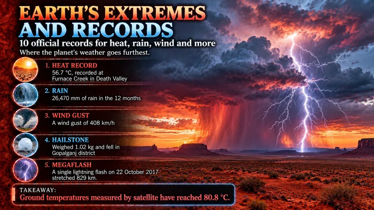
Planet Earth is full of extremes. Some places are hot enough to break thermometer records, and others are cold enough to freeze the air in your lungs. Some towns are soaked by monsoon rain for months, while some deserts go years without a drop. Scientists measure these extremes with weather stations, satellites, depth soundings and seismographs. Organisations such as the World Meteorological Organization (WMO) and Guinness World Records then check the readings before accepting them as official records.[1]
This Finepedia list, updated in October 2026, ranks the top 10 extremes and records on planet Earth. It covers the highest and lowest temperatures ever measured, the wettest and driest places, the strongest wind gust, the highest mountain, the deepest point of the ocean, the lowest dry land, the most lightning-struck spot and the strongest earthquake ever recorded. It also explains how each record was measured and why some of them are still debated. A short section on hail records follows the list.
Key Facts
The table below sums up the ten records on this list, with the value of each and where it is found.
Earth's Records at a Glance
| Rank | Record | Value | Where |
|---|---|---|---|
| 1 | Highest air temperature | 56.7 °C (134 °F), 10 July 1913 | Furnace Creek, Death Valley, United States[1] |
| 2 | Lowest air temperature | −89.2 °C (−128.6 °F), 21 July 1983 | Vostok Station, Antarctica[4] |
| 3 | Wettest place (average) | About 11,872 mm of rain a year | Mawsynram, Meghalaya, India[6] |
| 4 | Driest non-polar desert | About 15 mm of rain a year, and some stations have never had rain | Atacama Desert, Chile[8] |
| 5 | Strongest wind gust | 408 km/h (254 mph), 10 April 1996 | Barrow Island, Australia[10] |
| 6 | Highest mountain | 8,848.86 m (29,031.7 ft) | Mount Everest, Nepal–China border[11] |
| 7 | Deepest point of the ocean | About 10,935 m (35,876 ft) | Challenger Deep, Mariana Trench[13] |
| 8 | Lowest dry land | 439.78 m (1,443 ft) below sea level (2025) | Shores of the Dead Sea[14] |
| 9 | Most lightning | About 250 flashes per km2 per year | Lake Maracaibo, Venezuela[15] |
| 10 | Strongest earthquake | Magnitude 9.4–9.6, 22 May 1960 | Valdivia, Chile[16] |
How Earth's Records Are Measured
Records only count if they are measured in a standard way. The WMO and Guinness World Records treat air temperature as the standard for heat records. Ground and satellite readings are often unreliable.[1] The standard thermometer sits 1.5 metres (4 ft 11 in) above the ground and is shielded from direct sunlight.[1] Global surface temperatures have been monitored since the 1880s, when record keeping began.[1]
The difference between air and ground readings is large. Temperatures measured directly on the ground can be 30 to 50 °C (54 to 90 °F) higher than air temperatures.[1] Satellites can also capture higher readings, but these are often considered less reliable than thermometers on the ground. One reason is that a satellite slowly loses altitude because of friction with the atmosphere.[1] For this reason, most of the records below are ground-based measurements, and the satellite figures are mentioned separately.
1. Highest Temperature: Death Valley, United States
The official highest air temperature ever recorded on Earth is 56.7 °C (134.1 °F). It was measured at 14:00 local time on 10 July 1913 at Furnace Creek Ranch in Death Valley, eastern California.[1] At the time the site was called Greenland Ranch.[2] Death Valley lies mostly in Inyo County, near the border between California and Nevada, in the Great Basin east of the Sierra Nevada mountains.[2] The WMO lists it as the site of the hottest temperature recorded on Earth.[2]
The record has a complicated history. In 1922, a reading of 57.8 °C (136.0 °F) was taken at ʽAziziya in Libya, and it held the world record for about 90 years.[1] In 2012, the WMO decertified it, using a range of evidence that the reading was inaccurate, and the Death Valley figure became the official record again.[1] Several meteorological experts have since argued that the 1913 reading shows similar irregularities. The WMO has stood by the record while any future investigation is pending.[1]
- Death Valley, 20 June 2013
- Mitribah, Kuwait, 21 July 2016
- Tirat, in Mandatory Palestine, 21 July 1942
Furnace Creek also recorded 54.4 °C (129.9 °F) in August 2020 and in July 2021. Both readings are still awaiting validation.[1]
The Hottest Ground: The Lut Desert
Ground temperatures can be far higher than air temperatures. The hottest land surface recorded by the MODIS instrument on NASA's Aqua satellite between 2003 and 2010 was in Iran's Dasht-e Lut, or Lut Desert. Its land surface reached 70.7 °C (159.3 °F) in 2005, the highest known land surface temperature on Earth.[3] In 2019, researchers reported an even higher land surface temperature of 80.83 °C (177.49 °F), based on newer MODIS data.[3]
Scientists estimate that the theoretical maximum ground temperature is between 90 and 100 °C (194 and 212 °F), for dry, dark soils that conduct heat poorly.[1] There is no confirmed record for the highest ground temperature. The highest unverified claim is 93.9 °C (201.0 °F), said to have been recorded at Furnace Creek Ranch on 15 July 1972.[1]
2. Lowest Temperature: Vostok Station, Antarctica
The lowest natural temperature ever directly recorded at ground level is −89.2 °C (−128.6 °F; 184.0 K). It was measured at the then-Soviet Vostok Station in Antarctica on 21 July 1983.[4] The Soviet Union founded the station in 1957, during the International Geophysical Year.[5] It sits on the Antarctic Plateau at 3,488 metres (11,444 ft) above sea level and is one of the most isolated research stations on the continent.[5] Of all official weather stations still operating, Vostok is the coldest on Earth by mean annual temperature.[5]
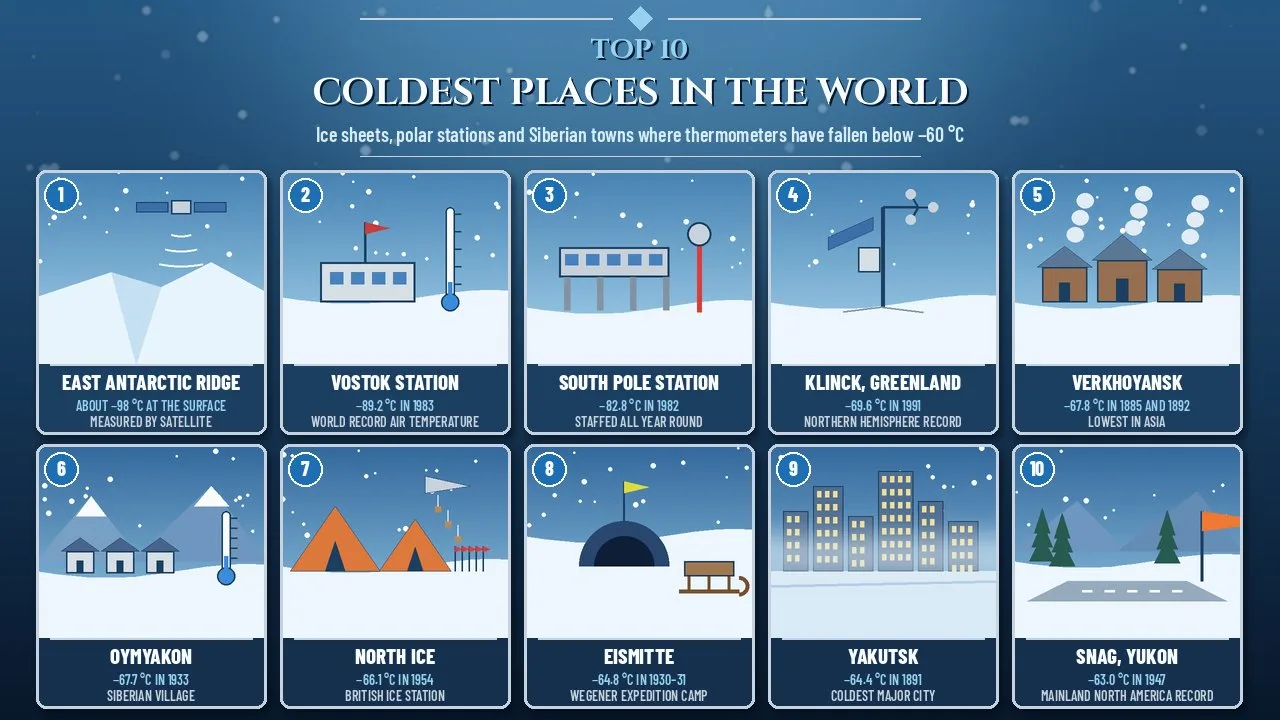
Related: Top 10 Coldest Places in the World
- 1838: −60 °C, recorded by a Russian merchant named Neverov in Yakutsk.
- 1885 and 1892: −68 °C and then −69.8 °C, reported from Verkhoyansk in Siberia.
- 1933: −67.7 °C, reported by Soviet researchers at Oymyakon.
- 1957: −73.6 °C on 11 May and −74.5 °C on 17 September, measured at the Amundsen–Scott South Pole Station.
- 1968: −88.3 °C, measured at Vostok.
- 1983: −89.2 °C, measured at Vostok, which broke its own record.
Even Colder from Space
Satellites have spotted even colder surfaces. On 10 August 2010, satellite observations showed a surface temperature of −92 °C (−134 °F) on a ridge between Dome Argus and Dome Fuji, at 3,900 m (12,800 ft) elevation.[4] This figure is not listed as the record because it was measured by remote sensing rather than a ground thermometer. It also reflects the temperature of the ice surface, while the Vostok reading measured the air above the ice.[4] Later work found many places on the high Antarctic plateau where surface temperatures drop to about −98 °C (−144 °F). These readings suggest near-surface air temperatures of about −94 °C (−137 °F).[4] Lake Vostok lies about 4,000 metres (13,000 ft) below the surface of the ice sheet and covering about 14,000 square kilometres.[5]
3. Wettest Place: Mawsynram and Sohra, India
Two towns in the Khasi Hills of Meghalaya, in northeastern India, compete for the title of the wettest place on Earth. Mawsynram stands at about 1,400 metres (4,600 ft), 15 km west of Cherrapunji, which is also known as Sohra.[6] It is reportedly the wettest place on Earth, with an average annual rainfall of 11,872 millimetres (467.4 in).[6] It also receives the highest rainfall in India.[6] Most of its rain falls during the monsoon months.[6] On 17 June 2022, Mawsynram received 1,003.2 millimetres (39.50 in) in 24 hours, its highest single-day total on record.[6]
- 26,471 millimetres (1,042.2 in) of rainfall between August 1860 and July 1861
- 9,300 millimetres (370 in) of rain in July 1861
Sohra gets its rain from the Bay of Bengal arm of the Indian summer monsoon.[7] Despite this, its winters are dry and mild, and the driest months run from November to February.[7] Over hundreds of years, local people have learned to grow tree roots into large living root bridges, such as the Double Decker root bridge at Nongriat village. A bridge takes 10 to 15 years to grow, and the oldest one still in use is over 500 years old.[7]
4. Driest Place: The Atacama Desert, Chile
At the opposite extreme is the Atacama Desert. It is the driest non-polar desert in the world, and only some spots in Antarctica's McMurdo Dry Valleys are drier.[8] The desert stretches along a strip about 1,600 km (1,000 mi) long, west of the Andes in northern Chile, and covers about 105,000 km2.[8] It is commonly called the driest place in the world, especially around the abandoned mining town of Yungay, where the University of Antofagasta has a desert research station.[8]
Average rainfall in the Atacama is about 15 mm (0.6 in) a year, and some places get only 1 to 3 mm.[8] Some weather stations in the desert have never recorded rain at all.[8] In the central part, between the cities of Antofagasta, Calama and Copiapó, there have been periods of up to four years with no rainfall.[8] Scientists use it to test Mars expeditions because it is similar to the Martian environment.[8] Its high altitude, almost cloudless skies, dry air and lack of light pollution also make it one of the best places in the world for astronomical observatories. The desert has more than 200 cloudless nights a year.[8]
5. Strongest Wind Gust: Barrow Island, Australia
The fastest wind speed ever recorded that was not caused by a tornado came during Tropical Cyclone Olivia on 10 April 1996.[9] An automatic weather station on Barrow Island, off the northwest coast of Western Australia, measured a wind gust of 113.3 m/s, or 408 km/h (254 mph).[9] The station recorded the three-second gust at 10:55 UTC. Its anemometer was 10 m (33 ft) above the ground and 64 m (210 ft) above sea level.[10] Olivia had formed on 3 April 1996 north of Australia's Northern Territory and was the 13th named storm of the 1995–96 Australian cyclone season.[10]
The next two highest wind gusts ever measured came from Hurricane Melissa in 2025, at 406 km/h (252 mph), and Typhoon Megi in 2010, at 399 km/h (248 mph).[9] The second-highest surface wind speed ever officially recorded is about 372 km/h (231 mph). It was measured on 12 April 1934 at the Mount Washington Observatory in New Hampshire, 1,917 m (6,288 ft) above sea level.[9]
Related: Top 10 Most Destructive Typhoons in Recorded History
Tornadoes can produce even faster winds, but these have never been measured accurately with ground instruments.[9] A mobile radar run by the University of Oklahoma recorded winds of up to 150 metres per second (540 km/h; 340 mph) inside the 2013 El Reno tornado. That is the fastest wind speed ever observed by radar.[9]
6. Highest Mountain: Mount Everest
Mount Everest is the highest mountain on Earth above sea level.[11] It lies in the Mahalangur Himal sub-range of the Himalayas, and its summit marks part of the border between China and Nepal.[11] In Nepali it is called Sagarmāthā, and in Tibetan Jomolangma.[11] A joint survey by Nepalese and Chinese authorities in 2020 measured its height at 8,848.86 m (29,031.7 ft). The two countries announced the new official height on 8 December 2020.[11]
British mountaineers made the first recorded attempts to reach the summit. The 1922 expedition became the first in which a person climbed above 8,000 m (26,247 ft).[11] Tenzing Norgay and Edmund Hillary made the first documented ascent of Everest in 1953, by the Southeast Ridge route.[11] The mountain remains dangerous. As of May 2024, 340 people had died on Everest.[11]
Other Ways to Measure "Highest"
Everest is the highest mountain above sea level, but not by every measure. Earth bulges at the equator, so the summit of Chimborazo in Ecuador, near the equator, is the point farthest from Earth's centre. It lies 6,384.4 km (3,967.1 mi) from the centre, even though it is only 6,263.47 m above sea level.[12] The summit of Everest is 2,168 m closer to the centre of the Earth.[12] Measured from base to peak, the tallest mountain is Mauna Kea in Hawaii, which rises 9,330 m (30,610 ft) from its base, though only 4,207.3 m of that is above sea level.[12]
7. Deepest Point: The Challenger Deep
The Challenger Deep is the deepest known point of Earth's seabed. It lies at the southern end of the Mariana Trench in the western Pacific Ocean, in the ocean territory of the Federated States of Micronesia.[13] A 2021 study measured its depth at 10,935 ± 6 m (35,876 ± 20 ft), so the deepest point of the ocean is deeper than Everest is high.[13]
The first vehicle to reach the bottom was the bathyscaphe Trieste, operated by the United States Navy, in January 1960.[13] The crew reported that the floor was made of diatomaceous ooze and that they saw "some type of flatfish" lying on the seabed.[13] On 26 March 2012, Canadian film director James Cameron made a solo dive to the bottom in the submersible Deepsea Challenger.[13] People have dug far less deep than the ocean goes. The deepest point ever reached underground is 12,262 m (40,230 ft), at the Kola Superdeep Borehole, which has since been sealed.[12]
8. Lowest Dry Land: The Dead Sea
The lowest dry land on Earth is the shore of the Dead Sea, the salt lake between Jordan to the east and Israel and the West Bank to the west. As of 2025, the lake's surface is 439.78 metres (1,443 ft) below sea level, making its shores the lowest land-based elevation on Earth.[14] The roads along its shores, Highway 90 on the Israeli and West Bank side and Highway 65 on the Jordanian side, are the lowest roads in the world, at 393 m (1,289 ft) below sea level.[14]
Related: Ball Lightning: The Mysterious Spherical Phenomenon
The Dead Sea also holds records for salt. It is 304 m (997 ft) deep, which makes it the deepest hypersaline lake in the world.[14] In 2011, its salinity was 342 g/kg, or 34.2 per cent, making it 9.6 times as salty as the ocean.[14] Its water has a density of 1.24 kg/L, which is why swimming in it is more like floating.[14]
9. Most Lightning: Lake Maracaibo, Venezuela
The place on Earth with the most lightning is Lake Maracaibo in Venezuela. There, a phenomenon called the Catatumbo lightning, or "the Everlasting Storm", forms over a bog where the Catatumbo River flows into the lake.[15] Storms occur on 140 to 160 nights a year and last about nine hours a night, with 16 to 40 lightning flashes a minute.[15] This gives the highest density of lightning in the world, at about 250 flashes per square kilometre per year.[15]
The storms are so regular that sailors once used them to navigate. In 1841, the Italian geographer Agustín Codazzi wrote that the lightning "directs the navigators as a lighthouse".[15] Between 1997 and 2000, four studies suggested that methane from the swamps and the area's large oil deposits were a major cause of the storms.[15] The lightning does sometimes stop. From January to March 2010 it ceased, apparently because of drought, and some people speculated that it had gone out for good.[15]
10. Strongest Earthquake: Valdivia, Chile, 1960
On 22 May 1960, an earthquake and tsunami struck Chile and devastated the city of Valdivia.[16] Most studies place the earthquake at magnitude 9.4 to 9.6 on the moment magnitude scale, which makes it the strongest earthquake ever recorded. A few studies put the magnitude below 9.4.[16] The shaking began at 15:11 local time and lasted 10 minutes. The rupture zone was about 800 km (500 mi) long, stretching from Arauco to below the Chiloé Archipelago.[16]
The tsunami crossed the Pacific Ocean and struck southern Chile, Hawaii, Japan, the Philippines, eastern New Zealand, southeastern Australia and the Aleutian Islands.[16] Estimates of the total death toll from the earthquake and tsunamis range from 1,000 to 6,000.[16] Most of the tsunami deaths in Japan were in the Sanriku region of northeastern Honshu.[16] Subduction zones, where one tectonic plate slides beneath another, produce the strongest earthquakes on Earth because more stress builds up there before it is released.[16]
Bonus Records: The Biggest Hailstones
- The heaviest hailstone ever recorded weighed 1.02 kg (2.2 lb). It fell in Gopalganj District, Bangladesh, on 14 April 1986.
- The largest hailstone by diameter officially measured was 20 cm (7.9 in) across, with a circumference of 47.3 cm (18.622 in). It fell at Vivian, South Dakota, on 23 July 2010.
Why Earth Has Such Extremes
- Heat: Death Valley is a long, narrow basin that drops below sea level and is walled by steep mountains. Its clear, dry air and dark, sparsely vegetated ground heat up intensely in the sun, and it lies in the rain shadow of four major mountain ranges. [2]
- Cold: Vostok's height of 3,488 metres on the Antarctic Plateau keeps it extremely cold. [5]
- Rain: Moist air from the Bay of Bengal arm of the monsoon brings Sohra's rain. [7]
- Wind: Large tropical cyclones, such as Olivia, produce the strongest non-tornadic winds. [10]
- Earthquakes: Subduction zones such as the one off Chile release the most energy. [16]
Records also change over time. The Libyan heat record was overturned after 90 years.[1] The official heights of Everest and the depth of the Challenger Deep have been revised as survey methods have improved.[11][13] The surface of the Dead Sea keeps falling, so its "lowest land" figure is given for a specific year.[14] The Catatumbo lightning can pause during droughts.[15] When reading any world record, it is worth checking how it was measured and when.
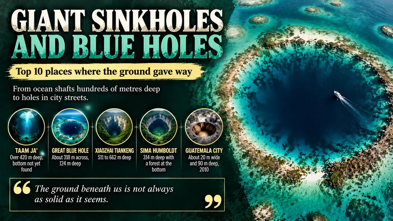
Related: Top 10 Giant Sinkholes and Blue Holes
Key Figures
- 56.7 °C (134.1 °F): Highest official air temperature, Death Valley, 10 July 1913. [1]
- 70.7 °C (159.3 °F): Highest land surface temperature measured by satellite, Lut Desert, 2005. [3]
- −89.2 °C (−128.6 °F): Lowest directly recorded temperature, Vostok Station, 21 July 1983. [4]
- 11,872 mm: Average annual rainfall reported at Mawsynram, India. [6]
- 26,471 mm: Most rain in a single year, Sohra, August 1860 to July 1861. [7]
- About 15 mm: Average yearly rainfall in the Atacama Desert. [8]
- 408 km/h (254 mph): Strongest wind gust, Barrow Island, 10 April 1996. [10]
- 8,848.86 m: Height of Mount Everest, from the 2020 survey. [11]
- About 10,935 m: Depth of the Challenger Deep, from a 2021 study. [13]
- 439.78 m below sea level: Surface of the Dead Sea in 2025. [14]
- About 250 flashes per km2 per year: Lightning density at Lake Maracaibo. [15]
- 9.4–9.6: Magnitude of the 1960 Valdivia earthquake. [16]
- 1.02 kg: Heaviest hailstone, Bangladesh, 1986. [17]
Frequently Asked Questions
What is the hottest temperature ever recorded on Earth?
The official record is 56.7 °C (134.1 °F), measured at Furnace Creek in Death Valley, California, on 10 July 1913. Some experts question it, but the WMO still recognises it.[1]
What is the coldest place on Earth?
The lowest temperature measured by a ground thermometer is −89.2 °C (−128.6 °F), at Vostok Station in Antarctica in 1983. Satellites have detected even colder ice surfaces, at around −98 °C, on the high Antarctic plateau.[4]
Which is the wettest place in the world?
Mawsynram in Meghalaya, India, is reportedly the wettest place, with an average of about 11,872 mm of rain a year. Lloró in Colombia disputes the title, and nearby Sohra holds the records for the wettest month and the wettest year.[6][7]
Is the ocean deeper than Everest is tall?
Yes. The Challenger Deep is about 10,935 m deep, while Everest rises 8,848.86 m above sea level.[11][13]
Where does lightning strike most often?
Lightning strikes most often over Lake Maracaibo in Venezuela. The Catatumbo lightning there produces about 250 flashes per square kilometre each year.[15]
What was the strongest earthquake ever recorded?
The strongest was the Valdivia earthquake in Chile on 22 May 1960, with a magnitude of 9.4 to 9.6.[16]
See also
- Top 25 Interesting Facts About Earth
- Top 10 Highest Mountains in the World
- Top 10 Interesting Facts About Antarctica
- ^ [1] "Highest temperature recorded on Earth". Wikipedia. Wikipedia
- ^ [2] "Death Valley". Wikipedia. Wikipedia
- ^ [3] "Lut Desert". Wikipedia. Wikipedia
- ^ [4] "Lowest temperature recorded on Earth". Wikipedia. Wikipedia
- ^ [5] "Vostok Station". Wikipedia. Wikipedia
- ^ [6] "Mawsynram". Wikipedia. Wikipedia
- ^ [7] "Cherrapunji". Wikipedia. Wikipedia
- ^ [8] "Atacama Desert". Wikipedia. Wikipedia
- ^ [9] "Wind speed". Wikipedia. Wikipedia
- ^ [10] "Cyclone Olivia". Wikipedia. Wikipedia
- ^ [11] "Mount Everest". Wikipedia. Wikipedia
- ^ [12] "Extremes on Earth". Wikipedia. Wikipedia
- ^ [13] "Challenger Deep". Wikipedia. Wikipedia
- ^ [14] "Dead Sea". Wikipedia. Wikipedia
- ^ [15] "Catatumbo lightning". Wikipedia. Wikipedia
- ^ [16] "1960 Valdivia earthquake". Wikipedia. Wikipedia
- ^ [17] "Hail". Wikipedia. Wikipedia



















Discussion
Log in with