






Top 10 Interesting Facts About Antarctica
 By Dhiraj Sharma · Published
· Updated
Share Post
Loading…
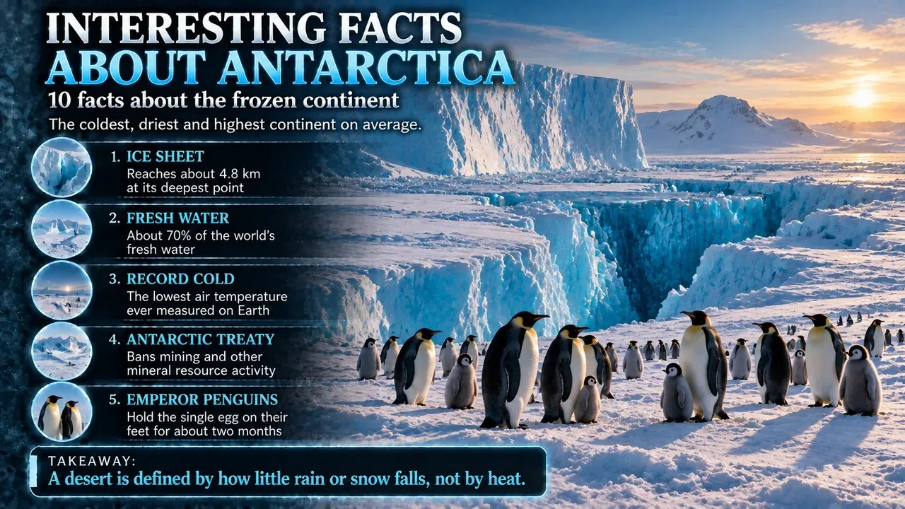
Antarctica is Earth's southernmost continent and the land around the South Pole. It covers about 14.2 million square kilometres, almost twice the area of Australia, which makes it the fifth-largest continent.[1] It is the coldest, driest and windiest continent on average, and it also has the highest average elevation.[1] Nearly all of it lies under a sheet of ice that averages 1.9 kilometres thick.[1] It is governed under an international treaty that sets it aside for science, and its population of a few thousand people lives at research stations.[1][12]
This Finepedia list, updated in October 2026, brings together the top 10 interesting facts about Antarctica, the frozen continent. Each fact comes with figures and context, from the coldest temperature ever measured on Earth to a lake hidden under four kilometres of ice, a volcano with a lake of lava, a waterfall the colour of blood, and the race to reach the South Pole.
Key Facts
| Feature | Detail |
|---|---|
| Area | About 14.2 million km² (5.5 million sq mi)[1] |
| Rank by size | Fifth-largest continent[1] |
| Ice cover | About 98% of the continent[2] |
| Average ice thickness | About 1.9 km[1] |
| Highest point | Vinson Massif, 4,892 m[1] |
| Lowest reliably measured temperature | −89.2 °C at Vostok Station, 21 July 1983[3] |
| Population | About 5,000 in summer, about 1,000 in winter[1] |
| Governance | Antarctic Treaty, signed 1959, in force 1961[12] |
| First to reach the South Pole | Roald Amundsen's team, 14 December 1911[14] |
1. It Is the Coldest, Driest, Windiest and Highest Continent
Antarctica leads the continents on four counts. On average it is the coldest, driest and windiest, and it has the highest average elevation.[1] Temperatures can fall as low as −90 °C, and some places receive only 1 to 3 cm of precipitation a year.[1] Antarctica is mainly a polar desert. The coast gets more than 200 mm of precipitation a year, and the interior gets far less.[1]
The cold changes a great deal from place to place. The mean annual temperature of the interior is −43.5 °C.[3] The warmest parts of the coast average about −10 °C, while the high inland plateau around Vostok averages about −55 °C.[3] At McMurdo Station, monthly means range from −26 °C in August to −3 °C in January.[3] In summer the coast can climb above 10 °C.[1]
Antarctica's Warmest Records
Antarctica does have warm days by its own standards. The highest temperature ever recorded in the Antarctic region was 19.8 °C at Signy Research Station on Signy Island on 30 January 1982.[3] The highest temperature on the mainland was 18.3 °C at Argentina's Esperanza Base on 6 February 2020.[3]
A Continent Once Covered in Forest
Antarctica was not always frozen. From the end of the Neoproterozoic era to the Cretaceous, it was part of the supercontinent Gondwana.[1] For much of the last 400 million years it had a fairly mild climate and was covered in forests, even though it lay at high latitude.[1] About 80 million years ago, flowering plants were the most varied group of plants on the continent.[1]
2. Its Ice Holds Most of the World's Fresh Water
The Antarctic ice sheet is a continental glacier that covers 98% of the continent, an area of about 14 million square kilometres.[2] It is the larger of Earth's two current ice sheets and contains about 26.5 million cubic kilometres of ice. That is equal to 61% of all fresh water on Earth.[2] Measured another way, about 70% of the world's freshwater reserves are frozen in Antarctica. If all of it melted, global sea levels would rise by almost 60 metres.[1]
Much of the coast is made of floating ice. A 1983 survey found that 44% of the coastline is ice shelf, 38% is ice walls resting on rock, 13% is ice streams or glacier edges, and only 5% is exposed rock.[1] The Transantarctic Mountains divide the continent into East Antarctica and West Antarctica. They stretch from Victoria Land to the Ross Sea.[1]
Related: Lake Vostok: The Largest Subglacial Lake Beneath Antarctica
West Antarctica and Sea Level
The West Antarctic ice sheet worries scientists most. Its possible melting is the biggest source of uncertainty in projections of sea level rise over the coming century.[1] Much of the West Antarctic ice sheet sits deep below sea level, which makes it vulnerable to a process called marine ice sheet instability. That process is difficult to simulate in ice-sheet models.[2] By 2100, net ice loss from Antarctica alone is projected to add around 11 cm to global sea level.[2]
3. It Holds the Record for the Coldest Temperature on Earth
The lowest reliably measured natural temperature on Earth is −89.2 °C. It was recorded at Russia's Vostok Station on 21 July 1983.[4] Vostok was founded by the Soviet Union on 16 December 1957, during the International Geophysical Year. It sits at the southern Pole of Cold, 3,488 metres above sea level, and is one of the most isolated research stations on the continent.[4] During the polar night, it gets no sunshine at all for a whole month.[4]
Satellites have found colder spots still. Using satellite data gathered by instruments such as those on Landsat 8, scientists found surface temperatures between −93.2 °C and −98 °C at nearly 100 locations on the high plateau between Dome A and Dome F. These measurements were revised in 2018.[3] These are measurements of the snow surface taken from space, so the −89.2 °C at Vostok remains the lowest reliably measured air temperature.[3]
4. A Giant Lake Lies Under Four Kilometres of Ice
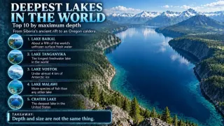
Beneath Vostok Station lies Lake Vostok. It is the largest of Antarctica's 675 known subglacial lakes and the 16th-largest lake in the world by area.[5] Its surface is about 4,000 metres below the top of the ice, which puts it about 500 metres below sea level.[5] The ice above it holds a continuous record of climate stretching back 400,000 years. The lake water itself may have been cut off from the outside world for 15 to 25 million years.[5]
Reaching the lake took decades of drilling. On 5 February 2012, a team of Russian scientists completed the longest ice core ever drilled, 3,768 metres long, and broke through to the surface of the lake.[5] The first core of freshly frozen lake ice was brought up on 10 January 2013 from a depth of 3,406 metres.[5] Most of Antarctica's other lakes that lie at the base of the ice sheet are found in the McMurdo Dry Valleys or in various oases.[1]
5. The Dry Valleys Hide a Waterfall the Colour of Blood
The McMurdo Dry Valleys are the coldest and driest desert in the world and the largest ice-free region in Antarctica.[6] They stay dry because they sit within the Transantarctic Mountains and because katabatic winds sweep away snow and moisture.[6] Katabatic winds form when cold, dense air is pulled downhill by gravity.[6] These unusual conditions have made the valleys a busy centre of scientific research.[6]
One of the valleys holds a strange sight. Blood Falls is a stream of saltwater, stained red by iron oxide, that flows from the tongue of Taylor Glacier onto the frozen surface of West Lake Bonney in the Taylor Valley.[7] The Australian geologist Thomas Griffith Taylor found the reddish deposit in 1911 while exploring the valley that now bears his name.[7] The salty water comes from a pool of unknown size beneath about 400 metres of ice, several kilometres from the small outlet at the falls.[7]
Related: Top 10 Coldest Places in the World
6. It Has a Volcano with a Lake of Lava
Mount Erebus, on Ross Island, is the southernmost active volcano on Earth.[8] Its summit stands 3,792 metres high. That makes it the second most prominent mountain in Antarctica after Mount Vinson.[8] It has been active for around 1.3 million years. A convecting lava lake has sat in its inner summit crater since at least the early 1970s, and it is one of only five long-lasting lava lakes on Earth.[8]
Erebus even gives off gold. Tiny gold particles up to 60 micrometres across have been found as far as 1,000 kilometres from the volcano.[8] A 1991 paper found that they condense from the volcano's gases, which include about 80 grams of gold vapour each day.[8] The mountain was also the site of a deadly air crash. On 28 November 1979, Air New Zealand Flight 901, a sightseeing flight from Auckland, crashed on Mount Erebus and killed all 257 people on board.[8]
7. Its Highest Peak Was First Climbed in 1966
The Vinson Massif, in the Ellsworth Mountains, is the highest peak in Antarctica at 4,892 metres.[1] In 1961 it was named after Carl Vinson, a United States Representative from Georgia who strongly supported funding for Antarctic research.[9] It was first climbed in 1966 by an American team led by Nicholas Clinch.[9] Two separate climbing groups merged that spring, at the urging of the National Science Foundation and the American Alpine Club, and Clinch was recruited to lead the joint expedition.[9]
8. Its Wildlife Runs on Krill
Few land animals live in Antarctica. Native species include mites, nematodes, penguins, seals and tardigrades.[1] The plants are mostly mosses and liverworts, with about 100 species of moss and 25 of liverwort.[1] The seas around the continent are far richer, with penguins, blue whales, orcas, colossal squid and fur seals.[1]
Much of this life depends on one small animal. Antarctic krill is the keystone species of the Southern Ocean ecosystem and an important food for whales, leopard seals, fur seals, squid, icefish, penguins and albatrosses.[1] Each krill grows to about 6 cm long, weighs up to 2 grams and can live for up to six years.[11] Krill live in huge swarms that can reach 10,000 to 30,000 animals per cubic metre.[11] Their combined biomass is about 500 million tonnes, making them one of the most abundant animal species on the planet, although they suffer from overfishing.[11]
The Emperor Penguin
The emperor penguin is the tallest and heaviest of all living penguins and is found only in Antarctica.[10] Adults stand 110 to 120 cm tall.[10] It is the only penguin that breeds during the Antarctic winter. To reach their breeding colonies, the birds trek 50 to 120 km across the ice.[10] The female lays a single egg, and the male keeps it warm for just over two months while she goes back to sea to feed.[10] During that time the male eats nothing and loses around 12 kg.[10] To survive the cold, emperors gather in tight huddles of ten to several hundred birds, each leaning on a neighbour.[10] When hunting, they can stay underwater for around 20 minutes and dive as deep as 535 metres.[10]
Related: Top 10 Famous Glaciers of the World
9. It Was Imagined Long Before It Was Seen
For centuries, Western geographers believed in a great southern land called Terra Australis, long before anyone saw it.[13] The name Antarctica comes from words meaning "opposite to the Arctic" or "opposite to the north". The Greek geographer Marinus of Tyre reportedly used the name on his world map in the second century AD.[1] In 1773, James Cook and his crew became the first to cross the Antarctic Circle.[13]
- 1820: A Russian expedition led by Fabian Gottlieb von Bellingshausen and Mikhail Lazarev probably saw the ice shelves for the first time. The British naval captain Edward Bransfield sighted the tip of the Antarctic Peninsula on 30 January 1820.
- 1895: A Norwegian-Swedish whaling ship, the Antarctic, reached Cape Adare and made the first confirmed landing on the continent.
- 1909: Douglas Mawson, Edgeworth David and Alistair Mackay reached the magnetic South Pole.
- 14 December 1911: Roald Amundsen and four companions reached the geographic South Pole.
Amundsen sailed south on Fridtjof Nansen's ship Fram. He kept even his own crew believing they were heading for the Arctic until they left Madeira on 9 September 1910.[14] The team's skill with skis and sled dogs made their journey fast and fairly smooth. They reached the Pole about five weeks ahead of the British party led by Robert Falcon Scott.[14] Scott and his four companions died on the return journey.[14]
10. It Belongs to No Country and Is Kept for Science
The Antarctic Treaty opened for signature on 1 December 1959 and came into force on 23 June 1961.[12] It was first signed by the 12 countries active in Antarctica during the International Geophysical Year of 1957–58: Argentina, Australia, Belgium, Chile, France, Japan, New Zealand, Norway, South Africa, the Soviet Union, the United Kingdom and the United States.[12] It was the first arms control agreement of the Cold War. It set the continent aside as a scientific preserve, guaranteed freedom of scientific research and banned military activity.[12] As of 2024, the treaty has 58 parties.[12]
Under the treaty, military activity, mining, nuclear explosions and nuclear waste disposal are all banned in Antarctica.[1] Coal, iron ore, platinum, copper, gold and other minerals have been found there, but not in amounts large enough to extract.[1] The Madrid Protocol on environmental protection came into force in 1998.[1] About 5,000 people live at research stations in summer, falling to around 1,000 in winter.[1] Tourists come too. More than 74,000 tourists visited during the 2019–2020 season, and 18,500 of them stayed on their cruise ships without going ashore.[1]
Where the Ozone Hole Was Found
Antarctica is also where one of the great environmental discoveries was made. In 1985, British scientists working with data from Halley Research Station on the Brunt Ice Shelf found a large area of low ozone over the continent.[1] This ozone hole is caused mainly by manufactured chemicals such as chlorofluorocarbons (CFCs).[15] Concern about it led to the Montreal Protocol in 1987, which bans the production of CFCs and other ozone-depleting chemicals.[15] The protocol is considered the most successful international environmental agreement to date, and the ozone layer is expected to recover around 2070.[15]
Key Figures
- 14.2 million km²: Area of Antarctica.[1]
- 98%: Share of the continent covered by the ice sheet.[2]
- 26.5 million km³: Volume of ice in the Antarctic ice sheet.[2]
- Almost 60 m: Rise in global sea level if all of Antarctica's ice melted.[1]
- −89.2 °C: Lowest reliably measured temperature on Earth, at Vostok in 1983.[4]
- 18.3 °C: Highest temperature recorded on the Antarctic mainland, in 2020.[3]
- 4,892 m: Height of the Vinson Massif, Antarctica's highest peak.[1]
- 675: Known subglacial lakes, Lake Vostok being the largest.[5]
- 500 million tonnes: Estimated combined biomass of Antarctic krill.[11]
- 58: Parties to the Antarctic Treaty, as of 2024.[12]
- 74,000+: Tourists in the 2019–2020 season.[1]
Frequently Asked Questions
How cold does Antarctica get?
The lowest reliably measured air temperature on Earth is −89.2 °C, recorded at Vostok Station on 21 July 1983. Satellites have detected snow surface temperatures as low as about −98 °C on the high plateau.[3][4]
Related: Top 10 Environmental Headlines That Need a Calmer Number
Does anyone live in Antarctica?
Its residents are mostly research staff. About 5,000 people live at research stations in summer and around 1,000 in winter.[1]
Who owns Antarctica?
No single country controls it. It is governed under the Antarctic Treaty System, which sets the continent aside for science and bans military activity and mining.[1][12]
What would happen if Antarctica's ice melted?
About 70% of the world's fresh water is frozen in Antarctica. If it all melted, sea levels would rise by almost 60 metres.[1]
Who reached the South Pole first?
Roald Amundsen's Norwegian team reached the South Pole on 14 December 1911, about five weeks before Robert Falcon Scott's British party.[14]
Is Antarctica a desert?
Yes. It is mainly a polar desert. The coast gets more than 200 mm of precipitation a year, and the interior gets far less.[1]
See also
- Top 25 Interesting Facts About Earth
- Top 10 Highest Mountains in the World
- Top 10 Largest Islands in the World
- ^ [1] "Antarctica". Wikipedia. Wikipedia
- ^ [2] "Antarctic ice sheet". Wikipedia. Wikipedia
- ^ [3] "Climate of Antarctica". Wikipedia. Wikipedia
- ^ [4] "Vostok Station". Wikipedia. Wikipedia
- ^ [5] "Lake Vostok". Wikipedia. Wikipedia
- ^ [6] "McMurdo Dry Valleys". Wikipedia. Wikipedia
- ^ [7] "Blood Falls". Wikipedia. Wikipedia
- ^ [8] "Mount Erebus". Wikipedia. Wikipedia
- ^ [9] "Vinson Massif". Wikipedia. Wikipedia
- ^ [10] "Emperor penguin". Wikipedia. Wikipedia
- ^ [11] "Antarctic krill". Wikipedia. Wikipedia
- ^ [12] "Antarctic Treaty System". Wikipedia. Wikipedia
- ^ [13] "History of Antarctica". Wikipedia. Wikipedia
- ^ [14] "Amundsen's South Pole expedition". Wikipedia. Wikipedia
- ^ [15] "Ozone depletion". Wikipedia. Wikipedia















Discussion
Log in with