








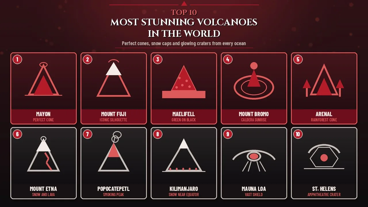
The most stunning volcanoes in the world pair perfect cones, snow caps and glowing craters into views that stop travellers on active and quiet peaks.
A volcano does not need to be erupting to earn a place on a beauty list. Some of the most photographed peaks on Earth are quiet for years at a time, yet their silhouettes, colours and visitor experiences still outrank louder neighbours. This guide ranks ten volcanoes for visual beauty, iconic shape and the quality of the visit, not for how deadly or how frequently they erupt.
Heights, eruption dates and status figures below are checked against the Smithsonian Institution Global Volcanism Program (GVP), the U.S. Geological Survey (USGS), national park services and other official sources, and are given as of 2026 where activity still matters. The order is original and different from common tourist round-ups of the same names.
Most Stunning Volcanoes in the World at a Glance
| Rank | Volcano | Height | Country | Why it stuns |
|---|---|---|---|---|
| 1 | Mayon Volcano | 2,462 m (8,077 ft) | Philippines | Near-perfect conical symmetry |
| 2 | Mount Fuji | 3,776 m (12,388 ft) | Japan | Globally iconic snowy cone |
| 3 | Mælifell | about 791 m (2,595 ft) | Iceland | Emerald moss on black sand |
| 4 | Mount Bromo | 2,329 m (7,641 ft) | Indonesia | Sunrise over a vast caldera |
| 5 | Arenal Volcano | 1,670 m (5,479 ft) | Costa Rica | Classic cone above rainforest |
| 6 | Mount Etna | about 3,357 m (11,014 ft) | Italy | Snow, lava and Mediterranean light |
| 7 | Popocatépetl | about 5,426 m (17,797 ft) | Mexico | Smoking peak near a megacity |
| 8 | Mount Kilimanjaro | 5,895 m (19,341 ft) | Tanzania | Snow near the equator, freestanding |
| 9 | Mauna Loa | 4,169 m (13,679 ft) summit | United States (Hawaiʻi) | Vast shield and fresh lava fields |
| 10 | Mount St. Helens | about 2,549 m (8,363 ft) | United States | Amphitheatre crater after 1980 |
How These Volcanoes Were Ranked
The ranking answers one question: which volcanoes look and feel most extraordinary to a visitor who is not chasing eruptions for danger. Four ideas guided the order.
- Silhouette clarity: how clean and memorable the outline is from common viewpoints.
- Colour and contrast: snow against dark rock, moss against black sand, steam against blue sky.
- Visitor experience: how reliably a careful traveller can see the peak at its best without extreme risk.
- Cultural or scenic fame: the degree to which the mountain has shaped art, film, pilgrimage or national identity.
Deadliness, eruption frequency and climbing difficulty were not ranking criteria. Several peaks here are active and must be treated with respect; beauty never cancels hazard zones, closures or official advice.
1. Mayon Volcano
| Attribute | Details |
|---|---|
| Height | 2,462 metres (8,077 feet), per Smithsonian GVP |
| Location | Albay province, southeastern Luzon, Philippines |
| Type | Stratovolcano with a simple central conduit |
| Status as of 2026 | Active; GVP lists eruptive activity into 2026 |
| Signature view | Symmetrical cone rising above Albay Gulf and Legazpi |
Mayon is often called one of the most perfectly shaped volcanoes on Earth, and for once the tourist phrase matches the geology. Eruptions from a single central conduit have built a steep, even cone whose upper slopes average about 35 to 40 degrees. From the right distance the mountain looks almost drawn with a compass.
Origins and History
Mayon rises from the shores of Albay Gulf and is shared by several cities and towns whose map boundaries meet at the summit like slices of a pie. Historical eruptions are recorded from 1616 onward. The 1814 eruption was especially destructive, burying communities and leaving a church tower visible in the ash at Cagsawa, a ruin that remains one of the most visited viewpoints today.
Because the cone is structurally simple, lava and pyroclastic flows have repeatedly travelled down the same ravines. Philippine Institute of Volcanology and Seismology (PHIVOLCS) alert levels, permanent danger zones and evacuation drills are part of daily life in Albay. Beauty and risk sit side by side here more clearly than almost anywhere else on this list.
Key Features
- A classic stratovolcano profile with a small summit crater
- Steep upper slopes that hold their shape between eruptions
- Viewpoints around Legazpi, Daraga and the Cagsawa Ruins
- Frequent steam and ash that add drama without needing a major blast
- A base circumference measured in tens of kilometres of farmland and towns
Significance
Mayon ranks first because visual beauty is the theme of this list, and almost no other volcano matches its symmetry from so many everyday angles. Photographers do not need a rare weather window to understand the shape. From the gulf, from rice fields and from hilltops around Albay, the cone reads as a single clear idea: a perfect volcanic mountain.
Interesting Facts
- Britannica and many geology guides still describe Mayon as among the world's most perfect volcanic cones.
- The 1814 eruption left the Cagsawa church tower standing in ash, now a landmark for visitors.
- PHIVOLCS maintains a permanent danger zone around the summit that expands when alert levels rise.
- Mayon's upper slopes are so steep that climbing is often restricted for safety, even between major eruptions.
- Night views from Legazpi can show a faint glow when the crater is restless.
2. Mount Fuji
| Attribute | Details |
|---|---|
| Height | 3,776 metres (12,388 feet), Japan's highest peak |
| Location | Honshu, on the border of Shizuoka and Yamanashi prefectures, Japan |
| Type | Stratovolcano (Fujisan), active with low recent eruption frequency |
| Last confirmed eruption | 1707–1708 Hōei eruption (GVP end date 1708 CE) |
| Signature view | Snow-capped cone reflected in the Fuji Five Lakes |
Mount Fuji is the volcano almost everyone can sketch from memory. The broad, even cone, winter snow and reflection in lakes near Kawaguchiko have filled Japanese art for centuries and now fill millions of photographs every year. It is also a UNESCO World Heritage property recognised for its sacred and artistic value.
Origins and History
The modern cone sits on older volcanic structures, so the simple outline hides a complex past. Younger Fuji grew through large lava outpourings and later explosive phases. More than 100 flank cones and vents sit on its slopes. The last major eruption, the Hōei event of 1707–1708, sent ash as far as Edo (today's Tokyo) and opened a large crater on the southeast flank.
Climbing culture is older than tourism. Pilgrims have ascended for centuries, and today summer routes from the Fuji Five Lakes side remain the most popular way to reach the crater rim. Official climbing seasons, hut systems and crowding controls change from year to year, so visitors should follow current prefecture guidance.
Key Features
- Japan's highest summit and a national symbol
- Clear conical profile that photographs well from dozens of classic viewpoints
- Fuji Five Lakes (Kawaguchi, Yamanaka, Sai, Motosu and Shōji) for reflections
- Seasonal snow that sharpens the silhouette in winter and spring
- UNESCO recognition for sacred places and artistic inspiration around the mountain
Significance
Fuji ranks second not because it is less beautiful than Mayon, but because its fame rests as much on culture as on pure geometry. Where Mayon wins on raw symmetry seen from ordinary roads, Fuji wins on the way a single mountain has shaped painting, poetry, stamps and the idea of Japan itself. For many travellers it is the first volcano they ever wanted to see.
Interesting Facts
- The Hōei eruption is Fuji's largest in historical time and is listed by GVP with an end in 1708 CE.
- Ash from that eruption reached the capital region more than 100 kilometres away.
- The mountain is visible from Tokyo on clear winter days, though haze often hides it.
- Official summer climbing seasons concentrate most summit attempts into a short window.
- Lake shores and Chureito Pagoda viewpoints are among the most repeated photo compositions in the world.
3. Mælifell
| Attribute | Details |
|---|---|
| Height | About 791 metres (2,595 feet) above sea level |
| Location | Southern Highlands of Iceland, north of Mýrdalsjökull |
| Type | Cone formed under ice, now exposed on a black sand plain |
| Access | Highland F-road F210; usually July to early autumn by 4x4 |
| Signature view | Green moss cone against black sandur and distant ice |
Mælifell (often written Maelifell in English) is not tall by the standards of this list, yet it may be the most surprising. In summer the cone wears a coat of green moss while the surrounding Mælifellssandur stays nearly black. The contrast looks unreal in photographs and even more so in person.
Origins and History
The cone formed beneath ice when Mýrdalsjökull covered more of the highlands. As the glacier retreated after the last Ice Age, roughly 10,000 years ago, the mountain was left standing alone on a flat volcanic sand plain. Katla, the large volcano under Mýrdalsjökull, still shapes floods and ash in the wider region, which is one reason the landscape feels so raw.
There are no cafes, fuel stations or mobile towers at the foot of the cone. The visit is a highland journey: weather, river crossings and road openings decide the day more than any ticket office.
Key Features
- Near-symmetrical cone rising more than 200 metres above the sand plain
- Summer moss that turns the slopes emerald against black sand
- Views toward Mýrdalsjökull on clear days
- Isolation that keeps crowds smaller than at roadside Icelandic icons
- A setting used in films and series for otherworldly Earth locations
Significance
Mælifell ranks third because colour contrast, not height, is what makes a volcano stunning. Few places on Earth put such a clean green cone on such an empty dark stage. It also reminds readers that the most beautiful volcanoes are not always the famous city-skyline peaks.
Interesting Facts
- Official Icelandic mapping places the summit near 791 metres; some guides round near 800 metres.
- The F210 southern Fjallabak route is typically open only in midsummer after snowmelt and flood checks.
- Walking the sand plain gives a truer sense of scale than roadside pull-offs alone.
- Overcast light often deepens the green-and-black contrast more than harsh sun.
- The cone's isolation means travellers must be self-sufficient with fuel, food and weather plans.
4. Mount Bromo
| Attribute | Details |
|---|---|
| Height | 2,329 metres (7,641 feet) |
| Location | East Java, Indonesia, inside Bromo Tengger Semeru National Park |
| Type | Active somma volcano inside the Tengger Caldera |
| Recent activity | Eruptions continue into the 2020s; check local alerts before visiting |
| Signature view | Sunrise over the Sea of Sand with Bromo, Batok and Semeru |
Mount Bromo is not the tallest peak in its own park, yet it steals the scene. It sits in the middle of the Tengger Caldera's Sea of Sand, often smoking, with the steeper cone of Batok nearby and the higher Semeru rising behind. Dawn from the caldera rim is one of Southeast Asia's classic mountain spectacles.
Origins and History
Bromo's name links to Brahma in the local Hindu tradition of the Tenggerese people. The Yadnya Kasada festival still brings offerings cast into the crater, a living ritual that visitors may see from a respectful distance when calendars and safety allow. The wider caldera is a protected landscape, with the Sea of Sand reserved since the early twentieth century and later folded into the national park.
Tour agencies run jeep and horseback approaches across the sand to the base of the climbing steps. Activity can close routes without much notice, so beauty here always comes with a weather-and-alert check.
Key Features
- An active crater that often vents steam and ash
- The flat Lautan Pasir (Sea of Sand) that frames the cones
- Sunrise viewpoints on the caldera rim above Cemoro Lawang
- Cultural pilgrimage tied to Tenggerese Hindu practice
- Semeru in the background on clear mornings
Significance
Bromo ranks fourth because the visitor experience is theatrical: you do not only look at one cone, you stand inside a volcanic amphitheatre. The combination of sand plain, smoking crater and distant higher peak is hard to copy anywhere else.
Interesting Facts
- Bromo is lower than neighbouring Semeru, yet far more visited for sunrise photography.
- The Sea of Sand is a nature reserve within the larger national park.
- Horseback rides and jeep tracks are the usual ways across the caldera floor.
- Dry-season months are popular, but volcanic alerts override seasonal advice.
- Offerings during Kasada can include vegetables, livestock and other gifts thrown toward the crater.
5. Arenal Volcano
| Attribute | Details |
|---|---|
| Height | 1,670 metres (5,479 feet) |
| Location | Northern Costa Rica, near La Fortuna |
| Type | Stratovolcano |
| Notable modern activity | Major eruption 1968; eruptive through 2010, then largely resting |
| Signature view | Steep cone above rainforest, lakes and hot springs |
Arenal looks like the volcano children draw: steep, solitary and green at the base. For decades after 1968 it was also one of Costa Rica's most reliably active peaks, sending lava and ash down its slopes. As of the mid-2010s into 2026 it has been far quieter, which makes the silhouette easier to enjoy from lodges, hanging bridges and lake shores around La Fortuna.
Origins and History
The July 1968 eruption destroyed settlements on the west side and announced Arenal as a serious modern hazard. Strombolian activity and lava flows continued for years, drawing both scientists and adventure travellers. When the eruptions eased after 2010, the tourism economy shifted toward rainforest walks, waterfall visits, lake views and thermal baths that still use the region's geothermal heat.
The cone remains a monitored volcano. Quiet years are not a promise of permanent rest, which is why Costa Rican authorities keep observation and zoning in place.
Key Features
- A tall, symmetrical cone rising above cloud forest
- Lake Arenal views that frame the peak on clear afternoons
- Hot springs and eco-lodges that make multi-day stays easy
- Adventure options nearby: hanging bridges, waterfalls and river trips
- Frequent cloud caps that make clear summit days feel earned
Significance
Arenal sits fifth because the visitor experience balances beauty with comfort better than most active-looking cones. You can wake to a perfect silhouette, spend the day in forest canopy and evening in thermal water, all within a short drive. That combination of shape and setting is rare.
Interesting Facts
- The 1968 eruption is the event that fixed Arenal in modern Costa Rican memory.
- GVP and regional summaries treat 2010 as the end of the long eruptive episode that began in 1968.
- Cloud cover often hides the summit even when lower slopes are clear.
- La Fortuna grew into a major tourism town largely because of the volcano's fame.
- Night glow from lava was once a common hotel selling point; today the draw is the daytime cone and the surrounding park.
6. Mount Etna
| Attribute | Details |
|---|---|
| Height | About 3,357 metres (11,014 feet); summit height changes with eruptions |
| Location | Eastern Sicily, Italy |
| Type | Complex stratovolcano, among Europe's tallest and most active |
| Status as of 2026 | Frequently active; GVP lists eruptive activity into 2026 |
| Signature view | Snow on the upper slopes above vineyards and the Ionian Sea |
Mount Etna is a Mediterranean giant that can wear snow in winter and send lava fountains into the news the same season. Its height shifts as summit craters build and collapse, which is why published elevations change over time. For visitors, the drama is the mix of fertile slopes, cable-car access on quiet days and a skyline that dominates eastern Sicily.
Origins and History
Etna has erupted for thousands of years in human memory and far longer in the geological record. Greek and Roman writers linked the mountain to Hephaestus and the forge of the gods. In modern times it is one of the best-monitored volcanoes in Europe, with observatories, restricted zones and frequent updates when summit or flank vents awaken.
Tourism infrastructure is unusually developed for an active volcano: roads, cable cars and guided 4x4 trips can take visitors high on the flanks when conditions allow. Closures are common and should be treated as part of the visit plan, not as a surprise.
Key Features
- A vast edifice with multiple summit craters and numerous flank vents
- Snow and ash that create striking colour contrasts
- Views from Taormina, the coast and inland towns
- Wine and agriculture on lower slopes enriched by volcanic soils
- UNESCO World Heritage recognition for the Etna area
Significance
Etna ranks sixth because stunning here means scale plus variety. One day can include citrus groves, black lava fields, snow patches and a steaming crater rim, depending on access. Few volcanoes offer that range of landscapes so close to cities and airports.
Interesting Facts
- Summit elevation figures differ between surveys because eruptions rebuild the top.
- GVP classifies Etna as erupting into 2026, reflecting near-continuous modern activity.
- Ancient writers already treated the mountain as a mythic forge and home of monsters.
- Ski facilities have operated on Etna's flanks in winter seasons when safety allows.
- Ash falls can close roads and airports even when lava flows stay high on the mountain.
7. Popocatépetl
| Attribute | Details |
|---|---|
| Height | About 5,426 metres (17,797 feet); figures vary slightly by survey |
| Location | Borders of México, Morelos and Puebla states, Mexico |
| Type | Active stratovolcano |
| Status as of 2026 | Persistently active; monitored by CENAPRED |
| Signature view | Smoking summit seen from the Valley of Mexico on clear days |
Popocatépetl, often shortened to Popo, is the smoking companion of the Mexican highlands. On clear mornings its plume can be seen from Mexico City and surrounding valleys, a reminder that a major active volcano stands within tens of kilometres of one of the world's largest urban regions. The Nahuatl name is commonly translated as smoking mountain.
Origins and History
Popocatépetl forms a famous pair with the neighbouring peak Iztaccíhuatl in Aztec legend, a story of warrior and princess turned to stone. In geological terms it is a tall, ice-touched stratovolcano with frequent ash emissions, dome growth and explosions in recent decades. Mexico's CENAPRED agency issues alert colours and restricts access to upper slopes when activity rises.
Climbing to the crater is often closed. Most visitors experience Popo from distant viewpoints, from Puebla-side roads or as a backdrop on flights and skyline photos. That distance is part of why it belongs on a beauty list rather than a casual hiking list.
Key Features
- A high, often snow-dusted cone with a frequent steam or ash plume
- Visibility from Mexico City and Puebla on clean-air days
- Cultural pairing with Iztaccíhuatl in story and skyline
- Continuous monitoring because millions live within ashfall range
- Alpine terrain near the summit when snow and ice are present
Significance
Popocatépetl ranks seventh because few stunning volcanoes combine height, activity and proximity to a megacity so dramatically. The plume turning gold at sunrise above the valley is a specifically Mexican image, and it needs no trailhead to impress.
Interesting Facts
- The volcano lies roughly 70 kilometres southeast of central Mexico City.
- CENAPRED alert levels determine how close the public may approach.
- Ash from Popo has repeatedly disrupted aviation and daily life in nearby states.
- The legend with Iztaccíhuatl is taught widely in Mexican schools and popular culture.
- Even when the crater is closed, distant miradors still offer memorable photographs.
8. Mount Kilimanjaro
| Attribute | Details |
|---|---|
| Height | Uhuru Peak 5,895 metres (19,341 ft), Africa's highest point |
| Location | Kilimanjaro Region, Tanzania |
| Type | Dormant stratovolcano complex (Kibo, Mawenzi and Shira) |
| Last known eruption | Pleistocene (GVP); no historical eruptions |
| Signature view | Snow and glaciers on a freestanding peak above savanna |
Kilimanjaro is stunning because it should not look the way it does. A freestanding volcanic mass rises from East African plains to a summit that still holds seasonal snow and shrinking glaciers almost on the equator. From Amboseli on the Kenyan side, the mountain often floats above clouds like a separate world.
Origins and History
Kilimanjaro is three volcanic centres in one massif. Kibo holds Uhuru Peak, the high point used in official height figures. Mawenzi is a jagged secondary peak, and Shira is a broad, eroded plateau. The last eruptive activity is placed deep in the Pleistocene by GVP, so climbers face altitude and weather rather than lava.
Hans Meyer and Ludwig Purtscheller made the first recorded ascent of Kibo's summit in 1889. Today several routes lead to the crater rim, with Machame, Lemosho and Marangu among the best known. National park rules require guides, and altitude illness is the main medical risk.
Key Features
- Africa's highest summit and one of the Seven Summits
- Ecological zones from rainforest to alpine desert in a few days' walk
- Glacier remnants and seasonal snow on Kibo
- Classic wildlife-foreground views from Amboseli National Park
- A large summit crater (Kibo) that hikers can traverse on some itineraries
Significance
Kilimanjaro ranks eighth on a beauty list because the silhouette and the snowline matter more here than eruptive drama. It is dormant, yet it remains one of the most recognisable volcanic outlines on Earth, especially when elephants or acacias stand in the foreground of photographs.
Interesting Facts
- Official Uhuru Peak height is commonly given as 5,895 metres (19,341 feet).
- GVP lists the last known eruption as Pleistocene, not historical.
- Glaciers have retreated sharply over the past century and remain a climate research focus.
- Relative to technical Himalayan peaks, the standard routes are non-technical but still demanding.
- The mountain is a UNESCO World Heritage site as Kilimanjaro National Park.
9. Mauna Loa
| Attribute | Details |
|---|---|
| Summit elevation | 4,169 metres (13,679 feet) above sea level (USGS) |
| Location | Island of Hawaiʻi, United States |
| Type | Shield volcano; Earth's largest active volcano by volume |
| Most recent eruption | 27 November to 10 December 2022 (USGS HVO) |
| Signature view | Broad shield slopes and fresh black lava within Hawaiʻi Volcanoes National Park |
Mauna Loa does not look like a sharp cone, and that is exactly why it belongs here. From a distance the shield can seem almost gentle. Up close, the scale of lava fields, caldera walls and rift zones is overwhelming. The reference claim that Mauna Loa stands about 30,085 feet high confuses summit elevation with the much larger figure measured from the deep ocean floor and depressed crust; the summit itself is 13,679 feet (4,169 metres) above sea level per USGS.
Origins and History
Mauna Loa covers more than half of the Island of Hawaiʻi and has erupted dozens of times in written history. The November–December 2022 eruption began in the summit caldera Mokuʻāweoweo and then focused on the Northeast Rift Zone, sending flows toward the saddle area between Mauna Loa and Mauna Kea. Hawaiian Volcano Observatory raised alerts, and park roads and trails closed for safety.
Visitors usually experience Mauna Loa through Hawaiʻi Volcanoes National Park viewpoints, desert-like lava landscapes and, when open, high-elevation roads and trails. The beauty is elemental: black rock, sulphur smell, vast sky and the knowledge that the ground can remake itself again.
Key Features
- A shield profile built by fluid basalt flows rather than steep ash cones
- Mokuʻāweoweo summit caldera
- Long Northeast and Southwest Rift Zones
- Fresh 2022 lava that rewrote parts of the high landscape
- Partnership in the park with neighbouring Kīlauea, another highly active volcano
Significance
Mauna Loa ranks ninth because stunning here means planetary scale. Standing on recent flows, or looking across the saddle to Mauna Kea, gives a sense of volcanic power that pointed cones cannot match. Correcting the height myth also matters: the ocean-to-summit story is impressive, but the number visitors should quote for the peak itself is the USGS summit elevation.
Interesting Facts
- USGS lists summit elevation as 4,169 metres (13,679 feet); GVP rounds near 4,170 metres (13,681 feet).
- Measured from the sea floor and accounting for crustal depression, the edifice is far taller than the summit elevation alone.
- The 2022 eruption was the first since 1984.
- Mauna Loa lava can travel long distances quickly because it is typically fluid basalt.
- National park alerts and closures are the practical guide for any visit plan as of 2026.
10. Mount St. Helens
| Attribute | Details |
|---|---|
| Current height | About 2,549 metres (8,363 feet); lower than the pre-1980 summit |
| Location | Cascade Range, Washington, United States |
| Type | Active stratovolcano |
| Defining modern eruption | 18 May 1980 lateral blast and debris avalanche |
| Later activity | Dome-building eruptions 2004–2008 (USGS) |
Mount St. Helens earns its place through a different kind of beauty: the amphitheatre left when the north face collapsed in 1980. Where a neat cone once stood, visitors now look into a vast crater with a lava dome complex growing inside it. Surrounding blast zones, downed forests and recovering meadows tell a visible story of destruction and return.
Origins and History
Before 1980 the mountain was a graceful Cascade cone often compared to Fujisan in tourist writing. The May eruption began with a landslide that uncorked a lateral blast, followed by a vertical column, ashfall across multiple states and lahars that poured into river valleys. Fifty-seven people died, and the landscape of the Toutle and surrounding drainages changed overnight.
USGS monitoring, the Mount St. Helens National Volcanic Monument and a network of visitor centres and viewpoints turn the site into one of the world's best outdoor classrooms on volcanic hazards. Dome growth from 2004 to 2008 showed that the mountain remains active even when it looks quiet from a distance.
Key Features
- A horseshoe crater open to the north
- Johnston Ridge and other viewpoints into the crater
- Spirit Lake and blast-zone forests in various stages of recovery
- Interpretive centres that explain the 1980 sequence
- Ongoing USGS monitoring of seismicity, gas and ground deformation
Significance
Mount St. Helens ranks tenth because stunning does not only mean symmetrical. The open crater at sunrise, steam rising from the dome and the patchwork of recovery below create a powerful, almost architectural landscape. It is also a reminder that beauty lists and hazard education can share the same viewpoint.
Interesting Facts
- The 1980 landslide and blast removed hundreds of metres from the old summit height.
- Ash from the eruption reached the East Coast of the United States within days.
- The national volcanic monument protects both the crater and the surrounding research landscape.
- Climbing permits are required for the crater rim route when it is open.
- Windy Ridge, Johnston Ridge Observatory and other pullouts offer different angles on the amphitheatre.
Frequently Asked Questions
What makes a volcano one of the most stunning rather than the most active?
Stunning refers to silhouette, colour, viewpoint quality and the feeling of the visit. An active plume can add drama, but a quiet cone with perfect symmetry or rare colour contrast can outrank a constantly erupting peak that is hard to see safely. This list favours beauty and visitor experience over eruption frequency.
Is it safe to visit active volcanoes such as Mayon, Etna or Popocatépetl?
It can be, if you stay outside restricted zones and follow official alerts. Agencies such as PHIVOLCS, Italy's volcano observatories, CENAPRED and USGS publish closures and hazard maps. Never treat a smoking crater as a hiking challenge when authorities have set exclusion areas.
Which stunning volcano is best for first-time travellers?
Mount Fuji and Arenal are often the easiest introductions because tourism infrastructure is strong and viewpoints do not require technical climbing. Bromo sunrise tours are also popular, provided alerts are green. Always check seasonal access and health requirements, especially for altitude on Fuji or Kilimanjaro.
Why is Mauna Loa's height often quoted above 30,000 feet?
That larger figure usually measures from the deep ocean floor and may include crust depressed by the volcano's weight. The summit elevation above sea level is about 13,679 feet (4,169 metres) according to USGS. Both stories can be true if the starting point of the measurement is stated clearly.
Do you need to climb to the crater to appreciate these volcanoes?
No. Mayon from Albay Gulf, Fuji from the lakes, Mælifell from the sand plain, Bromo from the caldera rim, Arenal from Lake Arenal, Etna from coastal towns, Popocatépetl from valley viewpoints, Kilimanjaro from Amboseli, Mauna Loa from park overlooks and St. Helens from Johnston Ridge are all powerful without a summit attempt.
When is the best season to photograph Mælifell and Mount Fuji?
Mælifell is typically reachable on highland roads only in midsummer, when moss is green and snow has retreated. Fuji photographs well with snow in winter and early spring from lake shores, while summer is the main climbing season. Local weather still decides every shoot.
Are any of these volcanoes dormant or extinct?
Kilimanjaro is dormant with no historical eruptions. Fuji has not erupted since 1707–1708 but is still classed as active. Arenal has been largely resting since about 2010. Mayon, Etna, Bromo, Popocatépetl, Mauna Loa and St. Helens have shown clear modern activity and must be treated accordingly as of 2026.
Conclusion
The most stunning volcanoes in the world are not always the tallest or the most explosive. Mayon's symmetry, Fuji's cultural silhouette, Mælifell's green-on-black contrast and Bromo's caldera sunrise show how shape and setting create awe. Etna, Popocatépetl, Kilimanjaro, Mauna Loa and Mount St. Helens add snow, smoke, scale and recovery to the same idea: volcanic landscapes can stop travellers cold even on quiet days. Visit with respect for closures and alerts, and the views on this list will stay with you long after the trip ends.
- Smithsonian Institution Global Volcanism Program (GVP) volcano pages for Mayon, Fujisan, Etna, Kilimanjaro, Mauna Loa and related entries.
- U.S. Geological Survey (USGS) / Hawaiian Volcano Observatory: Mauna Loa summit elevation and 2022 eruption notices; Mount St. Helens volcano pages.
- PHIVOLCS (Philippines) public information on Mayon alert levels and danger zones.
- CENAPRED (Mexico) monitoring information for Popocatépetl.
- UNESCO World Heritage descriptions for Fujisan and Kilimanjaro National Park / Mount Etna where applicable.
- Hawaiʻi Volcanoes National Park and Mount St. Helens National Volcanic Monument visitor guidance.
- Official and cartographic sources for Mælifell / Mælifellssandur access via Iceland highland F-roads.
- Reference topic awareness only: 10MostToday, "10 Most Stunning Volcanoes in the World" (original ranking and wording throughout).










Log in with