





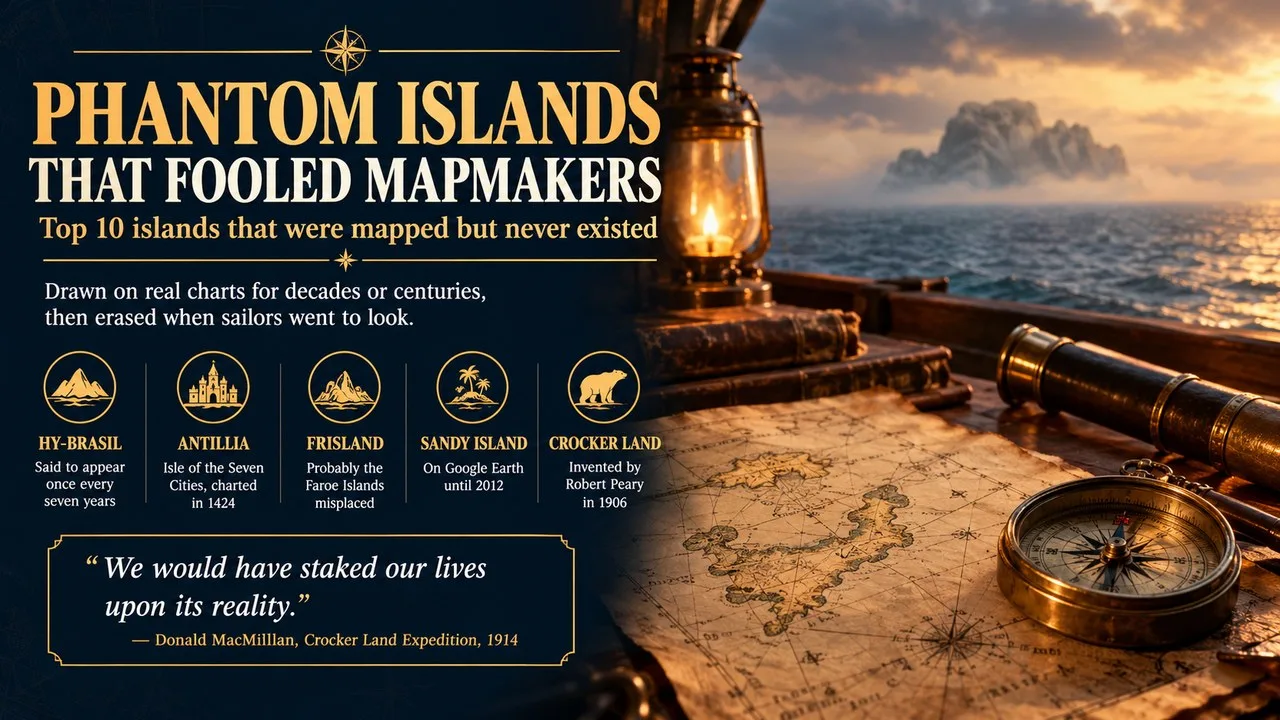
Phantom islands are islands that were drawn on real maps and sea charts, sometimes for centuries, but proved not to exist when sailors went to find them.
This Finepedia guide, written in October 2026, gathers 10 of the most famous phantom islands, from a ninth-century saint's paradise in the Atlantic to a Coral Sea island that stayed on Google Earth until 2012. The facts come from encyclopaedias, map libraries, expedition records and a 2013 scientific paper, and where a date or sighting rests on legend we say so. If you enjoy geography with a twist, you may also like Finepedia's guides to the top 10 largest islands in the world, the top ten mythical creatures in history and interesting facts about Antarctica.
How We Chose These
We picked islands that appeared on published maps or official charts, not ones that only lived in stories, and we checked each against at least two independent sources. The list is in chronological order, by the date each island first entered the written or cartographic record, so you can follow how the causes changed over time: legend and guesswork first, then navigation errors, then fraud, and finally a digital data mistake.
The 10 Phantom Islands at a Glance
| No. | Island | Ocean | First recorded | Likely explanation |
|---|---|---|---|---|
| 1 | Saint Brendan's Island | North Atlantic | 9th century text | Legend, mirages or cloud banks |
| 2 | Hy-Brasil | North Atlantic | c. 1325 | Medieval legend copied between charts |
| 3 | Antillia | North Atlantic | 1424 | Iberian legend of the Seven Cities |
| 4 | Bermeja | Gulf of Mexico | 1539 | Early charting error |
| 5 | Frisland | North Atlantic | 1558 | Misplaced Faroe Islands |
| 6 | Buss Island | North Atlantic | 1578 | Navigation error near Greenland |
| 7 | Saxemberg Island | South Atlantic | 1670 | Cloud or fog mistaken for land |
| 8 | Pepys Island | South Atlantic | 1683 | Misplaced Falkland Islands |
| 9 | Sandy Island | Coral Sea | 1876 | Pumice raft, then a database error |
| 10 | Crocker Land | Arctic Ocean | 1906 | Invented by Robert Peary |
1. Saint Brendan's Island Began as a Monk's Paradise
The oldest island on our list comes from the Navigatio Sancti Brendani Abbatis, a Latin text of the ninth century that tells how the Irish abbot Brendan of Clonfert sailed into the Atlantic with a band of monks, in a voyage traditionally dated to about AD 512 to 530. The story describes a green, fruitful island of the blessed. Mapmakers took it seriously: it sits on the Hereford world map of about 1275 and on Martin Behaim's globe of 1492, made in the year Columbus sailed. In the Canary Islands it is still called San Borondón.
Key Facts
- Other names: San Borondón, Saint Brendan's Isle
- Source: Navigatio Sancti Brendani Abbatis, 9th century
- Mapped on: Hereford map (c. 1275), Behaim's globe (1492)
- Location given: west of the Canary Islands
Did You Know?
Sightings did not stop in the Middle Ages. In 1566 a senior judge in the Canaries told officials on three of the western islands to investigate reports of the island, and a mayor of Valverde on El Hierro claimed to have seen it as late as 1721. Such sightings are often explained today as mirages or banks of cloud on the horizon.
2. Hy-Brasil Was Said to Appear Once Every Seven Years
Irish tradition told of an island west of Ireland hidden in mist, visible only one day in every seven years and impossible to reach even then. The name turns up on a portolan chart of about 1325 by the mapmaker Angelino Dulcert and on the Catalan Atlas of about 1375, usually drawn as a neat circle split by a channel. Expeditions from Bristol went looking for it in 1480 and 1481 and found nothing, yet the island, later shrunk to "Brasil Rock", was still being charted off Galway Bay until 1865.
Key Facts
- Irish name: UÃ Bhreasail
- First charted: Dulcert chart, c. 1325
- Searches: Bristol voyages of 1480 and 1481
- Last shown: on charts until about 1865
A Famous Fake Sighting
A story from 1674 claimed that a Captain John Nisbet went ashore on Hy-Brasil, where he found big black rabbits and an old magician living alone in a stone castle. Historians now treat this tale as a piece of fiction written by the Irish author Richard Head, not as a real voyage. The name Brasil may come from a prized red dye, the same word later given to the country of Brazil.
3. Antillia Was the Island of Seven Cities
Antillia grew out of a Christian legend from Iberia. When Muslim armies conquered most of Hispania around 714, seven bishops were said to have fled west across the ocean with their people, settling an island and founding seven towns. The island first appears clearly on a 1424 nautical chart by Zuane Pizzigano as a large rectangle far west of Portugal, and it then turned up on most Atlantic charts of the 15th century. Behaim's 1492 globe even carries an inscription retelling the story.
Key Facts
- Other name: Isle of the Seven Cities
- First clear map: Zuane Pizzigano chart, 1424
- Legend set: around AD 714
- Faded from maps: after Atlantic voyages from 1492
Why It Matters
Antillia faded once ships began crossing the Atlantic regularly, but its name survived. Spanish sailors passed it on to the Caribbean, whose islands are still called the Greater and Lesser Antilles. Because the island was drawn so large and so far west, some writers have argued it hints at pre-Columbian knowledge of America, an idea most historians treat with caution.
4. Bermeja Became a Modern Oil Mystery
Bermeja was a small islet charted north of Mexico's Yucatán Peninsula in the Gulf of Mexico. It is listed by the Spanish cosmographer Alonso de Santa Cruz in 1539, and around 1540 the navigator Alonso de Chaves gave its position and said it looked reddish from a distance, which is what bermeja means in Spanish. It stayed on maps for centuries, then took on new importance in 2008 and 2009, because a Mexican island in that spot would have pushed Mexico's sea boundary further into oil-rich waters.
Key Facts
- Meaning of name: "reddish" in Spanish
- First listed: Alonso de Santa Cruz, 1539
- Searches: survey in 1997; study by UNAM in 2009
- Stake: oil rights in the "Doughnut Holes" of the Gulf
The Search That Found Nothing
Mexico's National Autonomous University (UNAM) carried out a detailed study for the Mexican Chamber of Deputies in 2009 and found no island, no sandbank and no sign of a sudden change in the seabed. That did not stop a conspiracy theory, raised by several Mexican senators in 2008, that Washington had quietly blown it up. A simple early charting error is the far more likely answer.
5. Frisland Was Probably the Faroe Islands Misplaced
In 1558 the Venetian Nicolò Zen the Younger published letters and a map that he said described North Atlantic voyages made in the 1390s by two of his forebears, the brothers Nicolò and Antonio Zeno. The map showed a large island called Frisland south of Iceland. Leading mapmakers copied it, including Gerardus Mercator in 1569 and Abraham Ortelius, whose atlas appeared in 1570, and it appeared on almost every map of the region from the 1560s to the 1660s.
Key Facts
- Published by: Nicolò Zen the Younger, 1558
- Claimed voyage: 1390s
- Copied by: Mercator (1569), Ortelius (1570)
- Peak years: 1560s to 1660s
How the Mystery Was Solved
By 1693 the Italian cartographer Vincenzo Coronelli noted on his map that Frisland was thought to be a myth or a sunken island. In the 18th century the French geographer Philippe Buache re-worked its coordinates and concluded it was really the Faroe Islands, badly placed. Later scholars compared place names on the Zeno map with an early Danish map of the Faroes and found many close matches.
6. Buss Island Shrank Until It Sank
Buss Island was reported in September 1578 by sailors on the Emanuel of Bridgwater, a sturdy fishing vessel of the type known as a busse, during Martin Frobisher's third voyage to the Arctic. They placed it at roughly 57 degrees north, between Ireland and the imaginary Frisland. Historians think the crew mistook land or an optical effect near Greenland for a new island after an error in dead reckoning. In 1671 a Thomas Shepard even claimed to have charted its coast.
Key Facts
- Reported: September 1578
- Ship: the Emanuel (a busse) from Bridgwater
- Expedition: Martin Frobisher's third voyage
- Disproved: John Ross, 1818
Did You Know?
As more ships crossed the area and saw nothing, mapmakers drew the island smaller and smaller. By 1745 it had become the "Sunken Land of Buss", supposedly marked by shallow water. In 1818 the explorer John Ross, on the ship Isabella, sounded the spot and found no bottom at 180 fathoms, about 330 metres.
7. Saxemberg Island Was Seen but Never Landed On
The Dutch sailor John Lindestz Lindeman reported Saxemberg in the South Atlantic in 1670, giving a position near 30°45′ south and 19°40′ west. His sketch showed a low island with a pointed mountain in the middle. Many ships later passed the spot and saw only sea, and Matthew Flinders, the explorer of Australia, searched for it on the Investigator in September 1801 and decided it did not exist. Even so, the island kept slipping on and off charts until the 19th century.
Key Facts
- Reported by: John Lindestz Lindeman, 1670
- Given position: about 30°45′S, 19°40′W
- Searched for by: Matthew Flinders, 1801
- Landings: none ever recorded
Why It Matters
Saxemberg shows how hard it was to disprove an island before accurate longitude. An American captain named Galloway, commanding the Fanny, claimed four hours of sightings in 1804, and in 1816 a Captain Head, master of the True Briton, said the island stayed in sight for six. None of these captains went ashore, which suggests they saw cloud, fog or a mirage rather than rock.
8. Pepys Island Was the Falklands in the Wrong Place
In late 1683 the English buccaneer William Ambrose Cowley, sailing on the Bachelor's Delight, reported an uninhabited island at about 47 degrees south in the South Atlantic. He named it after Samuel Pepys, then a senior official of the English navy, and praised its fine harbour and many birds. The spot lies about 230 nautical miles north of the Falkland Islands. William Dampier, who sailed on the same voyage, thought they had simply seen the Falklands.
Key Facts
- Reported by: William Ambrose Cowley, 1683
- Named after: Samuel Pepys
- Given latitude: about 47°S
- Now explained as: the Falkland Islands, mis-located
The Long Search
Pepys Island sent some of the best navigators of the 18th century on wild goose chases, including George Anson in the 1740s, John Byron in 1764 and James Cook. All they found was open sea, floating weed and flocks of seabirds. Today it is generally accepted that Cowley's latitude was wrong and that his island was really the Falklands.
9. Sandy Island Survived Until 2012
Sandy Island is the phantom that lasted longest into the digital age. The whaling ship Velocity reported "Sandy Islets" in the Coral Sea, between Australia and New Caledonia, in 1876, and the island went onto charts. French hydrographers removed it in 1974 and Australian ones in 1985, but by then it had been copied into a widely used digital coastline database, so it lived on in scientific data sets and in Google Earth as a feature about 25 kilometres long.
Key Facts
- First reported: whaler Velocity, 1876
- Removed from charts: France 1974, Australia 1985
- Undiscovered: RV Southern Surveyor, late 2012
- Sea depth at the spot: well over 1,000 metres
How It Was Undiscovered
In 2012 Australian scientists led by Maria Seton of the University of Sydney sailed the research ship Southern Surveyor through the area and found deep open ocean where the island should have been. The story became the Sydney Morning Herald's most read article of 2012, and in April 2013 the team published a mock "Obituary: Sandy Island (1876 to 2012)" in the journal Eos. One likely cause of the first sighting is a raft of floating volcanic pumice.
10. Crocker Land Was an Explorer's Invention
In 1906 the American explorer Robert Peary said that from Cape Thomas Hubbard, in the far north of Canada, he had seen distant land about 130 miles to the north-west. He named the land after George Crocker, a San Francisco banker who had helped fund him. Peary's own diary from that day, however, says no land was visible. Historians think he invented Crocker Land to win more money from Crocker, who instead spent his fortune rebuilding San Francisco after the 1906 earthquake.
Key Facts
- Claimed by: Robert Peary, 1906
- Named after: banker George Crocker
- Expedition: Crocker Land Expedition, 1913 to 1917
- Backers: American Museum of Natural History and others
The Mirage on the Ice
In 1914 Donald MacMillan's expedition saw what looked like hills and snowy peaks on the horizon and spent five days crossing about 125 miles of sea ice towards them. Their Inuk guide Piugaattoq had warned them it was only mist, and he was right: it was a mirage, probably a Fata Morgana. MacMillan later wrote that, had they not been out on the frozen sea for 150 miles, "we would have staked our lives upon its reality."
Frequently Asked Questions
What is a phantom island?
A phantom island is an island that was shown on maps or charts but was later proved not to exist. Causes include navigation mistakes, mirages, icebergs, pumice rafts, legends and, in a few cases, deliberate fraud.
Are there still phantom islands on maps today?
Official nautical charts are now checked against satellite data and sonar, so new phantom islands are rare. Errors can still survive in digital data sets, as Sandy Island showed in 2012.
Conclusion
Phantom islands tell the story of mapmaking itself. Medieval charts were filled with islands from saints' tales and legends, early modern sailors added real-looking land through poor longitude and wishful sightings, Robert Peary added one for money, and Sandy Island proved that copying errors can outlast the age of sail. Each was eventually removed by the same simple test: someone went to look. For more on real islands and polar journeys, read Finepedia's top 10 largest islands in the world and interesting facts about Antarctica, the frozen continent.
- Seton, Maria, Simon Williams, Sabin Zahirovic and Steven Micklethwaite (2013), Obituary: Sandy Island (1876 to 2012), Eos, Transactions of the American Geophysical Union, vol. 94, no. 15, pp. 141 to 142.
- University of Sydney (2013), The scientific legacy of undiscovering an island, news release via Phys.org.
- Ramsay, Raymond H. (1972), No Longer on the Map: Discovering Places That Never Were, Viking Press, New York.
- MacMillan, Donald B. (1918), Four Years in the White North, Harper and Brothers, New York.
- Peary, Robert E. (1907), Nearest the Pole, Doubleday, Page and Co., New York.
- Encyclopaedia Britannica, entries on Saint Brendan and Robert Edwin Peary.
- Wikipedia (accessed October 2026), articles on Sandy Island, Bermeja, Crocker Land, Hy-Brasil, Frisland, Antillia, Buss Island, Saint Brendan's Island, Pepys Island and Saxemberg Island.
- BBC World Service, Mexico's Missing Island, radio documentary.
- Peary-MacMillan Arctic Museum, Bowdoin College, Crocker Land Expedition collections.
- 10 Most Today, 10 Islands On Maps That Don't Really Exist, 10mosttoday.com (topic reference).













Log in with