









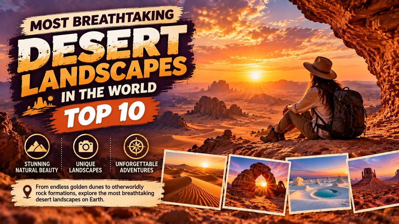
The most breathtaking desert landscapes, from Uyuni's salt mirror to Sossusvlei's red dunes, rank here by drama, geology, access and protection.
Deserts are often sold as empty space. On the ground they are anything but: salt crusts that turn into mirrors after rare rain, dunes that climb higher than city towers, limestone pillars that cast long shadows at dawn, and valleys so dry that scientists treat them as stand-ins for Mars. Beauty here is inseparable from extremes of heat, cold, wind and water scarcity.
This Finepedia listicle, written as of October 2026, ranks ten of the most breathtaking desert landscapes on Earth with a published scorecard rather than a mood board. Each place is scored for visual drama and scale, geological uniqueness, real-world visitor access, formal protection, and cultural or scientific fame. The order is original. It does not copy older roundups, and it does not invent visitor counts, temperature records or UNESCO claims.
Classic names such as Wadi Rum, Death Valley and the Atacama's Valle de la Luna still earn places because the evidence supports them. Weaker or muddled picks from older lists are replaced or reframed: White Sands enters for its rare gypsum dunes and national-park status; Iran's Dasht-e Lut enters for UNESCO-listed yardangs and extreme surface heat; the Nazca Desert and the Sinai Peninsula are discussed as honorable near misses rather than forced top tens. Travelers who like dramatic geology can also browse Most Stunning Volcanoes in the World: Top 10 and Most Dangerous Mountains in the World: Top 10 Deadliest.
How We Ranked the Most Breathtaking Desert Landscapes
Finepedia scored every candidate on five tests that can be checked against park services, UNESCO listings, geological surveys and widely cited field guides. Each landscape received up to 20 points.
- Visual drama and scale (up to 4 points): 4 when the signature vista fills a wide horizon with an immediately recognizable look; 3 when drama is strong but localized; 2 when beauty depends heavily on a single season or weather event
- Geological uniqueness (up to 4 points): 4 when the landform type is rare on a global scale (for example, a vast salt flat or gypsum dune field); 3 when the geology is distinctive but has clear cousins elsewhere; 2 when the setting is beautiful yet geologically typical for its desert type
- Accessibility for visitors (up to 4 points): 4 when independent travelers can reach key viewpoints with standard tour or park logistics in ordinary seasons; 3 when access needs permits, guides or long transfers; 2 when only researchers or expedition teams routinely visit
- Protected status (up to 4 points): 4 for UNESCO World Heritage or equivalent strong national-park protection covering the core vista; 3 for national park, reserve or strongly managed protected area; 2 when protection is partial, local or unclear
- Cultural or scientific fame (up to 4 points): 4 when the place is a household reference in travel, cinema or Earth-science education; 3 when it is well known in specialist circles; 2 when fame is mainly local
- Tiebreaks: first visual drama, then geological uniqueness, then protected status
Eighteen candidates were scored, including every landscape on the most widely shared desert roundups and several strong alternatives from North America, Asia and Africa. Places demoted to Honorable Mentions include the Nazca Desert (world-famous geoglyphs, but a flatter landscape signature than the top ten), the Sinai Peninsula (powerful history and mountain color, yet a broader region than a single coherent vista), the Empty Quarter's remote dune seas, Badain Jaran's mega-dunes, the Flaming Cliffs of the Gobi and Brazil's Lençóis Maranhenses, which is spectacular yet better described as a seasonal dune-and-lagoon system than a classic hyper-arid desert.
The ranking treats breathtaking as a mix of what the eye sees and what the land is. A site that is scientifically precious but nearly unreachable cannot outrank a protected, unique and visitable icon unless its drama and fame are overwhelming. That is why McMurdo's Dry Valleys still appear, but not at number one.
Most Breathtaking Desert Landscapes at a Glance
| # | Landscape | Country / region | Signature look | Score (of 20) |
|---|---|---|---|---|
| 1 | Salar de Uyuni | Bolivia | Mirror salt flat after rains; hexagonal salt polygons when dry | 19 |
| 2 | Sossusvlei and Deadvlei | Namibia | Towering red dunes around pale clay pans | 19 |
| 3 | Wadi Rum | Jordan | Sandstone massifs, arches and red sand valleys | 18 |
| 4 | White Sands | United States | Wave-like gypsum dunes under a wide sky | 17 |
| 5 | Valle de la Luna (Atacama) | Chile | Moon-like ridges, salt and dune forms in hyper-arid desert | 17 |
| 6 | Death Valley | United States | Badlands, dunes, playa and basin extremes | 17 |
| 7 | Dasht-e Lut | Iran | Yardangs, dark desert pavement and extreme heat surfaces | 16 |
| 8 | Erg Chebbi | Morocco | Golden linear dunes rising above the Sahara fringe | 15 |
| 9 | The Pinnacles (Nambung) | Australia | Limestone pillars in yellow sand | 15 |
| 10 | McMurdo Dry Valleys | Antarctica | Ice-free rocky valleys; Mars analog research landscape | 14 |
Photographers chasing color beyond sand and salt may also like Most Colorful Cities in the World: Top 10. Drivers who collect extreme routes can compare desert access roads with the picks in Most Dangerous Roads in the World: Top 10.
1. Salar de Uyuni
| Attribute | Details |
|---|---|
| Location | Altiplano of southwestern Bolivia, near the town of Uyuni |
| Landscape type | High-altitude salt flat (salar) with seasonal shallow flooding |
| Signature vista | Endless sky reflection after rains; dry-season salt hexagons and Isla Incahuasi cactus island |
| Protection / status | National protected landscape context; major tourism destination on the Bolivian Altiplano |
| Finepedia score | 19 of 20 (drama 4, geology 4, access 4, protection 3, fame 4) |
Origins and History
Salar de Uyuni formed as prehistoric lakes on the Altiplano dried and left thick evaporite crusts. The modern salt flat is widely described as the largest on Earth, on the order of 10,000 square kilometers, a scale that turns a flat white plain into a planet-like horizon. Indigenous communities have long known the salar; global tourism grew as overland circuits from Uyuni and nearby towns packaged sunrise, sunset and wet-season mirror tours.
The wet-season mirror effect depends on a thin sheet of water that is not guaranteed every calendar week. Dry months reveal a cracked polygonal salt crust that is just as distinctive, plus mineral-rich islands of volcanic rock where giant cacti grow. Lithium-rich brines beneath parts of the salar have made the region economically important, which is why conservation and industrial pressure are discussed together in modern coverage.
Key Features
- Seasonal mirror surface that reflects clouds and mountains when water is present
- Dry-season hexagonal salt polygons that stretch to the horizon
- Isla Incahuasi (and similar islands), rocky outcrops with columnar cacti
- Train cemetery and salt-hotel architecture near Uyuni as cultural side notes, not the geological core
- High elevation that adds cold nights and intense sunlight to the visual drama
Significance
Salar de Uyuni ranks first among the most breathtaking desert landscapes because few places on Earth offer a horizon that can become a perfect sky mirror, then transform into a geometric salt desert weeks later. The geology is globally rare at this scale, independent travelers can join established circuits, and the place is already a cultural shorthand for otherworldly travel photography. Protection is strong enough for managed tourism but is scored below full UNESCO-coast or classic national-park icons, which keeps the total at 19 rather than a perfect 20.
Interesting Facts
- The salar is frequently cited as the world's largest salt flat by area
- Wet-season reflections are weather-dependent; operators time tours around recent rains rather than a fixed postcard date
- The flat, bright surface has been used in satellite calibration discussions because of its uniform reflectance when dry
- Nearby colored lagoons and volcanic skylines often appear on multi-day circuits, extending the visual story beyond salt alone
- Night skies at altitude can be exceptionally clear when clouds and light pollution are low
2. Sossusvlei and Deadvlei
| Attribute | Details |
|---|---|
| Location | Namib Desert inside Namib-Naukluft National Park, Namibia |
| Landscape type | Red sand dunes surrounding clay pans and ephemeral river end-points |
| Signature vista | Apricot-to-crimson dunes at sunrise; Deadvlei's dead camel thorn trees on white clay |
| Protection / status | Inside a major national park; Namib Sand Sea is a UNESCO World Heritage Site |
| Finepedia score | 19 of 20 (drama 4, geology 4, access 3, protection 4, fame 4) |
Origins and History
The Namib is among the world's oldest deserts, shaped by Atlantic winds and a cold offshore current that limits rainfall. Sossusvlei is a clay pan at the end of the Tsauchab River's reach, surrounded by some of the Namib's highest dunes. Deadvlei, a nearby pan, preserves stark dead trees that died after the river's course and dune movements cut off water, creating one of Africa's most photographed desert tableaux.
Modern access is through park gates and a mix of two-wheel-drive approaches plus sand tracks that often need four-wheel drive or a shuttle for the final stretch to the vlei. Sunrise ballooning and dune climbs (including well-known named dunes on tourist maps) made the area a flagship of Namibian tourism without erasing its geological seriousness.
Key Features
- High linear and star dunes with iron-oxide-rich red sand
- Sossusvlei clay pan that floods only after rare inland rains
- Deadvlei's pale floor and skeletal trees contrasting with red dune walls
- Strict park rules on tracks and camping that protect fragile crusts
- Part of the broader Namib Sand Sea World Heritage landscape
Significance
Sossusvlei ties Salar de Uyuni for score because drama, uniqueness, protection and fame are all near the ceiling. Accessibility loses a point only because the deepest viewpoints need park timing, sand driving or shuttles. For visitors, the reward is a desert scene that looks designed for chiaroscuro: dark dead wood, white clay, red sand and a hard blue sky. Among the most breathtaking desert landscapes, it is the clearest example of dune architecture meeting a story you can walk into.
Interesting Facts
- The Namib Sand Sea's UNESCO listing recognizes a coastal dune system of exceptional scale and age
- Deadvlei's trees are long dead yet remain standing because decay is extremely slow in the dry air
- Dune color deepens when low sun rakes across ripple faces at dawn and dusk
- Fog from the Atlantic can wet the coastal Namib even when inland pans stay dry
- Climbing major dunes is popular, but heat and soft sand make early starts essential
3. Wadi Rum
| Attribute | Details |
|---|---|
| Location | Southern Jordan, east of the Hisma desert and north of Aqaba routes |
| Landscape type | Sandstone and granite massifs rising above red sand corridors |
| Signature vista | Jebel landscapes, natural arches, petroglyphs and camp-sky nights |
| Protection / status | UNESCO World Heritage Site (inscribed 2011) as a mixed cultural and natural property |
| Finepedia score | 18 of 20 (drama 4, geology 3, access 4, protection 4, fame 3) |
Origins and History
Wadi Rum's cliffs and corridors were carved from ancient sandstone in a desert that has hosted Nabataean and Bedouin routes for centuries. Rock inscriptions and petroglyphs record long human presence. In the twentieth century the valley became associated with the Arab Revolt and later with filmmakers seeking a stand-in for alien planets, which layered cinema fame onto an already striking natural amphitheater.
UNESCO's 2011 inscription highlighted both natural scenery and cultural landscape values. Today, Bedouin-run camps, jeep tours, camel treks and climbing routes make the valley one of the Middle East's most structured desert visitor experiences, while still requiring respect for private camps, tracked areas and fragile desert varnish.
Key Features
- Towering sandstone massifs such as Jabal Rum framing red sand valleys
- Natural rock arches and narrow siqs that change color through the day
- Petroglyphs and inscriptions on sheltered rock faces
- Overnight camps with clear-sky viewing far from city lights
- Established jeep and camel circuits that keep most visitors on known routes
Significance
Wadi Rum ranks third because it combines cinematic drama with formal World Heritage protection and relatively straightforward tourism logistics from Jordan's southern corridor. Its geology is spectacular yet belongs to a wider family of sandstone deserts, so uniqueness scores a notch below Uyuni's salt crust or White Sands' gypsum. Cultural fame is high in film and travel media, though still slightly narrower than Death Valley's global science-and-park brand.
Interesting Facts
- UNESCO lists Wadi Rum for mixed natural and cultural criteria
- Several science-fiction productions used the valley as an other-planet set
- Jabal Rum is among Jordan's highest peaks and a known climbing objective
- Night silence and star density are major parts of the visitor experience, not side notes
- Local Bedouin communities operate many camps and guiding services
4. White Sands
| Attribute | Details |
|---|---|
| Location | Tularosa Basin, New Mexico, United States |
| Landscape type | Gypsum dune field |
| Signature vista | Brilliant white ripple fields under blue sky, with San Andres and Sacramento mountain backdrops |
| Protection / status | White Sands National Park (U.S. National Park Service) |
| Finepedia score | 17 of 20 (drama 3, geology 4, access 4, protection 4, fame 2) |
Origins and History
White Sands is not ordinary quartz beach sand. The dunes are made largely of gypsum crystals derived from evaporite deposits in the Tularosa Basin, broken down and blown into one of the world's great gypsum dune fields. The U.S. National Park Service manages the core landscape as White Sands National Park, after earlier status as a national monument, reflecting long recognition of the site's rarity.
Unlike many Sahara-style dune destinations, White Sands sits beside a highway corridor with a paved park loop, picnic areas and sledding slopes on soft gypsum. That accessibility is part of its modern identity, even as neighboring military lands and park rules shape where visitors may walk.
Key Features
- Extensive dunes of white gypsum rather than common quartz sand
- Interdune flats and ripple textures that photograph sharply in low light
- A park road system that brings ordinary cars close to the dune crest zone
- Rare desert plants and animals adapted to bright, shifting gypsum
- Mountain rims that frame the white basin on clear days
Significance
White Sands enters this top ten—ahead of several more famous named deserts—because gypsum dune fields of this size are globally uncommon, protection is unambiguous, and visitors can experience the signature look without expedition logistics. Drama scores a little below Uyuni's mirror or Sossusvlei's red walls because the palette is quieter: white, blue and soft shadow. Fame outside North America is still growing, which is why the cultural score stays modest even though the geology is elite.
Interesting Facts
- Gypsum is water-soluble; the dunes persist because the basin climate is dry enough to limit dissolution
- The bright surface can feel cooler underfoot than dark rock at the same air temperature, but sun glare is intense
- Park status elevates conservation and interpretation compared with unmanaged dune tracks
- Sunset and after-rain moments add subtle color without needing dramatic clouds
- The site is a strong teaching example of evaporite recycling into eolian landforms
5. Valle de la Luna (Atacama)
| Attribute | Details |
|---|---|
| Location | Near San Pedro de Atacama, Antofagasta Region, northern Chile |
| Landscape type | Hyper-arid ridges, salt-encrusted valleys and dune patches in the Atacama Desert |
| Signature vista | Moon-like jagged terrain at sunset; salt caves and amphitheater viewpoints |
| Protection / status | Part of Los Flamencos National Reserve / protected tourism circuits around San Pedro |
| Finepedia score | 17 of 20 (drama 4, geology 3, access 4, protection 3, fame 3) |
Origins and History
The Atacama Desert is routinely cited among the driest non-polar deserts on Earth, a product of the Andes rain shadow, the cold Humboldt Current and stable subtropical high pressure. Valle de la Luna (Valley of the Moon) takes its popular name from sharp, pale ridges and barren slopes that reminded visitors of lunar terrain. Wind, rare water pulses and salt crystallization sculpt the amphitheater of stone and sand that day-trippers from San Pedro de Atacama now visit in large numbers.
Older listicles sometimes treat the whole Atacama as a single postcard. Finepedia focuses on Valle de la Luna as the accessible, named landscape where the moon-valley look is concentrated, while noting that the wider Atacama also holds geysers, lagoons and volcano backdrops for separate itineraries.
Key Features
- Serrated ridges and dry valleys with a lunar nickname earned on sight
- Salt-encrusted surfaces and occasional cave-like salt formations on guided walks
- Dune patches and wind-fluted rock that catch red sunset light
- Easy day-trip logistics from San Pedro de Atacama
- Nearby Andean volcano silhouettes that deepen the sense of scale
Significance
Valle de la Luna scores high on drama and access: it delivers an instantly readable otherworldly scene to ordinary travelers. Geological uniqueness is strong within South America yet shares traits with other hyper-arid mountain-front deserts, and protection is reserve-level rather than a single global brand equal to the Namib Sand Sea. Still, among the most breathtaking desert landscapes, it remains the flagship Atacama vista for good reason.
Interesting Facts
- Parts of the Atacama are used in Mars-analog research because of extreme dryness and soils
- Sunset tours are popular because low light exaggerates ridge relief and color
- Salt crusts can sound brittle underfoot where visitation is allowed
- The valley name is popular and descriptive, not a claim that the geology matches the Moon's
- Clear skies and altitude also make the wider Atacama a major astronomy region
6. Death Valley
| Attribute | Details |
|---|---|
| Location | California–Nevada border region, United States |
| Landscape type | Desert basin and range: playas, badlands, dunes, salt flats and canyon mouths |
| Signature vista | Zabriskie Point badlands; Mesquite Flat Dunes; Racetrack Playa sailing stones |
| Protection / status | Death Valley National Park; also part of a UNESCO biosphere reserve context in broader Mojave–Colorado desert conservation discussions |
| Finepedia score | 17 of 20 (drama 3, geology 3, access 4, protection 4, fame 3) |
Origins and History
Death Valley sits in the Basin and Range province, where crustal extension created deep valleys and steep ranges. The valley floor drops below sea level at Badwater Basin, while surrounding peaks rise high enough to hold snow in winter—an extreme vertical contrast in one park. Indigenous peoples knew the region long before nineteenth-century travelers gave it a fearsome English name during the California Gold Rush era.
The National Park Service now interprets a mosaic of habitats and landforms. Furnace Creek holds one of the most widely cited air-temperature extremes on Earth: 56.7 °C (134 °F) recorded on 10 July 1913, a figure repeated in World Meteorological Organization discussions of historic extremes. Summer heat is dangerous; most scenic road travel concentrates in cooler months.
Key Features
- Badwater Basin salt flat below sea level
- Zabriskie Point and other badlands carved into colorful lake sediments
- Mesquite Flat and Eureka sand dunes
- Racetrack Playa, where thin ice and wind can move rocks across a mud surface
- Artist's Palette and canyon drives that add mineral color beyond beige sand
Significance
Death Valley earns its place for variety plus protection and access. It is not a single dune postcard; it is a desert anthology inside one park boundary. That variety slightly dilutes the one-look drama score compared with Uyuni or Deadvlei, yet it raises educational and repeat-visit value. Among North American desert destinations it remains the best-known name, and it pairs naturally with other Finepedia extreme-place reading for travelers who study risk alongside beauty.
Interesting Facts
- The 1913 Furnace Creek reading of 56.7 °C is the classic cited air-temperature extreme for the valley
- Below-sea-level elevation helps trap heat in summer
- Sailing stones on Racetrack Playa are explained by ice-panel and wind mechanisms documented by researchers, not mystery magnets
- Night skies in remote park sectors are excellent when weather cooperates
- Winter snow on high peaks can sit above a dry, sunlit valley floor in the same view
7. Dasht-e Lut
| Attribute | Details |
|---|---|
| Location | Southeast Iran, primarily Kerman and neighboring provinces |
| Landscape type | Hot hyper-arid desert with yardangs, sand seas and dark desert pavement |
| Signature vista | Wind-carved yardang ridges and vast barren corridors |
| Protection / status | UNESCO World Heritage Site (Lut Desert), inscribed 2016 |
| Finepedia score | 16 of 20 (drama 3, geology 4, access 2, protection 4, fame 3) |
Origins and History
Dasht-e Lut (the Lut Desert) is a hyper-arid Iranian desert whose yardangs—streamlined ridges carved by relentless wind—create a landscape that looks engineered by a blade. Satellite and field studies have also highlighted extremely high land-surface temperatures in parts of the Lut, making it a reference point in discussions of Earth's hot extremes (surface skin temperature is not the same as standard air temperature, a distinction older listicles often blur).
UNESCO inscribed the Lut Desert in 2016 for its outstanding desert landforms. Tourism exists but is thinner and more logistics-heavy than Jordanian or Namibian icons, which is why accessibility scores lower even though protection and geology are excellent.
Key Features
- Extensive yardang fields sculpted by wind erosion
- Sand seas and dark stony pavements in adjoining sectors
- Extreme heat conditions documented in remote-sensing studies of land surface temperature
- UNESCO recognition focused on desert geomorphology
- Sparse settlement rims that keep night horizons dark
Significance
Dasht-e Lut replaces weaker "famous name, flatter look" entries from older desert lists. It is here for landform science and formal World Heritage status, not for easy weekend tourism. Visual drama is real but less globally televised than Wadi Rum's film sets, so the fame score sits in the middle. For readers building a serious map of the most breathtaking desert landscapes, the Lut is the hot-wind counterpart to Antarctica's dry valleys.
Interesting Facts
- UNESCO's listing text emphasizes the Lut's yardangs and desert geomorphology
- Land-surface temperature extremes reported from satellites should not be confused with the Furnace Creek air-temperature record style figures
- Yardangs demonstrate how wind alone can carve bedrock-scale sculpture
- Access typically needs local knowledge, vehicles and seasonal caution
- The desert's name is widely rendered in English as Lut Desert or Dasht-e Lut
8. Erg Chebbi
| Attribute | Details |
|---|---|
| Location | Near Merzouga, eastern Morocco, on the Sahara's northwestern fringe |
| Landscape type | Linear erg (dune sea) of golden sand |
| Signature vista | Steep dune faces glowing at sunrise; camel caravans on ridgelines |
| Protection / status | Local tourism management around Merzouga; part of Morocco's desert heritage landscape rather than a single global park brand |
| Finepedia score | 15 of 20 (drama 4, geology 2, access 4, protection 2, fame 3) |
Origins and History
Erg Chebbi is a compact but visually powerful sand sea whose dunes rise sharply above darker hamada and village edges near Merzouga. Wind regimes pile sand into ridges that are widely marketed at heights on the order of 150 meters at the tallest crests—impressive local relief even if mega-dune systems elsewhere grow larger. Berber and Arab desert communities long used the region as corridor and pasture fringe; late-twentieth-century tourism turned camel treks and overnight bivouacs into the dominant visitor script.
Compared with the Namib Sand Sea, Erg Chebbi is geologically a classic erg rather than a one-of-a-kind landform class, which caps the uniqueness score. What it offers instead is immediate, photogenic Sahara drama with relatively simple arrival logistics from Morocco's tourist circuit.
Key Features
- Tall golden dunes with crisp wind ripples
- Sunrise and sunset color shifts from gold to rose
- Camel and 4x4 circuits staged from Merzouga and nearby villages
- Overnight desert camps beyond the first dune line
- Clear winter skies popular with photographers
Significance
Erg Chebbi stays in the top ten of the most breathtaking desert landscapes because the first glimpse of its wall of dunes still stops conversations. Protection and uniqueness are only moderate, so it cannot overtake UNESCO heavyweights. For many first-time Sahara visitors, though, it is the landscape that finally matches the mental image of "desert," and that cultural roleability keeps its fame score healthy.
Interesting Facts
- An erg is a large area of shifting sand dunes within a desert
- Merzouga is the usual staging village on the erg's edge
- Dune heights vary by crest; marketing figures around 150 meters refer to the taller summits, not every ridge
- Sand temperatures swing widely between midday and night
- Music and drum traditions at camps are cultural add-ons, not geological features
9. The Pinnacles (Nambung)
| Attribute | Details |
|---|---|
| Location | Nambung National Park, Western Australia |
| Landscape type | Limestone pillars rising from yellow desert sand |
| Signature vista | Thousands of stone spires casting long dawn shadows |
| Protection / status | Nambung National Park |
| Finepedia score | 15 of 20 (drama 3, geology 3, access 4, protection 3, fame 2) |
Origins and History
The Pinnacles are limestone formations in Nambung National Park, created as ancient calcareous sands were cemented, eroded and exhumed into pillars and knobs. Scientific explanations have been refined over time, but the visitor experience is immediate: a desert floor studded with stone fingers that look planted overnight. European exploration accounts and later park tourism turned the field into one of Western Australia's signature day trips from the Cervantes area.
Seasonal wildflowers in the wider park add color in late winter and spring, a detail older articles sometimes treat as constant. The core spectacle remains the limestone-and-sand geometry under harsh sunlight.
Key Features
- Dense fields of limestone pinnacles of varied height and shape
- Yellow sand floor that heightens contrast
- Loop drives and short walks managed by the national park
- Dramatic shadows at sunrise and late afternoon
- Nearby coastal landscapes on the same regional itinerary
Significance
The Pinnacles rank ninth because they offer a desert silhouette unlike dune or salt-flat icons, inside a clear national-park frame, with easy vehicle access. Drama and fame are more regional than global, and similar karst-desert curiosities exist elsewhere, so the scores stay mid-pack. Still, anyone assembling a visual dictionary of the most breathtaking desert landscapes needs this limestone chapter.
Interesting Facts
- The formations are limestone, not petrified wood, despite occasional tourist myths
- Best shadow play is near sunrise or sunset; midday flattens relief
- Park roads make the field accessible without dune driving
- Wildflower seasons are separate from the stone spectacle and vary by year
- Combining the Pinnacles with Indian Ocean coastal stops is a common Western Australia circuit
10. McMurdo Dry Valleys
| Attribute | Details |
|---|---|
| Location | Southern Victoria Land, Antarctica, near McMurdo Sound |
| Landscape type | Ice-free polar desert valleys with glaciers at their heads and rocky floors |
| Signature vista | Stark ice-free valleys under polar light; glacier tongues ending above barren ground |
| Protection / status | Antarctic Treaty System protections; managed as sensitive scientific sites |
| Finepedia score | 14 of 20 (drama 3, geology 4, access 1, protection 3, fame 3) |
Origins and History
The McMurdo Dry Valleys are among Antarctica's largest ice-free regions. Katabatic winds descending from the polar plateau can evaporate and sublimate moisture so effectively that snowfall struggles to accumulate, leaving rocky valley floors that look deceptively temperate in photographs. Older popular articles sometimes quote precipitation figures that are far too high for these valleys; the scientific consensus treats them as an extreme polar desert and a premier Mars-analog landscape for microbiology and geomorphology research.
Human presence is dominated by national Antarctic programs. Tourism is tightly limited compared with temperate deserts, which is why accessibility scores at the bottom even though scientific fame is outsized.
Key Features
- Ice-free valley floors in a continent otherwise buried in ice
- Katabatic winds that maintain extreme dryness
- Glacier termini that stop short of filling the valleys
- Hypersaline lakes and unique microbial habitats studied by researchers
- Strict environmental protocols under Antarctic governance
Significance
McMurdo closes the list because breathtaking here is intellectual as much as scenic: the valleys rewrite what visitors think a desert must look like. Geology and science fame are excellent; ordinary traveler access is minimal. Finepedia keeps the site in the top ten of the most breathtaking desert landscapes so the ranking is not only a tourism brochure, while being honest that most readers will experience it through research imagery rather than a weekend tour.
Interesting Facts
- The Dry Valleys are a classic Earth analog in Mars research literature
- Precipitation is extremely low; popular claims of hundreds of millimeters per year do not match the polar-desert reality of these valleys
- Winds can remove snow by sublimation and transport, not only by melting
- Lakes in the valleys can have unusual chemistry and perennial ice covers
- Visits require Antarctic program frameworks, not standard hotel tourism
Honorable Mentions
Several strong places scored just outside the final ten or failed a coherence test.
- Nazca Desert, Peru: corrected from the common typo "Nazca Dessert" in older posts. The Nazca Lines (roughly dated across the first millennium BCE into the first millennium CE in many summaries) make the plain world-famous, yet the ground-level landscape is a subtler pampa than Uyuni or Sossusvlei. Aerial viewing is the main reveal.
- Sinai Peninsula, Egypt: mountain color, religious history and Red Sea edges are powerful, but "Sinai Desert" names a broad region more than one signature landform amphitheater.
- Rub' al Khali (Empty Quarter): immense dune seas with limited routine tourist access.
- Badain Jaran, China: lakes among mega-dunes; logistics and fame are more specialist.
- Lençóis Maranhenses, Brazil: unforgettable dune-and-lagoon seasonality, yet not a classic hyper-arid desert under Finepedia's working definition for this list.
Frequently Asked Questions
What makes the most breathtaking desert landscapes different from ordinary dry land?
Breathtaking deserts combine an instantly readable vista with uncommon geology, enough access for people to witness it, formal protection where possible, and a cultural or scientific story. Empty aridity alone is not enough on this Finepedia scorecard.
Is Salar de Uyuni always a mirror?
No. The mirror effect needs a shallow water layer after rains. In dry periods the same salar shows white salt polygons and still ranks among the most dramatic high-altitude desert flats on Earth.
Why include McMurdo Dry Valleys if tourists rarely go?
Because the ranking measures landscape quality, not only hotel convenience. The Dry Valleys are a polar desert of global scientific importance and unique ice-free scenery, even though access is restricted to research frameworks.
Which desert is the hottest?
It depends on the metric. Death Valley holds a famous historic air-temperature extreme of 56.7 °C at Furnace Creek in 1913. Some deserts, including parts of the Lut, are discussed for very high land-surface temperatures measured by satellites. Those are different measurements.
Are White Sands and ordinary beach dunes the same?
No. White Sands is famous for gypsum dunes, not the quartz sand of most beaches. That mineral difference is central to its geological uniqueness score.
What errors appear in older desert listicles?
Common problems include the "Nazca Dessert" spelling mistake, inflated or vague precipitation claims for Antarctica's Dry Valleys, mixing surface and air temperatures, and treating entire regions such as Sinai as if they were a single viewpoint.
Can I visit all ten in one trip?
Practically no. They span Bolivia, Namibia, Jordan, the United States, Chile, Iran, Morocco, Australia and Antarctica. A realistic plan samples one continent at a time and checks park seasons, heat warnings and permit rules first. Flight logistics to remote parks can be as fiddly as the approaches in Most Dangerous Airports in the World: Top 10.
Conclusion
The most breathtaking desert landscapes are not empty blanks on a map. They are salt mirrors, red dune amphitheaters, sandstone film sets, gypsum seas, moon valleys, basin extremes, wind-carved yardangs, Sahara ergs, limestone pinnacles and polar dry valleys—each scored here for what the eye sees and what the Earth is doing. Use the scorecard as a travel filter: chase drama, respect protection rules, and treat extreme heat, cold and isolation as design features of the scenery, not footnotes.
- UNESCO World Heritage Centre — Wadi Rum Protected Area; Namib Sand Sea; Lut Desert (Dasht-e Lut) listing pages
- U.S. National Park Service — Death Valley National Park; White Sands National Park official pages
- NASA / Antarctic research overviews — McMurdo Dry Valleys as Mars-analog polar desert (science summaries)
- World Meteorological Organization and meteorological histories — discussion of the 10 July 1913 Furnace Creek temperature extreme
- Gobierno de Chile / CONAF and Atacama tourism resources — Valle de la Luna / Los Flamencos visitor context
- Namibia tourism and Namib-Naukluft park information — Sossusvlei and Deadvlei access notes
- Bolivian tourism and Altiplano geography references — Salar de Uyuni extent and seasonal flooding behavior
- Western Australia Parks information — Nambung National Park / The Pinnacles
- Reference topic prompt only (not copied): https://10mosttoday.com/10-most-breathtaking-desert-landscapes/













Log in with