










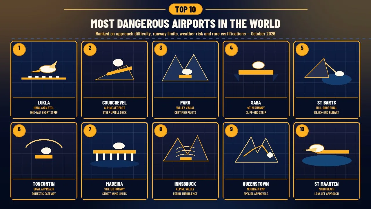
These most dangerous airports pair short runways with mountain approaches and crosswinds, ranked by difficulty, runway limits, weather and rare ratings.
Airline passengers usually meet a long, well-lit runway guided by instrument landing systems. At a handful of civil airports the picture is different: the strip is only a few hundred metres long, the final turn is flown by eye between ridgelines, or published wind limits ground flights that would be routine elsewhere. Those places are not unsafe because airlines ignore rules. They are demanding because geography leaves little margin, so regulators, operators and pilots wrap them in special training, daylight limits and go-around discipline.
This Finepedia ranking, written as of October 2026, covers ten currently notable airports used by civil or passenger traffic where short fields, mountain valleys, coastal winds or visual-only procedures still shape everyday operations. It uses official aerodrome data, airport-authority pages and reputable aviation reporting. Closed historic fields such as Hong Kong's Kai Tak appear only in Honorable Mentions, clearly labelled. Military-only or research strips that dominated older listicles are left out of the main ten. Scores are editorial, not official accident rankings, and scheduled airlines that serve these airports do so under approved procedures.
"Dangerous" here means operationally demanding for flight crews, not a prediction that any given flight will end badly. Modern turboprops and jets arrive with performance calculations, go-around criteria and company approvals that did not exist in the same form when some of these strips first became famous. Passengers still feel the difference as steep finals, sudden go-arounds, weather delays and, in a few places, the sight of water or rock just beyond the asphalt.
How We Ranked These Most Dangerous Airports
Each airport was scored from 1 to 5 on four criteria, for a total out of 20. The same definitions were applied to every entry and checked against AIP summaries, airport authority publications and reputable aviation journalism listed in Sources.
- Approach difficulty (1 to 5): how tightly terrain, circling, one-way operations or visual-only finals constrain the last miles before touchdown.
- Runway constraint (1 to 5): how short, sloping, displaced or physically exposed the usable strip is compared with typical jet or turboprop needs.
- Weather and terrain risk (1 to 5): how often wind, turbulence, cloud, ice or surrounding peaks force delays, diversions or aborted approaches.
- Special-ops rarity (1 to 5): how strongly the field depends on special pilot qualifications, mountain ratings, rare approvals or unusually strict operating limits.
When totals tie, higher Approach difficulty ranks first, then higher Runway constraint. Honorable Mentions near the end cover closed, niche or otherwise notable fields that did not make the top ten.
The Scorecard
| Rank | Airport | Approach | Runway | Weather | Special | Total |
|---|---|---|---|---|---|---|
| 1 | Tenzing-Hillary Airport, Lukla | 5 | 5 | 5 | 5 | 20 |
| 2 | Courchevel Altiport | 5 | 5 | 4 | 5 | 19 |
| 3 | Paro International Airport | 5 | 3 | 5 | 5 | 18 |
| 4 | Juancho E. Yrausquin Airport, Saba | 4 | 5 | 3 | 5 | 17 |
| 5 | Gustaf III Airport, St. Barts | 5 | 5 | 3 | 4 | 17 |
| 6 | Toncontin International Airport | 5 | 4 | 4 | 4 | 17 |
| 7 | Cristiano Ronaldo Madeira Airport | 4 | 3 | 5 | 4 | 16 |
| 8 | Innsbruck Airport | 4 | 3 | 5 | 4 | 16 |
| 9 | Queenstown Airport | 4 | 3 | 4 | 4 | 15 |
| 10 | Princess Juliana International Airport | 3 | 3 | 2 | 2 | 10 |
Princess Juliana scores lowest on pure operational hardness among the ten, yet it stays on the list because its famous low approach over Maho Beach still defines how millions of travelers experience a constrained Caribbean runway. Courchevel outranks longer mountain gateways because its uphill strip leaves almost no room for a conventional go-around. Toncontin remains ranked despite Palmerola taking most international traffic, because domestic and remaining operations still face the same bowl of hills.
Most Dangerous Airports at a Glance
| Rank | Airport | Country / territory | Codes | Runway snapshot | Signature challenge |
|---|---|---|---|---|---|
| 1 | Tenzing-Hillary (Lukla) | Nepal | LUA / VNLK | About 527 m asphalt, high elevation | One-way mountain strip into Everest region |
| 2 | Courchevel Altiport | France | CVF / LFLJ | About 537 m with steep uphill slope | Mountain landing with limited go-around room |
| 3 | Paro International | Bhutan | PBH / VQPR | About 2,265 m asphalt in a deep valley | Daylight visual approaches; certified pilots only |
| 4 | Juancho E. Yrausquin | Saba (Caribbean Netherlands) | SAB / TNCS | 401 m concrete (AIP) | Shortest widely cited commercial runway, cliff ends |
| 5 | Gustaf III | Saint Barthelemy | SBH / TFFJ | About 646 m | Steep drop over a hill onto a beach-end strip |
| 6 | Toncontin | Honduras | TGU / MHTG | About 2,021 m asphalt | Bowl approach; international jets largely moved to Palmerola |
| 7 | Cristiano Ronaldo Madeira | Portugal | FNC / LPMA | About 2,781 m pavement; LDA about 2,481 m | Stilted extension; strict published wind limits |
| 8 | Innsbruck | Austria | INN / LOWI | About 2,000 m in an alpine valley | Foehn winds, turbulence and terrain-bound procedures |
| 9 | Queenstown | New Zealand | ZQN / NZQN | Main runway about 1,777 m | Mountain RNP AR approaches needing special approval |
| 10 | Princess Juliana | Sint Maarten | SXM / TNCM | 2,300 m asphalt (AIP) | Very low approach over Maho Beach to runway 10 |
Readers exploring other Finepedia travel and risk lists may also like Most Dangerous Tourist Destinations in the World: Top 10, Most Dangerous Bridges in the World: Top 10, Things to Do on a Long-Haul Flight: Top 10 Ideas, Coldest Places in the World: Top 10 and Most Dangerous Mountains in the World: Top 10 Deadliest.
1. Tenzing-Hillary Airport, Lukla
| Attribute | Details |
|---|---|
| Location | Lukla, Solukhumbu District, Nepal; gateway to Sagarmatha / Everest trekking routes |
| Codes | IATA LUA; ICAO VNLK |
| Elevation | About 2,846 to 2,859 m (roughly 9,340 to 9,380 ft), depending on the charted reference |
| Runway | 06/24 asphalt, about 527 m long; commonly described as steeply sloping and effectively one-way |
| Main challenge | Short high-altitude strip between rising terrain, weather that closes the valley, limited lighting |
Lukla is the airport most trekkers meet on the way toward Everest Base Camp. The strip sits on a mountainside shelf: landings are typically flown uphill toward rising ground, and take-offs go downhill toward open valley air. There is little of the long, flat overrun space found at lowland jet airports, which is why Lukla tops this ranking even though only small turboprops and specialised aircraft normally use it.
Approach Challenge
Pilots must thread a Himalayan valley, judge cloud and wind by eye, and commit to a short paved surface that leaves almost no room for a late correction. Charts and operator materials emphasise special qualification. Afternoon cloud and wind often shut the field, which is why many flights leave Kathmandu early. Density altitude at nearly 2,850 m further reduces engine and wing performance, so the same runway feels even shorter than its measured length.
Key Features
- Asphalt runway about 527 m (1,729 ft) long on headings 06/24
- Field elevation near 2,850 m above sea level
- One-way operating pattern driven by terrain slope and surrounding peaks
- Unlit or limited lighting compared with major international airports
- Scheduled STOL turboprop service when weather allows
Significance
Without Lukla, the Everest region would depend far more on multi-day walks or helicopter lifts. The airport concentrates risk into a few minutes of flying, then hands travelers to trails that create their own hazards. For aviation, it is a textbook case of how altitude, slope and valley weather can outweigh raw runway length as the dominant danger factors.
Trekking companies build slack into itineraries for that reason. A closed morning at Lukla can cascade into missed lodge bookings and compressed acclimatisation days on the trail. The aviation risk and the mountain-travel risk are linked: the same monsoon cloud that grounds aircraft also turns paths slick and cold.
Interesting Facts
- The airport is named for Tenzing Norgay and Edmund Hillary, the first climbers confirmed to reach Everest's summit in 1953.
- Civil Aviation Authority of Nepal materials and logistics assessments list the strip among the country's most constrained mountain aerodromes.
- Weather, not runway length alone, cancels a large share of planned Lukla flights each season.
- Helicopter alternatives exist but cost more and face their own mountain-weather limits.
- Lukla is a domestic gateway; international passengers connect via Kathmandu.
2. Courchevel Altiport
| Attribute | Details |
|---|---|
| Location | Courchevel, Savoie, French Alps |
| Codes | IATA CVF; ICAO LFLJ |
| Elevation | High alpine altiport above the ski resort |
| Runway | About 537 m long, with a steep uphill segment often cited near 18 percent on part of the strip |
| Main challenge | Uphill landing, downhill take-off, mountain rating culture, little conventional go-around room |
Courchevel's altiport is a short mountain runway built for the ski resort rather than for airline jets. Aircraft land uphill so that the slope helps them stop, then take off downhill to gain speed. The profile is so unusual that French mountain-flying culture treats it as a specialist field, not a normal regional strip.
Approach Challenge
The final approach aims at a rising deck. Misjudging energy leaves almost no flat overrun, and a go-around is constrained by rising terrain and the short usable length. Winter operations add snow, ice and low cloud that can hide the strip until late. Only suitably trained crews in appropriate aircraft types are expected to operate there.
Key Features
- Runway length about 537 m (roughly 1,760 ft)
- Strong longitudinal slope on a large portion of the paved surface
- Landings typically on the uphill heading; take-offs on the downhill heading
- Ski-resort access rather than hub airline traffic
- Mountain-flying experience expected of crews
Significance
Courchevel shows that danger is not reserved for remote Himalayan strips. A glamorous Alpine resort can still host one of civil aviation's most unforgiving short fields. Its presence on this list also balances long-runway jet airports with true short-field mountain aviation.
Interesting Facts
- French AIP and mountain-flying clubs describe the steep mid-runway gradient in detail rather than treating the strip as flat.
- The altiport appears often in short-runway comparisons alongside Saba and Lukla.
- Jet operations are not the normal use case; turboprops and suitable light aircraft dominate.
- Resort demand keeps the field relevant each winter season.
- Nearby Alpine valleys create rapid weather changes even when the resort village looks calm.
3. Paro International Airport
| Attribute | Details |
|---|---|
| Location | Paro Valley, Bhutan, about 3.5 km from Paro town and roughly 54 km by road from Thimphu |
| Codes | IATA PBH; ICAO VQPR |
| Elevation | About 2,245 m (7,364 ft) |
| Runway | 15/33 asphalt; physical length commonly about 2,265 m (charted figures vary slightly by source) |
| Main challenge | Daylight visual valley approach among high peaks; only specially certified pilots |
Paro's runway is not especially short by turboprop or regional-jet standards. The danger comes from the valley: surrounding peaks rise toward 5,500 m, the final track is curved, and official materials stress visual meteorological conditions and daylight hours. Bhutan's Department of Air Transport notes that only a select group of pilots is certified to land there.
Approach Challenge
Crews fly by landmarks through a winding valley, often seeing the runway late. Bhutan AIP guidance has long warned that final approach tracks are curved because of hills, that approach angles can be steeper than a standard three-degree path, and that classic visual aids such as VASI, PAPI and ILS are not available on final in the way pilots expect at large hubs. Afternoon valley winds are a known operational concern, which is why morning arrivals are preferred when possible.
Key Features
- Single asphalt runway in a deep Himalayan valley
- Daylight / visual-condition operating culture emphasised by the airport authority
- Special pilot certification or navigator arrangements for many flights
- Field elevation above 2,200 m affecting aircraft performance
- National gateway role for international visitors to Bhutan
Significance
Paro is proof that a moderately long runway can still rank among the world's hardest civil approaches. Certification scarcity, terrain and visual-only discipline matter more here than raw pavement length. For travelers, the arrival is part of Bhutan's controlled tourism experience; for aviation, it is a Category C-style difficult aerodrome in practice.
Because so few pilots are cleared, airline schedules depend on a small pool of currency and weather windows. That is why afternoon valley winds and cloud matter commercially as well as aerodynamically: a missed morning bank of arrivals is hard to recover the same day.
Interesting Facts
- Official quick facts from Bhutan's Department of Air Transport place the airport 3.5 km from Paro town.
- Surrounding peaks are described in authority materials as rising to about 5,500 m (18,000 ft).
- Paro was Bhutan's only airport until additional domestic fields opened from 2011 onward.
- Simulator training or a qualified navigator is commonly required before a new crew is cleared in.
- RNP and cloud-break procedures have been developed, but visual terrain awareness remains central.
4. Juancho E. Yrausquin Airport, Saba
| Attribute | Details |
|---|---|
| Location | Saba, Caribbean Netherlands |
| Codes | IATA SAB; ICAO TNCS |
| Elevation | Low coastal cliff site (thresholds around 35 to 41 m in AIP data) |
| Runway | 12/30 concrete, 401 m x 18 m; LDA about 349 m (RWY 12) and 355 m (RWY 30) |
| Main challenge | Extremely short commercial runway with water and cliffs beyond both ends |
Saba's airport is repeatedly cited as the shortest commercial runway in regular passenger use. Dutch Caribbean AIP figures list a 401-metre concrete strip. Landing distance available is even shorter because of displaced thresholds. Beyond the pavement, the island drops toward the sea, so there is no long safety area of the kind found at inland airports.
Approach Challenge
Only small STOL aircraft suitable for the declared distances operate. Pilots must land precisely, absorb energy quickly and reject approaches early if the picture is unstable. Trade winds and island turbulence add work on short final. The public entity of Saba itself markets the field as having a roughly 400-metre runway almost encircled by Caribbean water.
Key Features
- AIP physical length 401 m; width 18 m
- Declared landing distances under 360 m on both ends
- Cliff and water beyond the strip instead of long overrun
- Twin Otter-class / STOL traffic rather than jets
- Essential air link for a small island without a long flat coastal plain
Significance
Saba demonstrates the absolute end of the commercial runway-length spectrum. Where Lukla adds altitude and Courchevel adds slope, Saba adds sheer shortness and cliff exposure. That combination earns it a place near the top even though its weather is usually kinder than Himalayan or Alpine fields.
Island logistics explain why the strip exists at all. Saba's cliffs leave no room for a 2,000-metre coastal runway of the kind Sint Maarten enjoys, so the community accepts STOL aircraft and precise flying as the price of a quick link to the wider Caribbean.
Interesting Facts
- Dutch Caribbean AIP AD 2.12 lists runway dimensions as 401 x 18 m concrete.
- LDA figures of 349 m and 355 m show how displaced thresholds shrink usable landing distance.
- Ferry and air links together keep the island supplied; the airport is not a tourist thrill ride for jetliners.
- Spelling varies (Yrausquin / Irausquin) across official and tourism pages.
- The field is often paired with St. Barts in Caribbean short-runway discussions.
5. Gustaf III Airport, St. Barts
| Attribute | Details |
|---|---|
| Location | Saint Jean, Saint Barthelemy (French Caribbean) |
| Codes | IATA SBH; ICAO TFFJ |
| Elevation | Low coastal strip ending toward St. Jean Beach |
| Runway | 10/28, about 646 m long and about 18 m wide |
| Main challenge | Steep descent after clearing a hill / ridge on the runway 10 approach |
Gustaf III Airport packs a short Caribbean runway into a crowded coastal bowl. The famous approach to runway 10 clears the Col de la Tourmente area, then drops quickly onto a strip that ends near the beach. Videos make the arrival look like a stunt; in reality it is a published short-field operation limited to suitable aircraft and trained crews.
Approach Challenge
On runway 10, pilots cross rising ground and a busy road area before seeing a short final. Energy management has to be exact: too high and the landing uses too much of the 646 m; too low and terrain or obstacles become a threat. The beach beyond the far end leaves little forgiveness if a landing goes long. Trade winds and traffic in the visual circuit add workload.
Key Features
- Runway length about 646 m (roughly 2,120 ft)
- Steep visual arrival over a hill toward runway 10
- Beach and bay beyond the pavement
- Small turboprop / STOL traffic serving a luxury tourism island
- No long jet runway alternative on the island itself
Significance
St. Barts sits between Saba's ultra-short cliff strip and Madeira's jet-capable but wind-limited runway. It is one of the most watched passenger approaches in the Caribbean precisely because ordinary travelers can stand near the hill and watch aircraft clear it by a small margin.
Interesting Facts
- The airport is also known as Saint Barthelemy Airport or St. Jean Airport.
- Local tourism writing treats the arrival as part of the island's identity, not a hidden industrial strip.
- Aircraft size is tightly constrained by runway length and surrounding terrain.
- The hill approach is directional; the opposite landing does not create the same viral camera angle.
- Nearby ferry and connecting flights via larger islands fill gaps when weather or load limits interfere.
6. Toncontin International Airport
| Attribute | Details |
|---|---|
| Location | Tegucigalpa, Honduras |
| Codes | IATA TGU; ICAO MHTG |
| Elevation | Highland capital basin surrounded by hills |
| Runway | 02/20 asphalt, about 2,021 m x 45 m; runway 02 has a large displaced threshold in AIP data |
| Main challenge | Curving approach into a bowl of hills; most scheduled international jets moved to Palmerola in 2021 |
Toncontin became world-famous for the sharp turn onto runway 02 among hills that ring Tegucigalpa. As of 2025-2026 reporting, Palmerola International Airport in Comayagua handles most commercial international traffic, while Toncontin continues with domestic schedules, private flights and related operations. The geography that made the old jet approaches notorious has not moved.
Approach Challenge
Charts and pilot briefings describe a terrain-constrained arrival that requires precise tracking and a late alignment with the runway. Displaced threshold data on runway 02 reduce landing distance available compared with the full paved length. Visibility and wind in the bowl still cause temporary closures, as Honduran aviation notices continue to show. Travelers should not assume every Tegucigalpa ticket still uses Toncontin; many international itineraries now list Palmerola.
Key Features
- Asphalt runway about 2,021 m long
- Historic bowl approach that defined older "dangerous airport" lists
- International commercial jets largely shifted to Palmerola (MHPR) from late 2021
- Ongoing domestic and private activity at the capital field
- Elevation and surrounding ridges that still demand disciplined energy management
Significance
Toncontin remains on this list because the approach problem is real and still relevant to aircraft that use it, not because every long-haul jet still lands there. Including the Palmerola transition is part of writing an accurate 2026 article instead of copying decade-old rankings.
Interesting Facts
- Honduran press and aviation authorities still report weather-related suspensions at Toncontin.
- Palmerola was opened to give the country a less terrain-bound international gateway roughly an hour from the capital by road.
- Older viral landing videos usually show the pre-2021 international jet era.
- AIP figures for displaced thresholds explain why usable landing distance is shorter than a casual glance at pavement length suggests.
- The airport's reputation outlived its role as the main international gateway.
7. Cristiano Ronaldo Madeira Airport
| Attribute | Details |
|---|---|
| Location | Santa Cruz, Madeira, Portugal |
| Codes | IATA FNC; ICAO LPMA |
| Elevation | About 58 m (roughly 190 ft) |
| Runway | 05/23; total pavement about 2,781 m; landing distance available about 2,481 m; part of the strip sits on a stilted platform |
| Main challenge | Orographic wind, turbulence and unusually explicit AIP wind limits |
Madeira's airport looks spectacular because a major extension sits on concrete columns over the bay. The harder operational story is wind. Portuguese AIP material publishes numerical touchdown wind limits by sector and runway — something most airports leave to airline policy — and warns of severe turbulence near the runway 23 threshold with certain southerly and westerly flows.
Approach Challenge
Mountainous terrain beside a coastal plateau creates shear, updrafts and downdrafts on short final. Straight-in approaches from some navaids are restricted; circling and special approvals appear in procedure notes. When winds exceed published limits, flights divert to Porto Santo or the mainland. The stilts themselves are an engineering answer to length; they do not remove the mountain-wave problem.
Key Features
- Extended runway partly supported on dozens of concrete pillars
- Declared landing distance shorter than total pavement length
- Sector-based mean and gust wind limits in AIP documentation
- Regular European jet traffic when weather is within limits
- High diversion rate compared with flat coastal airports
Significance
Madeira belongs on a civil jet list because ordinary holidaymakers still fly there on mainstream airlines. The danger is not a 400-metre cliff strip; it is a full-size runway that nature frequently makes unusable. That distinction matters for travelers reading viral "scary landing" videos.
From the cabin, a Madeira arrival can look like continuous rudder work and a firm touchdown. From the flight deck, it is a monitored approach against published numbers: if the wind saturates the limit, the decision is diversion, not heroics. Porto Santo's shorter hop across the water is the usual alternate when Funchal is out of limits.
Interesting Facts
- The airport was renamed after Cristiano Ronaldo, Madeira's most famous footballer.
- Local briefings emphasise the difference between 2,781 m of pavement and about 2,481 m of landing distance available.
- ANAC and airport working groups have studied lidar and other sensors to better detect turbulence.
- Diversions are a planned part of Madeira operations, not a rare embarrassment.
- Crosswind landing videos from Funchal are among the most shared airport clips in Europe.
8. Innsbruck Airport
| Attribute | Details |
|---|---|
| Location | Innsbruck, Tyrol, Austria |
| Codes | IATA INN; ICAO LOWI |
| Elevation | Alpine valley floor beneath the Nordkette and surrounding ranges |
| Runway | 08/26, about 2,000 m (roughly 6,560 ft) |
| Main challenge | Valley terrain, Foehn winds, turbulence and special approach procedures |
Innsbruck is a scheduled alpine gateway that packs airline traffic into a narrow valley. The runway length is adequate for many narrow-body operations, but surrounding mountains and the Foehn wind regime create turbulence, shear and route constraints that training departments treat seriously.
Approach Challenge
Arrivals follow terrain-aware tracks rather than a wide-open ILS from any direction. Airport pilot information discusses Foehn best practices, including preferred runways, visual references along the Nordkette and expectations of turbulence over the Inn River and city. Missed approaches and departures must respect rising terrain immediately beyond the valley.
Key Features
- Single main runway in a deep Alpine valley
- Foehn and valley-wind turbulence highlighted in pilot briefings
- Scheduled leisure and regional airline traffic
- Special crew qualification culture at many operators
- Winter sports demand that keeps the airport busy in difficult seasons
Significance
Innsbruck shows how a European city airport can still earn a "dangerous" reputation without a tiny runway. Terrain and wind, not pavement length, drive the score. For passengers, that usually means delays and diversions rather than spectacle; for crews, it means currency and briefings that ordinary lowland airports do not require.
Interesting Facts
- Innsbruck Airport publishes dedicated Foehn guidance for business-aviation and airline crews.
- The Nordkette ridge above the city is both a scenic landmark and an operational reference.
- RNP and visual routes are part of the modern procedure set used to stay clear of terrain.
- Diversions to Munich or other Austrian fields occur when valley winds exceed limits.
- Ski-season peaks coincide with some of the most unstable weather windows.
9. Queenstown Airport
| Attribute | Details |
|---|---|
| Location | Queenstown, Otago, New Zealand |
| Codes | IATA ZQN; ICAO NZQN |
| Elevation | Lakeside alpine setting among the Remarkables and surrounding ranges |
| Runway | Main 05/23 about 1,777 m; shorter general-aviation runway also present |
| Main challenge | Mountain RNP AR approaches requiring aircraft and crew approvals |
Queenstown is New Zealand's adventure-tourism gateway and one of the clearest examples of modern performance-based navigation used to manage mountain risk. Airline arrivals rely heavily on RNP Authorization Required procedures that thread valleys with precise lateral and vertical paths. Those procedures only work with approved aircraft, trained crews and acceptable weather.
Approach Challenge
Conventional long straight-in approaches are limited by high terrain. RNP AR tracks let jets follow curved paths that stay inside surveyed corridors, but crews must be current and the aircraft must meet the navigation specification. When cloud, wind or equipment issues remove that option, schedules slip or flights divert. The airport's own corporate communications have explained how RNP improved access while still demanding special qualification.
Key Features
- Main sealed runway about 1,777 m (5,830 ft)
- Mountainous visual and RNP AR environment
- Operator-specific training and approval culture
- Strong domestic jet demand from tourism
- Weather that can close valley approaches quickly
Significance
Queenstown balances this list toward the Pacific and toward modern jet procedures rather than only short STOL strips. It is dangerous in the sense that terrain leaves little room for informal flying, not because the runway is 400 m long. That is an important nuance for readers who equate "dangerous airport" only with viral Caribbean or Himalayan clips.
Tourism growth forced the technology investment. Without RNP AR, more flights would cancel on marginal days; with it, access improved while the underlying mountain geometry stayed exactly as demanding as before. Passengers see a smooth curved approach; regulators see a tightly controlled authorisation regime.
Interesting Facts
- Civil Aviation Authority of New Zealand materials treat RNP AR as a demanding navigation specification with training obligations.
- Queenstown Airport has publicly discussed how RNP widened weather windows compared with older procedures.
- The Remarkables and lake setting create both the tourism draw and the terrain constraint.
- General aviation uses a shorter cross runway in addition to the main airline strip.
- Diversions to Invercargill, Dunedin or Christchurch are part of normal contingency planning.
10. Princess Juliana International Airport
| Attribute | Details |
|---|---|
| Location | Simpson Bay, Sint Maarten |
| Codes | IATA SXM; ICAO TNCM |
| Elevation | About 4 m (14 ft) |
| Runway | 10/28, 2,300 m x 45 m asphalt (Dutch Caribbean AIP); LDA 2,200 m |
| Main challenge | Very low approach over Maho Beach to runway 10; popular spotting creates ground risks if rules are ignored |
Princess Juliana is the most famous "dangerous" airport that is not especially short by modern jet standards. Dutch Caribbean AIP data list a 2,300-metre runway. What made the field legendary is the runway 10 approach: aircraft fly a standard three-degree path that passes extremely low over Maho Beach before touchdown. Jet blast on departure toward the beach has injured people who stood too close to the fence, which is a ground-safety story as much as a cockpit story.
Approach Challenge
For crews, runway 10 is a normal visual/instrument environment with PAPI set at three degrees, but the beach and road sit under short final, so any unstable approach is highly visible. Runway 28 is more restricted. Obstacle and departure notes require terrain and obstacle clearance on climb-out. The operational hardness score is lower than Lukla or Saba; the cultural fame is higher.
Key Features
- AIP runway length 2,300 m; width 45 m
- Landing distance available 2,200 m on both ends in declared-distance tables
- Maho Beach directly under the runway 10 final
- Full international jet traffic for the island's tourism economy
- Strong spotting culture that airport and local authorities periodically warn about
Significance
Including Princess Juliana keeps this list honest for travelers: not every viral landing is a 400-metre cliff strip. Some are ordinary jet approaches flown where geography puts a beach under the glide path. The Finepedia scorecard therefore ranks it tenth — present because of real constraint and public risk on the ground, not because it matches Lukla's operational severity.
Interesting Facts
- Visit St. Maarten tourism pages openly brand Maho as the airplane beach.
- AIP lighting data show PAPI on runway 10 at three degrees and note limitations on runway 28.
- Fence-line injuries from jet blast have been reported over the years when spectators ignored warnings.
- The airport remains the main international gateway for Sint Maarten / Saint Martin tourism.
- Right turn-outs on runway 10 departures are among the published local procedures.
Honorable Mentions
| Airport | Why it is notable | Why it is not in the Top 10 |
|---|---|---|
| Kai Tak, Hong Kong (closed 1998) | Famous checkerboard approach over the city into Victoria Harbour | Closed when Chek Lap Kok opened; historic only |
| Gibraltar International (LXGB) | Runway on a narrow isthmus; Rock-induced turbulence; Winston Churchill Avenue pedestrian crossing culture | Real constraints, but less severe short-field profile than the top STOL fields |
| Narsarsuaq, Greenland (BGBW) | Remote fjord weather and ice-era heritage approaches | Civil traffic is limited; older listicles exaggerated volcanic claims without solid sourcing |
| Barra Airport, Scotland | Scheduled flights land on a tidal beach beach runway | Unique and weather-limited, but a different kind of challenge than mountain STOL strips |
| MCAS Futenma, Japan | Dense urban surroundings often cited in older lists | Military air station, not a civil passenger gateway for this ranking |
Frequently Asked Questions
What makes an airport one of the most dangerous airports?
Short or sloping runways, terrain that blocks a stable final, strong local winds, visual-only rules and rare pilot qualifications. Accident rate alone is a poor guide because busy safe airports record more absolute events than tiny fields with few flights.
Is Lukla Airport still used by tourists?
Yes. It remains the main fixed-wing gateway for Everest-region trekkers when weather allows. Flights are often delayed or cancelled, and operators use aircraft suited to short high-altitude strips.
Why is Kai Tak not in the main Top 10?
Kai Tak closed in 1998 after Hong Kong International Airport opened at Chek Lap Kok. It belongs in aviation history and Honorable Mentions, not in a ranking of airports travelers can still fly into.
Are Madeira landings unsafe for passengers?
Airlines operate there under published limits and divert when winds exceed them. The videos look dramatic because of crosswind technique and the stilted runway, not because crews are improvising outside the rules.
Did Toncontin close completely?
No. Most commercial international traffic moved to Palmerola in Comayagua from 2021, but Toncontin continued domestic and other operations. Always check which airport your ticket names.
Why do some lists include military bases or Antarctic fields?
Older listicles mixed civil, military and research strips for shock value. This Finepedia ranking prefers passenger-relevant civil airports and flags closed or military sites separately.
Can ordinary pilots land at Paro or Courchevel?
Not without the required training, approvals and suitable aircraft. Authorities and operators treat both as specialist aerodromes.
Conclusion
The most dangerous airports in everyday civil use are demanding because geography compresses the margin for error, not because airlines enjoy risk. Lukla, Courchevel, Paro and Saba sit at the extreme end of short-field and mountain flying. Madeira, Innsbruck and Queenstown show that full-size jet runways can still be unforgiving when wind and terrain dominate. Princess Juliana reminds readers that fame and operational severity are not the same thing. As of October 2026, the practical lesson for travelers is simple: choose reputable carriers, build slack into mountain and island itineraries, and treat viral landing videos as entertainment rather than a safety briefing.
- Dutch Caribbean AIP / DC-ANSP eAIP — TNCS (Saba) and TNCM (Princess Juliana) aerodrome data: https://dc-ansp.org/
- Public Entity Saba — Juancho E. Irausquin Airport: https://www.sabagov.nl/units-directorates/juancho-e-irausquin-airport
- OurAirports / NG Route summaries for VNLK runway and elevation cross-checks: https://ourairports.com/airports/VNLK/runways.html
- Logistics Cluster — Nepal Tenzing-Hillary Minor Domestic Airport factsheet: https://lca.logcluster.org/nepal-2216-tenzing-hillary-minor-domestic-airport
- Bhutan Department of Air Transport — Paro International Airport quick facts: https://www.doat.gov.bt/quick-facts/
- Bhutan AIP aerodrome materials for VQPR (approach and runway notes)
- NAV Portugal / AIS — LPMA Madeira aerodrome publications: https://ais.nav.pt/
- MadeiraCentral runway length and wind-limit explainer citing AIP figures: https://madeiracentral.com/madeira-airport/
- AHAC Honduras eAIP — MHTG Toncontin runway data
- Honduran press reporting on Palmerola international shift and Toncontin domestic role (El Heraldo and related 2024-2025 coverage)
- Innsbruck Airport pilot information and Foehn best-practice material: https://www.innsbruck-airport.com/en/business-aviation/aviation/pilot-info/
- Queenstown Airport corporate explanation of RNP operations: https://www.queenstownairport.co.nz/
- New Zealand Civil Aviation Authority advisory material on RNP AR / PBN training obligations
- Gibraltar Government press releases on the airport tunnel and continued pedestrian runway-crossing arrangements (2023)
- Visit St. Maarten — Maho Beach / airplane beach overview: https://www.visitstmaarten.com/beaches/maho-beach/
- Finepedia internal reading: https://finepedia.com/post/most-dangerous-tourist-destinations-in-the-world-top-10
- Finepedia internal reading: https://finepedia.com/post/most-dangerous-bridges-in-the-world-top-10
- Finepedia internal reading: https://finepedia.com/post/things-to-do-on-a-long-haul-flight-top-10-ideas
- Finepedia internal reading: https://finepedia.com/post/coldest-places-in-the-world-top-10
- Finepedia internal reading: https://finepedia.com/post/most-dangerous-mountains-in-the-world-top-10-deadliest
- Topic prompt only (not copied): https://10mosttoday.com/10-most-dangerous-airports-in-the-world/


















Log in with