









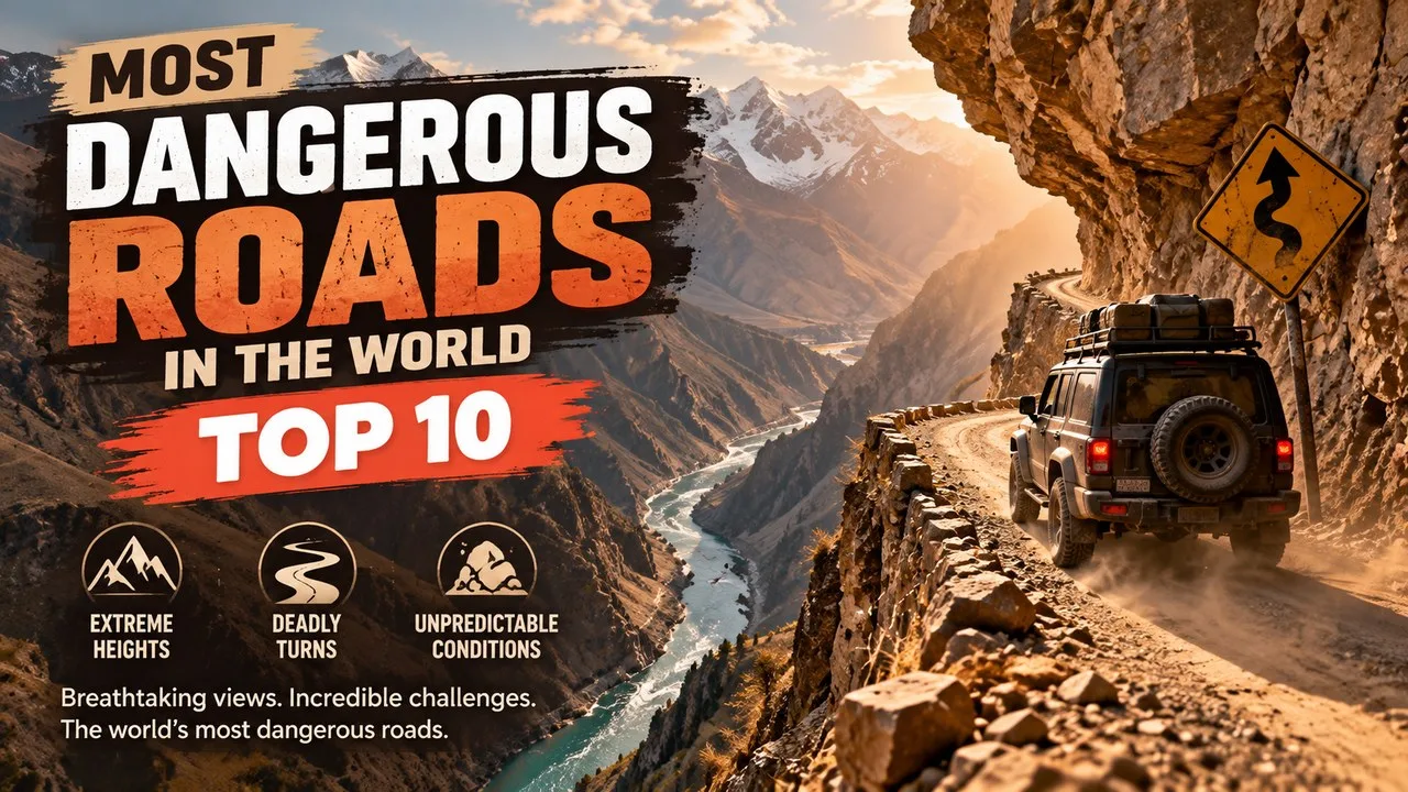
The most dangerous roads in the world include Bolivia's Death Road, the Karakoram Highway, Zoji La and Russia's Road of Bones, ranked here as of 2026.
Road danger is rarely about one thing. A route can be deadly because it hangs over a cliff with no barrier, because landslides bury it every monsoon, because winter shuts it for months, because there is no fuel for hundreds of kilometres, or because the tide swallows it twice a day. Many of the routes below combine several of those risks at once, and some have become famous adventure-travel trophies precisely because of them.
This Finepedia listicle, written as of October 2026, ranks ten roads that engineers, transport agencies and long-distance drivers repeatedly single out for their hazards. Each entry is described with verified details on length, altitude, history and the specific dangers drivers face. Where safety has improved, for example through bypasses, tunnels or speed cameras, that change is stated plainly, because a road that was lethal in 1990 is not always lethal today.
How We Chose the Most Dangerous Roads in the World
There is no single official ranking of dangerous roads, so this list weighs several kinds of evidence rather than one statistic. A road earned its place if it scored strongly on at least two of the following measures.
- Terrain hazard: sheer drops, unguarded edges, hairpin bends, single-lane sections or tunnels cut into rock
- Natural threats: landslides, rockfall, avalanches, floods, extreme cold or tides
- Remoteness: long stretches without fuel, mobile signal, towns or rescue services
- Recorded harm: documented crashes, deaths or a formal label from a development bank or road-safety body
- Current relevance: the road is still open and used, at least seasonally, in 2025–2026
Global context matters too. The World Health Organization's Global Status Report on Road Safety 2023 estimated about 1.19 million road traffic deaths a year, and road crashes are the leading cause of death for children and young people aged 5 to 29. Most of those deaths happen on ordinary roads, not famous mountain passes, which is why the routes below are best understood as extreme examples of hazards that exist everywhere.
Most Dangerous Roads in the World at a Glance
| # | Road | Country | Main hazard |
|---|---|---|---|
| 1 | North Yungas Road (Death Road) | Bolivia | Narrow cliff-edge track with long unguarded drops |
| 2 | Kabul–Jalalabad Road (Tang-e Gharu) | Afghanistan | Gorge bends, heavy trucks and conflict damage |
| 3 | Karakoram Highway | Pakistan / China | Landslides, rockfall and extreme altitude |
| 4 | Zoji La | India | Unpaved pass, snow walls and seasonal closures |
| 5 | Guoliang Tunnel Road | China | Hand-cut cliff tunnel with open rock windows |
| 6 | Kolyma Highway (Road of Bones) | Russia | Extreme cold and long isolated gravel sections |
| 7 | James W. Dalton Highway | United States | Remote haul road with few services and Arctic weather |
| 8 | Skippers Road | New Zealand | One-lane gravel ledge where hire-car insurance is not honoured |
| 9 | Stelvio Pass | Italy | 48 tight hairpins on one side at 2,757 metres |
| 10 | Passage du Gois | France | Causeway flooded by the sea twice a day |
Travellers interested in other extreme journeys may also want to read Most Dangerous Bridges in the World: Top 10, Most Dangerous Airports in the World: Top 10, Most Dangerous Mountains in the World: Top 10 Deadliest and Coldest Places in the World: Top 10.
1. North Yungas Road (Death Road), Bolivia
| Attribute | Details |
|---|---|
| Route | La Paz to Coroico, through the Yungas region |
| Length | About 64 kilometres |
| Built | 1930s, partly by Paraguayan prisoners from the Chaco War |
| Descent | Roughly 3,500 metres from the high Andes into cloud forest |
| Famous label | Labelled the deadliest route on the planet in a 1995 Inter-American Development Bank assessment |
Origins/History
The North Yungas Road was carved in the 1930s to link La Paz with the humid Yungas valleys and, beyond them, Bolivia's Amazon lowlands. Much of the labour came from Paraguayan prisoners captured during the Chaco War. For decades it was the only road between Coroico and the capital, so buses, fuel tankers and timber trucks all squeezed onto a track that in places is less than three metres wide.
Its reputation peaked in 1995, when an Inter-American Development Bank assessment singled it out as the deadliest route on the planet. Commonly cited estimates put deaths at 200 to 300 a year before a modern alternative opened, and a single bus crash in July 1983 killed more than 100 passengers.
Key Features
- A dirt and gravel surface that turns to mud in the wet season
- Drops of several hundred metres with almost no guardrails on the old alignment
- Waterfalls that spill directly onto the road surface
- A local rule requiring downhill drivers to keep to the outer, cliff-side edge so they can see their wheels
- Frequent fog, rain and small landslides
Significance
A long modernisation programme ended in 2006 with a two-lane paved bypass between Chusquipata and Yolosa, complete with drainage and barriers. Most motor traffic now uses the new route, and the old road has become one of South America's most famous mountain-biking descents, drawing tens of thousands of riders a year. The danger has not disappeared, though: at least 18 cyclists have died on it since 1998, according to widely reported tallies.
Interesting Facts
- The left-hand driving rule is unusual because Bolivia otherwise drives on the right.
- Bike tours start high near La Cumbre and end in warm, subtropical forest.
- Many riders finish with a souvenir T-shirt, a sign of how danger became a tourism brand.
- The new road has not made the old one empty; support vans and local vehicles still use it.
2. Kabul–Jalalabad Road (Tang-e Gharu), Afghanistan
| Attribute | Details |
|---|---|
| Official name | National Highway 08 (NH08) |
| Length | About 152 kilometres |
| Elevation change | From about 575 metres at Jalalabad to about 1,790 metres at Kabul |
| Most notorious section | The Tang-e Gharu gorge beside the Kabul River |
| Built | Gorge road begun in the 1940s and completed in the 1960s |
Origins/History
The modern road between Kabul and Jalalabad replaced the older Lataband Pass route through the Karkacha hills. Engineers cut the new alignment through the Tang-e Gharu gorge, a canyon of blue-grey limestone where the Kabul River has worn a narrow passage. Parts of the corridor follow the line of the British Army's disastrous retreat from Kabul in 1842, so the route has carried a grim reputation for nearly two centuries.
The road forms a major part of the Afghan section of the historic Grand Trunk Road, giving landlocked Afghanistan its main link towards Pakistan and the port of Karachi. That strategic value means it carries a constant stream of fuel tankers, cargo trucks and buses.
Key Features
- Tight switchbacks that climb the gorge wall above the river
- Sheer cliffs on one side and steep drops to the water on the other
- Heavily loaded trucks travelling slowly while cars overtake on blind bends
- Surface damage from decades of conflict, heavy use and occasional closures
- Few barriers on many curves
Significance
Because of repeated fatal crashes, the Kabul–Jalalabad road is widely described as one of the deadliest highways anywhere. Its danger is mostly about traffic behaviour and terrain rather than isolation: the gorge funnels fast and slow vehicles into the same narrow space. Security conditions add another layer, and as of 2025 several governments, including the United Kingdom, advise against all travel to Afghanistan.
Interesting Facts
- The Tang-e Gharu gorge itself is thought to be only about two million years old.
- The limestone cliffs formed around 250 million years ago.
- The road links Kabul with Jalalabad, the largest city in eastern Afghanistan.
- Drivers often describe the gorge as a test of nerve rather than skill.
3. Karakoram Highway, Pakistan and China
| Attribute | Details |
|---|---|
| Other names | KKH, N-35, China–Pakistan Friendship Highway |
| Length | About 1,300 kilometres in Pakistan, from Hasan Abdal to the Khunjerab Pass |
| Highest point | About 4,714 metres near the Khunjerab Pass |
| Construction | Started in the early 1960s, completed in 1979, opened to the public in 1986 |
| Network | Part of Asian Highway AH4 |
Origins/History
The Karakoram Highway was built jointly by China and Pakistan through one of the most unstable mountain landscapes on Earth. On the Pakistani side, the Frontier Works Organisation and army engineers blasted the road along the Indus and Hunza valleys. About 810 Pakistani workers and well over 100 Chinese workers died during construction, mostly in landslides and falls, and more than 140 Chinese workers are buried in a cemetery in Gilgit.
The route follows one strand of the ancient Silk Road and crosses into China at the Khunjerab Pass, where it continues as China National Highway 314 towards Kashgar.
Key Features
- Constant rockfall and landslide risk along gorges hundreds of metres deep
- Thin air and cold near the Khunjerab Pass, one of the highest paved border crossings anywhere
- Earthquake exposure, because the road crosses the collision zone of the Indian and Eurasian plates
- Long sections with few repair facilities
- Seasonal closures of the high border section in winter
Significance
The danger became visible to the world on 4 January 2010, when a massive landslide near Attabad in the Hunza Valley dammed the river and created Attabad Lake. The lake drowned more than 20 kilometres of highway, and for years goods crossed it by boat. A 24-kilometre bypass of bridges and five tunnels opened on 15 September 2015, and later upgrades have widened other sections, but landslides still close parts of the road from time to time.
Interesting Facts
- The highway is sometimes called the Eighth Wonder of the World.
- China originally preferred the Khunjerab route over the Mintaka Pass.
- The longest Attabad bypass tunnel is about 3.36 kilometres long.
- Attabad Lake is now a popular turquoise tourist stop.
4. Zoji La, India
| Attribute | Details |
|---|---|
| Location | Between Ganderbal district (Jammu and Kashmir) and Kargil district (Ladakh) |
| Highway | National Highway 1, Srinagar to Leh |
| Elevation | About 3,500 metres according to most Indian highway and tourism sources |
| Distance | About 100 kilometres from Srinagar and 15 kilometres from Sonmarg |
| Maintained by | Border Roads Organisation (BRO) |
Origins/History
Zoji La is an ancient Himalayan crossing that links the Kashmir Valley with the Dras and Suru valleys and, beyond them, Ladakh. Its military history is remarkable. During the First Kashmir War, Indian forces recaptured the pass on 1 November 1948 in Operation Bison, using tanks at an altitude where armour had never fought before. The pass remains a strategic artery for supplying Ladakh.
The name is often written as Zojila Pass, but "La" already means pass in Ladakhi and Tibetan, so the longer form repeats itself.
Key Features
- A narrow, often unpaved road cut into steep mountainside
- Deep snow that closes the pass for part of most winters
- Driving between towering walls of ice when the BRO reopens the route in spring
- Military convoys and trucks sharing tight bends with tourist jeeps
- Rockfall, mud and meltwater in early summer
Significance
For Ladakh, Zoji La is a lifeline rather than an adventure. When it shuts, road links from the Kashmir side are cut, which is why India approved the Zojila Tunnel in January 2018. Construction was inaugurated in May 2018, and the tunnel of roughly 14 kilometres is designed to cut the crossing from more than three hours to around 15 minutes. When finished, it is expected to be the longest bidirectional road tunnel in Asia. It was still under construction in the most recent reports we could verify.
Interesting Facts
- Local tradition links the name to a goddess of the four seasons.
- At the time, Operation Bison was the highest-altitude tank action ever recorded.
- Indian tanks were moved up the pass in secret, which surprised the opposing troops in 1948.
- The Sonmarg side is a popular base for day trips to the pass.
5. Guoliang Tunnel Road, China
| Attribute | Details |
|---|---|
| Location | Taihang Mountains, Huixian, Xinxiang, Henan Province |
| Length | About 1.2 kilometres |
| Size | About 5 metres tall and 4 metres wide |
| Built | 1972–1977 by villagers, largely with hammers and chisels |
| Opened | 1 May 1977 |
Origins/History
Guoliang village sits in a valley ringed by sheer cliffs of the Taihang range. Before the 1970s, villagers reached the outside world by a steep path cut into the rock. In 1972 a group led by Shen Mingxin decided to build a road through the mountain itself. They sold livestock to pay for tools and materials, and thirteen villagers began the work. One of them died during construction.
Without power tools for much of the job, progress was painfully slow. At the hardest stage, the tunnel advanced about one metre every three days. It finally opened to traffic on 1 May 1977.
Key Features
- A road chiselled through the cliff face rather than built on top of it
- Irregular rock "windows" that open onto drops of hundreds of metres
- Room for vehicles to pass only with care in many places
- Uneven lighting and wet patches inside the tunnel
- Tour buses and cars sharing the space with walkers taking photos
Significance
The Guoliang Tunnel is often called "the road that tolerates no mistakes", a nickname that reflects how little margin drivers have. Today it sits inside a busy scenic tourist area, and visitors are urged to drive slowly and give way carefully. Its larger significance is human: it is a monument to a village that refused to stay isolated and built its own connection to the world.
Interesting Facts
- The village is named after a rebel leader from the Han dynasty era.
- Villagers sold their livestock to pay for tools and materials.
- The cliffside setting has been used as a film location.
- Tourism turned a remote farming village into a busy visitor destination.
6. Kolyma Highway (Road of Bones), Russia
| Attribute | Details |
|---|---|
| Official name | R504 Kolyma Highway, part of the M56 route |
| Route | Nizhny Bestyakh (across the Lena River from Yakutsk) to Magadan |
| Length | Roughly 2,000 kilometres via the maintained Ust-Nera alignment |
| Built | 1932–1953 using Gulag prison labour under the Dalstroy directorate |
| Status | Federal road status since 2008; maintained all-weather gravel |
Origins/History
The Kolyma Highway was built during Stalin's era to open the gold-rich Kolyma region of the Russian Far East. Prisoners of the Sevvostlag labour camp began the first section in 1932, and forced labour continued until 1953. The nickname Road of Bones comes from the widely repeated claim that workers who died were buried in or beside the roadbed. That claim has not been confirmed by documented remains, and death estimates vary enormously, so historians treat the figures with caution.
Key Features
- Winter temperatures that can fall far below minus 40 degrees Celsius
- Hundreds of kilometres of gravel with very few settlements or fuel stops
- River crossings, potholes and washouts after summer floods
- Dust, poor visibility and heavy trucks in summer
- Minimal mobile coverage on long stretches
Significance
After the road gained federal status in 2008, the main route was rerouted north through Ust-Nera and kept open year-round. The older section via Tomtor, known as the Old Summer Road, was largely abandoned, with washed-out bridges and streams reclaiming the track. In 2020 a teenage driver froze to death after following a navigation app onto that abandoned stretch, a tragedy that shows how unforgiving the region remains.
Interesting Facts
- Oymyakon, often called the coldest permanently inhabited place on Earth, lies about 100 kilometres from the highway.
- The route became famous with motorcyclists after the travel series Long Way Round.
- The Kolyma route connects at Nizhny Bestyakh with the Lena Highway.
- An Anadyr Highway extension towards Chukotka has been under construction since the 2010s.
7. James W. Dalton Highway, United States
| Attribute | Details |
|---|---|
| Location | Alaska, from the Elliott Highway north of Fairbanks to Deadhorse near Prudhoe Bay |
| Length | 414 miles (666 kilometres) |
| Built | 1974, as a supply road for the Trans-Alaska Pipeline |
| Highest point | Atigun Pass in the Brooks Range, 4,739 feet (1,444 metres) |
| Fuel stops | Yukon River Bridge (Mile 56), Coldfoot and Deadhorse |
Origins/History
The Dalton Highway began life as the North Slope Haul Road. When oil was found at Prudhoe Bay, the pipeline builders needed a road north, and in 1974 crews completed about 390 miles in roughly five months. The road was later named after James W. Dalton, an Arctic engineer. Public access came in stages: first to Disaster Creek at Mile 211 in 1981, and then along the full length after court rulings in the 1990s removed the permit requirement.
Key Features
- Mostly unpaved surface, with paved sections covering only part of the route
- Long distances between the three main fuel stops
- Heavy trucks hauling oil-field supplies at speed on gravel
- Winter darkness, blizzards and temperatures that can drop to dangerous extremes
- Steep grades and avalanche risk around Atigun Pass
Significance
The Dalton's danger is remoteness. A breakdown can leave drivers hours from help, and flying gravel regularly cracks windscreens and punctures tyres. Many rental companies restrict their cars from the road, and travellers are advised to carry spare tyres, extra fuel, food and cold-weather gear. Its fame grew through television, including seasons of Ice Road Truckers and the first episode of the BBC series World's Most Dangerous Roads.
Interesting Facts
- It ends near the Arctic Ocean, close to the Prudhoe Bay oil fields.
- It crosses the Arctic Circle and the Brooks Range.
- Coldfoot began as a gold-mining camp and is now a key truck stop.
- An earlier winter road to the North Slope was abandoned in 1969 after it thawed the permafrost.
8. Skippers Road, New Zealand
| Attribute | Details |
|---|---|
| Location | Skippers Canyon, north of Queenstown, Otago |
| River | Shotover River, once one of New Zealand's richest gold-bearing rivers |
| Surface | Mostly one-lane gravel with sheer drops of several hundred metres |
| History | Surveyed around 1883 for the gold-mining settlements |
| Insurance | Rental car insurance is generally not honoured on this road |
Origins/History
Gold was found near Arthurs Point in 1862, starting one of Otago's biggest rushes. Miners pushed up the Shotover River into a steep canyon named after 'Skipper' Malcolm Duncan, who found gold there the same year. Settlements such as Charlestown sprang up and then faded once the easy gold was gone. Skippers Road was surveyed around 1883 and hacked out of the canyon walls by hand, at a cost locals joked was greater than all the gold it served.
By the time the road was finished, the rush had largely ended, and motor vehicles were initially banned from it in the early 1900s. A court later allowed cars, but only with permission arranged in advance.
Key Features
- A narrow ledge with very few places for two vehicles to pass
- Steep, unguarded drops into the canyon
- Loose gravel and tight corners that punish speed
- Weather that can turn the surface slippery quickly
- Historic remains, including the old Skippers suspension bridge area
Significance
Skippers Road is unusual on this list because its danger is written into commercial policy. New Zealand rental companies typically exclude it from insurance cover, so most visitors take guided tours rather than drive themselves. It shows how insurers and tour operators help manage risk on a road that is too historic to widen and too steep to make truly safe.
Interesting Facts
- In 1886 Skippers Canyon became one of the first places in New Zealand to use hydroelectric power for gold mining.
- Charlestown once had around 1,000 residents before shrinking rapidly.
- The canyon is also known for jet-boating and bungee activities.
- Only stones, a plaque and an information panel remain at the Charlestown site.
9. Stelvio Pass, Italy
| Attribute | Details |
|---|---|
| Location | Ortler Alps, between Stilfs (South Tyrol) and Bormio (Sondrio), next to Switzerland |
| Elevation | 2,757 metres |
| Hairpins | 48 mostly tight bends on the 28-kilometre northern side; 34 on the southern side |
| Built | 1820–1825 by the Austrian Empire, engineer Carlo Donegani |
| Season | Usually open to vehicles from late spring to autumn |
Origins/History
The Austrian Empire built the Stelvio road in the 1820s to connect Lombardy with the rest of its territory. Engineer Carlo Donegani designed a climb of 1,871 metres, and the route has changed little since. Before the end of the First World War, the pass marked the border between Austria-Hungary and Italy, and fighting took place in the ice and snow around it.
Key Features
- Numbered stone markers on each of the northern hairpins
- Steep gradients that overheat brakes on long descents
- Large numbers of cyclists and motorcyclists in summer
- Sudden snow and fog even outside winter
- Tunnels and avalanche galleries on the southern side near Bormio
Significance
The Stelvio is the highest paved pass in the Eastern Alps and the second highest in the Alps, just 7 metres below France's Col de l'Iseran. It is less deadly than other roads on this list, but its density of hairpins, traffic and altitude makes it demanding for any driver. The BBC show Top Gear once named it the greatest driving road in the world, and the Giro d'Italia has crossed it since 1953.
Interesting Facts
- Racing driver Stirling Moss went off the road here during a vintage car event in the 1990s.
- On Stelvio Bike Day the road closes to motor traffic for thousands of cyclists.
- Moto Guzzi and Alfa Romeo have both named vehicles after the pass.
- The nearby Three Languages Peak marks where Italian, German and Romansh areas meet.
10. Passage du Gois, France
| Attribute | Details |
|---|---|
| Location | Between Beauvoir-sur-Mer and the island of Noirmoutier, Vendée |
| Length | 4.125 kilometres |
| Type | Tidal causeway with a paved road |
| Hazard | Covered by the sea twice a day at high tide |
| Sporting fame | Used in the Tour de France in 1999 and 2011 |
Origins/History
The Passage du Gois is a natural causeway on France's Atlantic coast that appears only when the tide goes out. For centuries it was the main dry-footed way to reach Noirmoutier. A paved road now runs along it, and a bridge built later offers a tide-free alternative, but many drivers still choose the causeway for its strange beauty.
Key Features
- Water that rises across the road quickly as the tide turns
- Slippery seaweed and wet surfaces even at low tide
- Tide tables displayed at both ends of the crossing
- Raised refuge posts for anyone caught by the rising sea
- Fog and wind that can hide the edge of the road
Significance
The causeway's danger is timing. Drivers who misjudge the tide can be trapped, and vehicles are still caught by the water from time to time. In stage two of the 1999 Tour de France, a crash on the slick surface split the race by about six minutes, effectively ending the chances of several favourites, including eventual runner-up Alex Zülle. The Tour returned in 2011, using the causeway as the start of the first stage.
Interesting Facts
- An annual running race, the Foulées du Gois, starts as the tide begins to rise.
- Elite runners wait until the water reaches their shoes before starting.
- England's Broomway in Essex is a similar tidal path.
- At low tide, people gather shellfish on the exposed flats beside the road.
Comparing the Most Dangerous Roads in the World
| Road | Main risk type | Seasonal closure? | Safer alternative available? |
|---|---|---|---|
| North Yungas Road | Cliff edges and narrow width | No, but wet season is worst | Yes, the 2006 paved bypass |
| Kabul–Jalalabad Road | Traffic, bends and security | Occasional closures | Limited |
| Karakoram Highway | Landslides and altitude | High border section in winter | No direct alternative |
| Zoji La | Snow, mud and rockfall | Yes, part of most winters | Zojila Tunnel under construction |
| Guoliang Tunnel Road | Cliff tunnel and open edges | Weather dependent | No, it is the village's main road link |
| Kolyma Highway | Cold and isolation | No, but winter is extreme | No |
| Dalton Highway | Remoteness and gravel | No | Air travel only |
| Skippers Road | One-lane ledge | Weather dependent | Guided tours |
| Stelvio Pass | Hairpins and altitude | Yes, winter | Other Alpine passes |
| Passage du Gois | Tides | Twice daily by the sea | Yes, the Noirmoutier bridge |
What Makes a Road Dangerous
Road-safety research usually groups hazards into three areas: the road itself, the vehicles using it and the people driving. Dangerous roads tend to fail on the first factor. Missing barriers, narrow lanes and sharp bends leave no room for small mistakes. Weather and geology then multiply the risk by adding mud, ice, rockfall or water.
Human factors matter just as much. Fatigue on long remote drives, overtaking on blind bends, overloaded trucks and unfamiliarity with local rules all appear repeatedly in crash reports. That is why the safest way to see many of these roads is with experienced local drivers or guides.
- Check weather, tide and closure updates before setting out
- Use a vehicle suited to gravel and steep grades
- Carry spare fuel, food, water and warm clothing on remote routes
- Never rely only on a navigation app on closed or abandoned roads
- Follow local traffic customs, such as the Yungas downhill rule
Frequently Asked Questions
Which is the most dangerous road in the world?
Bolivia's North Yungas Road is the most famous answer because a 1995 Inter-American Development Bank assessment singled it out as the deadliest route on the planet. A paved bypass opened in 2006, so most vehicle traffic avoids it now, but the old route remains risky for the cyclists and tour vans that use it every day.
Is the Death Road in Bolivia still open?
Yes. The old North Yungas Road is still open and is used mainly by mountain bikers, tour support vehicles and some local traffic. Most buses and trucks take the newer paved route between La Paz and Coroico, which has guardrails and drainage. Riders should choose reputable operators with good bikes and safety briefings.
Why is it called the Road of Bones?
The Kolyma Highway in Russia was built by Gulag prisoners between 1932 and 1953, and a popular account says workers who died were buried in or near the road. Historians note that this has not been confirmed by documented remains, but the name reflects the enormous human cost of forced labour in the Kolyma region.
Can tourists drive the Karakoram Highway?
Yes, many tourists drive or ride the Karakoram Highway, especially between spring and autumn when the Khunjerab Pass is open. Travellers should expect landslide delays, checkpoints and altitude effects near the border. Hiring an experienced local driver and checking road conditions each day is a sensible way to reduce the risk.
Why does rental insurance not cover Skippers Road?
Skippers Road near Queenstown is mostly one lane, steep and gravel, with sheer drops and few passing places. New Zealand rental companies generally exclude it from cover because of the high chance of damage or accidents. Most visitors therefore join a guided tour with drivers who know the road well.
Is the Stelvio Pass safe to drive?
The Stelvio Pass is a busy, well-paved tourist road, so it is far less dangerous than the remote routes on this list. Its 48 northern hairpins, steep gradients and heavy cycle traffic still demand care. Drive slowly, use low gears on the descent and check that the pass is open before you go.
How do people avoid getting trapped on the Passage du Gois?
Tide timetables are displayed at both ends of the Passage du Gois and published locally, and drivers should cross only in the safe window around low tide. Raised refuge posts along the causeway give anyone caught by rising water a place to wait. When in doubt, the Noirmoutier bridge is the safer choice.
Conclusion
The most dangerous roads in the world are dangerous for very different reasons. Bolivia's Death Road and Skippers Road hang on narrow ledges, the Karakoram Highway and Zoji La fight constant battles with mountains and snow, the Kolyma and Dalton highways test drivers with cold and isolation, and the Passage du Gois disappears under the sea. Many of these routes are now safer than they once were thanks to bypasses, tunnels and better management, yet all still demand respect. For travellers, the lesson is simple: check conditions, choose experienced guides where possible, and remember that the most dramatic road is never worth an avoidable risk.
- World Health Organization, Global Status Report on Road Safety 2023: https://www.who.int/publications/i/item/9789240086517
- Wikipedia, Yungas Road (for cross-checked dates and figures): https://en.wikipedia.org/wiki/Yungas_Road
- Wikipedia, Kabul–Jalalabad Road and Tang-e Gharu: https://en.wikipedia.org/wiki/Kabul%E2%80%93Jalalabad_Road
- Wikipedia, Karakoram Highway: https://en.wikipedia.org/wiki/Karakoram_Highway
- Wikipedia, Zoji La: https://en.wikipedia.org/wiki/Zoji_La
- Wikipedia, Guoliang Tunnel: https://en.wikipedia.org/wiki/Guoliang_Tunnel
- Wikipedia, R504 Kolyma Highway: https://en.wikipedia.org/wiki/R504_Kolyma_Highway
- Wikipedia, Dalton Highway: https://en.wikipedia.org/wiki/Dalton_Highway
- Wikipedia, Skippers Canyon: https://en.wikipedia.org/wiki/Skippers_Canyon
- Wikipedia, Stelvio Pass: https://en.wikipedia.org/wiki/Stelvio_Pass
- Wikipedia, Passage du Gois: https://en.wikipedia.org/wiki/Passage_du_Gois
- UK Foreign, Commonwealth and Development Office, Afghanistan travel advice: https://www.gov.uk/foreign-travel-advice/afghanistan
- Reference topic prompt: https://10mosttoday.com/10-most-dangerous-roads-in-the-world/















Log in with