










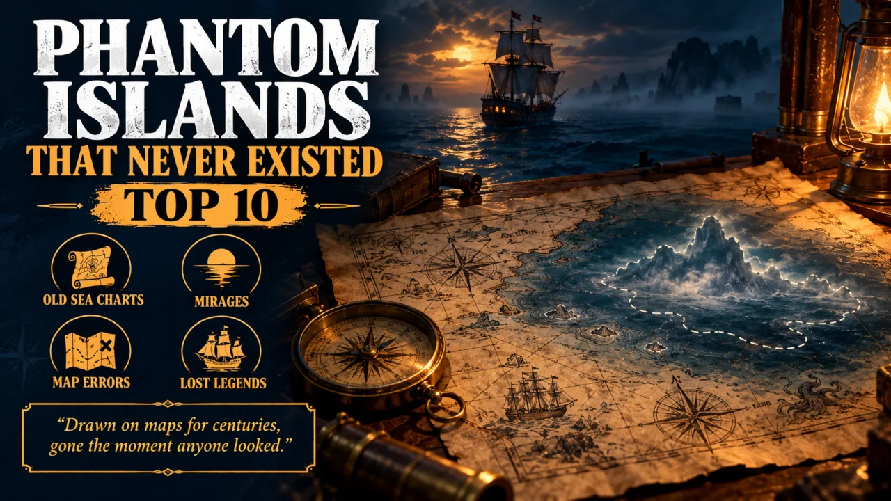
Phantom islands that never existed are islands drawn on real maps, sometimes for centuries, that later proved to be mirages, mistakes or outright inventions.
For most of history a map was only as good as the last sailor's report. A captain who glimpsed a low cloud bank, a floating raft of volcanic rock or a mirage on the polar ice could return home convinced he had found new land, and mapmakers, who rarely had a way to check, copied the claim from one chart to the next. Once an island was printed, removing it took far more effort than adding it.
This Finepedia guide looks at ten of the most remarkable phantom islands, from medieval legends in the Atlantic to a Pacific island that was still on Google Maps in 2012. For each one you will find a Quick Facts table, where the idea came from, how it was finally disproved and what scientists and historians now think the original sailors actually saw. Dates and locations have been checked against the documented history of each island.
How We Chose These Phantom Islands
A phantom island is different from a lost land such as Atlantis. A lost land is said to have existed once and then vanished, while a phantom island was claimed to exist at the same time people were mapping it, and was later shown never to have been there at all. Finepedia's list uses three simple tests.
- It appeared on real maps or nautical charts, not only in stories or poems.
- It was searched for, and the searches came back empty.
- There is a documented explanation, or at least a strong theory, for how the mistake began.
Within those limits the list mixes medieval legends, Age of Exploration errors, a polar hoax and two cases with modern political consequences. The order reflects how long each island survived on maps and how much influence it had, rather than any single number.
Why Phantom Islands Appeared on Maps
Most phantom islands share a handful of causes. Knowing them makes each story below easier to follow.
- Longitude errors: before the marine chronometer came into wide use in the late 18th century, sailors could measure latitude fairly well but often guessed their east-west position by dead reckoning, so a real island could be recorded twice in two different places.
- Optical illusions: fog banks, low clouds and polar mirages such as the Fata Morgana can look exactly like a distant coastline.
- Floating debris: rafts of pumice from underwater volcanoes can stretch for kilometres and look like a sandy islet from a ship's deck.
- Legends and wishful thinking: religious tales, patriotic stories and the hope of new territory encouraged people to believe reports that were never confirmed.
- Fraud: at least one famous phantom island was invented to impress a sponsor.
- Copying: mapmakers routinely copied each other, so a single error could survive for generations.
Phantom Islands at a Glance
| Rank | Phantom island | Supposed location | First recorded | Finally removed or disproved |
|---|---|---|---|---|
| 1 | Sandy Island | Coral Sea, near New Caledonia | 1876 (whaler Velocity) | 2012 survey by R/V Southern Surveyor |
| 2 | Hy-Brasil | Atlantic, west of Ireland | About 1325 (Dulcert chart) | Faded from charts by 1865 |
| 3 | Antillia | Atlantic, far west of Iberia | 1424 (Pizzigano chart) | Dropped from most maps after the 1490s |
| 4 | Saint Brendan's Island | Atlantic, near the Canary Islands | 9th-century Navigatio text | Sightings faded after the 1700s |
| 5 | Frisland | North Atlantic, south of Iceland | 1558 (Zeno map) | Gone from maps by the late 1600s |
| 6 | Crocker Land | Arctic Ocean, north-west of Ellesmere Island | 1906 (Robert Peary) | 1914 (MacMillan expedition) |
| 7 | Bermeja | Gulf of Mexico, off Yucatán | 1539 (Alonso de Santa Cruz) | 2009 UNAM survey |
| 8 | Isle Phelipeaux | Lake Superior | 1744 (Bellin map) | 1820s boundary survey |
| 9 | Buss Island | North Atlantic, about 57°N | 1578 (Frobisher expedition) | 1818 (John Ross) |
| 10 | Pepys Island | South Atlantic, north of the Falklands | 1683 (William Ambrose Cowley) | 18th-century searches found nothing |
If you enjoy real islands as much as imaginary ones, compare this list with the largest islands in the world.
1. Sandy Island
Sandy Island is the phantom island that survived longest into the digital age. Marked between Australia and New Caledonia in the Coral Sea, it sat on charts, atlases and online maps for more than a century before a research ship sailed straight through the spot where it was supposed to be.
| Attribute | Details |
|---|---|
| Supposed location | Eastern Coral Sea, between the Chesterfield Islands and Nereus Reef |
| First recorded | 1876, by the whaling ship Velocity |
| Removed from French charts | 1974 |
| Disproved publicly | 22 November 2012, by the R/V Southern Surveyor |
| Likely cause | Pumice rafts and a coastline database error |
Origins and History
The story begins with the whaler Velocity, whose master reported "Sandy Islets" and a line of heavy breakers after a Pacific voyage in 1876. The report found its way into an Australian maritime directory in 1879 and onto later charts, including an 1895 British Admiralty chart. In that era it was normal practice to record every possible hazard, because a missing reef could sink a ship while an extra one only cost a detour.
Over time hydrographers grew suspicious. Charts began to carry the abbreviation ED, meaning existence doubtful, and the French Hydrographic Service removed the island from its charts in 1974. Australia's hydrographic office followed in 1985. Yet the island lived on in a global coastline data set first digitised by the United States military mapping agency, and from there it spread into scientific software, atlases and eventually Google Maps.
How It Was Disproved
In November 2012 Australian scientists aboard the research vessel Southern Surveyor, studying plate tectonics in the Coral Sea, noticed that their maps disagreed about the island. They sailed to the spot and found open ocean, with the seafloor never shallower than about 1,300 metres. Google removed the island on 26 November 2012, and National Geographic announced three days later that it was striking Sandy Island from its maps.
What the Sailors Probably Saw
- Pumice rafts: floating masses of volcanic rock from undersea eruptions near Tonga can drift thousands of kilometres westward, and modelling shows such rafts can pass close to the reported position.
- A genuine Cook chart: Captain James Cook marked a real "Sandy I." on New Caledonia's reef in 1774, several degrees of longitude to the east, and some historians think the two may have been confused.
- Digital copying: once the island entered the coastline database, other data sets used it as a land mask, which made it look as if satellites had confirmed it.
Interesting Facts
- Amateur radio operators reported that the island was missing as early as 2000, twelve years before the famous survey.
- The Australian Hydrographic Service said it was not a deliberate copyright trap, the kind of fake street some mapmakers add to catch copiers.
- The case pushed data providers to re-check other remote coastlines that had been digitised from old paper charts.
2. Hy-Brasil
Hy-Brasil is the most famous phantom island of the Irish Atlantic. For more than five centuries mapmakers drew a round island west of Ireland, often split in two by a straight channel, and generations of storytellers said it was hidden in mist and visible only once every seven years.
| Attribute | Details |
|---|---|
| Supposed location | Atlantic Ocean, west or south-west of Ireland |
| First on a chart | About 1325, Angelino Dulcert's portolan chart |
| Shape on maps | Circular, often with a channel running east to west |
| Last appearance | Shown as "Brasil Rock" until 1865 |
| Possible real feature | Porcupine Bank, a shallow area about 200 km west of Ireland |
Origins and History
An island named Bracile appears on Dulcert's chart of around 1325 and on the Catalan Atlas of about 1375. Later charts moved it around the Atlantic, and the spelling wandered just as freely; one 19th-century historian counted thirteen versions of the name. The origin of the name is still debated. Some scholars link it to brazil, a red dye traded across medieval Europe, while Irish tradition connects it to a Gaelic clan name.
The legend was strong enough to send real ships to sea. Expeditions sailed from Bristol in 1480 and 1481 to look for the island and returned with nothing to show. A Spanish diplomat's letter written after John Cabot's 1497 voyage even mentions that men from Bristol had once found Brasil, a line that historians still argue about.
The Tall Tales
Hy-Brasil gathered colourful stories over the centuries. In 1674 a tale circulated about a Captain John Nisbet who had supposedly landed there and found giant black rabbits and a magician living alone in a stone castle, but this account is now known to be a piece of fiction written by the Irish author Richard Head. Another 17th-century writer described a local man who believed he had spent two days on the island.
What It Might Have Been
- A mirage or fog bank over the open Atlantic, which fits the legend of an island that appears and then vanishes.
- Porcupine Bank, a shallow shoal discovered in 1862, which a paper read to the Geological Society of Ireland in 1870 suggested as the source.
- A blend of older Atlantic legends, including the Isles of the Blessed, carried along by mapmakers who copied one another.
In Popular Culture
The island has appeared in poetry, short stories and novels, and in the 1989 comedy film Erik the Viking it hides the magical Horn Resounding. It remains a favourite subject for writers interested in Irish folklore and lost worlds.
Interesting Facts
- A volcanic hill on Terceira in the Azores is still called Monte Brasil, a reminder of a time when some maps placed the island there.
- On some 15th-century Catalan charts two separate islands carry the Brasil name.
- The island was shown on charts for roughly 540 years, from the 1320s to the 1860s.
3. Antillia
Antillia, also called the Isle of Seven Cities, was the great rectangular island of 15th-century Atlantic charts. It was said to have been settled by Christian refugees from Iberia, and its name survives today in the Antilles of the Caribbean.
| Attribute | Details |
|---|---|
| Supposed location | Atlantic Ocean, far to the west of Portugal and Spain |
| Other name | Isle of Seven Cities |
| First clear appearance | 1424 portolan chart of Zuane Pizzigano |
| Notable map | Martin Behaim's 1492 Nuremberg globe |
| Legacy | Gave its name to the Antilles |
Origins and History
The legend says that around 714, during the Muslim conquest of the Iberian Peninsula, seven Christian bishops sailed west into the Atlantic with their followers. They found a large island, founded seven settlements and, in later versions of the tale, burned their ships so that nobody could return.
Antillia appears as a large rectangle on Pizzigano's chart of 1424 and became a regular feature of Atlantic charts during the 15th century. Martin Behaim's 1492 globe, made in the same year Columbus first crossed the ocean, carries an inscription retelling the legend. Portuguese chroniclers later added stories of ships that had stumbled on the island and met its Portuguese-speaking inhabitants.
How It Disappeared
Antillia faded quickly once ships began crossing the Atlantic routinely. After the voyages of Christopher Columbus in the 1490s, almost every new map dropped it, including the 1500 world map of Juan de la Cosa and the 1502 Cantino planisphere. Some later writers moved the name to São Miguel in the Azores, where a protected area around two crater lakes is still called Sete Cidades, meaning Seven Cities.
Why It Matters
Antillia shows how a legend could shape real exploration. The belief that rich, unknown islands lay to the west encouraged sailors and sponsors to take the risk of crossing the ocean. When Europeans reached the Caribbean, they borrowed the name, and the Greater and Lesser Antilles still carry it today.
Interesting Facts
- Antillia is often drawn next to a second phantom island called Satanazes, the island of devils.
- A 16th-century Spanish writer gave the island a size of 87 by 28 leagues, with many good ports and rivers.
- Its prominence on pre-1492 charts has fuelled many theories about earlier contact with the Americas, none of them proven.
4. Saint Brendan's Island
Saint Brendan's Island, known in Spanish as San Borondón, began as a paradise in an Irish saint's voyage and ended up as one of the most frequently sighted phantom islands in history. People in the Canary Islands reported seeing it on the horizon for centuries.
| Attribute | Details |
|---|---|
| Supposed location | North Atlantic, west of North Africa near the Canary Islands |
| Source of the legend | Navigatio Sancti Brendani Abbatis, 9th century |
| Named after | Saint Brendan of Clonfert, an Irish monk |
| Famous map | Martin Behaim's 1492 globe |
| Spanish name | La isla de San Borondón |
Origins and History
The 9th-century Latin text known as the Voyage of Saint Brendan the Abbot tells how Brendan and a band of monks crossed the ocean in search of a promised land. Among the wonders they meet is a blessed island covered in plants and fruit trees, and in one famous episode the monks camp on what they think is an island, only to discover it is a giant sea creature. The story spread across medieval Europe and gave mapmakers a new island to place.
Sightings from the Canaries
What makes this island unusual is how many people claimed to see it. In 1566 a senior judge of the Canary Islands ordered officials on La Palma, El Hierro and La Gomera to investigate. A governor of El Hierro later listed about 100 witnesses to one appearance, and in 1721 the military governor of the islands set up a new commission of inquiry, which found nothing. A Franciscan friar wrote in 1759 that he had watched the island for about 90 minutes alongside some forty other people.
What It Probably Was
Historians and scientists generally explain the sightings as atmospheric effects. On some days, layers of warm and cool air over the sea bend light so that a distant island such as La Palma, or a bank of cloud, appears in the wrong place or seems to float above the horizon.
Interesting Facts
- One 18th-century account says a priest performed an exorcism toward the island as it appeared behind a cloud.
- The island has been placed in several different spots, from near the Canaries to the waters off Ireland.
- Saint Brendan's legend helped inspire the idea that Irish monks might have reached distant Atlantic lands.
5. Frisland
Frisland was a sizeable island printed on almost every map of the North Atlantic for about a hundred years. It came from a single sensational publication from Venice and was copied by the leading mapmakers of the age.
| Attribute | Details |
|---|---|
| Supposed location | North Atlantic, south of Iceland |
| Source | Letters and a map published by Nicolò Zen the younger in 1558 |
| Famous maps | Mercator (1569), Ortelius (1570) |
| Period on maps | About the 1560s to the 1660s |
| Modern explanation | A badly placed version of the Faroe Islands, or a mix-up with Iceland or Greenland |
Origins and History
In 1558 Nicolò Zen, a Venetian, published letters and a map that he said he had found in his family's storeroom. They described a 1390s voyage by his ancestors, the brothers Nicolò and Antonio Zeno, to a group of northern lands that included Frisland. The account was accepted by respected geographers, and Gerardus Mercator placed "Frislant" on his 1569 world map, followed a year later by Abraham Ortelius in his atlas.
The island moved and changed over time. Some maps showed it close to Greenland, and a 1693 map by Vincenzo Coronelli added a note saying it was believed to be a fable or to have sunk into the sea.
The Faroe Islands Theory
A Canadian map curator has compared the Zeno map with the first printed map of the Faroe Islands, made in 1673, and found that many of the place names match closely, from the southern rock shaped like a monk to several bays and headlands. That suggests Frisland was a real archipelago drawn in the wrong place and in an unrecognisable shape.
Why It Matters
Frisland caused real confusion during exploration. The English navigator Martin Frobisher, sailing in the 1570s, believed he had seen it, probably because he mistook Greenland for Frisland. A single misplaced island could throw off how explorers understood an entire ocean.
Interesting Facts
- Some maps use the alternative spelling Fixland.
- Even in the mid-18th century, a few maps still showed Frisland divided from Greenland by a wide channel.
- The Zeno map also introduced another phantom land called Estotiland.
6. Crocker Land
Crocker Land is the phantom island most clearly linked to deliberate fraud. The American explorer Robert Peary reported it in 1906, a major expedition spent years looking for it, and the land turned out to be a mirage on the Arctic sea ice.
| Attribute | Details |
|---|---|
| Supposed location | Arctic Ocean, north-west of Ellesmere Island |
| Reported by | Robert E. Peary, 1906 |
| Named after | George Crocker, a San Francisco banker and Peary backer |
| Search expedition | Crocker Land Expedition, 1913 to 1917 |
| Outcome | Found to be a mirage in April 1914 |
Origins and History
After failing to reach the North Pole in 1906, Peary wrote that he had seen distant land from the north-western heights of Ellesmere Island and named it after George Crocker, one of his financial supporters. Historians now believe the claim was invented, because Peary's diary from the time says no land was visible. The name may have been meant to win more money from Crocker, who was instead spending his resources on rebuilding San Francisco after the 1906 earthquake.
The Search
The question became urgent after 1909, when both Peary and his rival Frederick Cook claimed to have reached the pole. Cook said he had crossed the area without seeing land, so finding Crocker Land would help Peary's side. The American Museum of Natural History and other institutions sponsored an expedition led by Donald Baxter MacMillan, which left the Brooklyn Navy Yard in July 1913.
In March 1914 MacMillan set out across the ice. On 21 April his party saw what looked like hills, valleys and snowy peaks on the horizon. Their Inuit guide Piugaattoq, an experienced hunter, said it was only mist, but MacMillan pressed on for days. By 27 April, after roughly 200 kilometres of dangerous sea ice, he admitted the land was a mirage, most likely a Fata Morgana.
The Dark Side of the Expedition
The expedition is also remembered for a tragedy. During a later scouting trip, expedition member Fitzhugh Green shot and killed Piugaattoq after a dispute in a blizzard, and the killing was hidden from the Inuit community at the time. Green was never prosecuted.
Interesting Facts
- MacMillan described Crocker Land in newspapers as the world's last geographical problem.
- The expedition was stranded in Greenland for years before it could finally return home in 1917.
- A Fata Morgana can make flat sea ice appear as cliffs and mountains on the horizon.
7. Bermeja
Bermeja is a small phantom island in the Gulf of Mexico that suddenly became a matter of national importance in the 21st century. If it existed, it could have changed where Mexico's offshore oil rights ended.
| Attribute | Details |
|---|---|
| Supposed location | Gulf of Mexico, off the north coast of the Yucatán Peninsula |
| First mention | 1539, Alonso de Santa Cruz |
| Meaning of the name | Reddish or blondish, from its colour at a distance |
| Searches | 1997 survey and a 2009 study by UNAM |
| Why it mattered | Mexico's maritime boundary and oil rights |
Origins and History
The Spanish cosmographer Alonso de Santa Cruz listed Bermeja among the islands of the Yucatán region in 1539, and Alonso de Chaves gave a precise position in his navigators' guide around 1540, noting that the island looked reddish from afar. It went on appearing on maps of the Gulf for centuries.
The Modern Search
Interest returned in 2008 and 2009, when Mexico and the United States were negotiating rights to drill for oil in deep-water areas of the Gulf known as the doughnut holes. An island would have extended Mexico's exclusive economic zone, so the government ordered searches. A detailed study by the National Autonomous University of Mexico in 2009, carried out for the Chamber of Deputies, found no island, no sandbank and no sign of dramatic change in the seafloor.
Theories and Rumours
- A simple mistake by 16th-century cartographers is the most widely accepted explanation.
- Some suggest the island sank or was eroded, though surveys found no evidence of this.
- In 2008 several Mexican senators even asked whether the United States had secretly destroyed it, a theory with no supporting evidence.
Interesting Facts
- British charts from 1844 onward reportedly described the island as sunk about 110 metres below the surface.
- The search was covered by television networks as well as scientists.
- Bermeja shows that a centuries-old map entry can still carry legal and economic weight today.
8. Isle Phelipeaux
Isle Phelipeaux is a phantom island in a lake rather than an ocean, and it was written into one of the most important treaties in American history. It was supposed to sit in Lake Superior, between Isle Royale and Michigan's Keweenaw Peninsula.
| Attribute | Details |
|---|---|
| Supposed location | Lake Superior |
| Named by | Pierre François Xavier de Charlevoix, after his patron Louis Phélypeaux |
| First map | Jacques-Nicolas Bellin, published 1744 |
| Treaty mention | 1783 Treaty of Paris |
| Disproved | 1820s boundary surveys |
Origins and History
The French Jesuit traveller Charlevoix described several islands in Lake Superior and named them after his patron, whose titles included count of Pontchartrain and count of Maurepas. The royal mapmaker Bellin used Charlevoix's journal for a 1744 map that showed Isle Phelipeaux next to Isle Royale, along with islands called Pontchartrain, Maurepas and Sainte Anne. The influential 1755 Mitchell Map copied them.
A Border Drawn Around Nothing
After the American Revolutionary War, negotiators used the Mitchell Map to define the new border between the United States and British North America. The 1783 Treaty of Paris says the line runs through Lake Superior north of the Isles Royal and Phelipeaux. When surveyors tried to mark the boundary precisely in the 1820s, they discovered that Isle Phelipeaux did not exist.
What It Probably Was
The island on Bellin's map closely resembles Isle Royale itself, so the most likely explanation is that the same island was drawn twice under two names. Pontchartrain may be Michipicoten Island, and Sainte Anne may correspond to Caribou Island.
Interesting Facts
- Isle Royale is now a United States national park, while its phantom twin exists only in old atlases.
- The treaty also mentions a Long Lake that surveyors could not identify, so they followed the Pigeon River instead.
- The case shows why treaty negotiators today rely on precise coordinates rather than named landmarks.
9. Buss Island
Buss Island was "discovered" during Martin Frobisher's third expedition to the Arctic and slowly shrank on maps for two centuries until it became a sunken land and then vanished altogether.
| Attribute | Details |
|---|---|
| Supposed location | North Atlantic, about 57°N, between Ireland and Frisland |
| Reported | September 1578 |
| Named after | The ship Emanuel, a type of vessel called a busse |
| Later label | The Sunken Land of Buss, by 1745 |
| Disproved | 1818, by John Ross |
Origins and History
Sailors aboard the Emanuel of Bridgwater, a busse returning from Frobisher's 1578 voyage, reported a new island in the North Atlantic. Historians believe the crew made a dead-reckoning error and mistook optical effects near Greenland for new land. In 1671 a Thomas Shepard even claimed to have explored and mapped it.
How It Faded
As more ships crossed the Atlantic, the island kept failing to appear, and mapmakers made it smaller each time. By 1745 it was relabelled the Sunken Land of Buss, on the theory that it had sunk and left shallow water behind. In 1818 John Ross, on his first Arctic expedition aboard the Isabella, sounded the area and found no bottom at about 330 metres, which ended the idea.
Why It Matters
Buss Island is a good example of how a phantom could adapt instead of disappearing. Rather than admit the island had never been there, mapmakers turned it into a hazard, which kept it on charts for another seventy years.
Interesting Facts
- The island was named after the ship, not a person.
- Frobisher's own expedition also confused Greenland with Frisland.
- The sunken-island label persisted on some charts into the 19th century.
10. Pepys Island
Pepys Island was reported by an English privateer in the South Atlantic in 1683 and named after Samuel Pepys, the famous diarist who was then working for the Admiralty. Some of the most celebrated explorers of the 18th century looked for it and failed.
| Attribute | Details |
|---|---|
| Supposed location | South Atlantic, about 47°S, north of the Falkland Islands |
| Reported by | William Ambrose Cowley, master of the Bachelor's Delight |
| Year | December 1683 |
| Named after | Samuel Pepys, Secretary to the Admiralty |
| Modern view | A misplaced sighting of the Falkland Islands |
Origins and History
Cowley's log described a wooded, uninhabited island with fresh water, crowds of seabirds and a harbour large enough for hundreds of ships. His shipmate William Dampier thought they were simply looking at the Sebald Islands, an old name for part of the Falklands. Cowley's figure of 47°S placed the island several degrees north of the Falklands, and that difference is what turned a known archipelago into a new phantom.
The Searches
Expeditions led or joined by Lord Anson, John Byron, James Cook, Louis de Bougainville, Lapérouse and George Vancouver all crossed the waters where Pepys Island should have been. Several reported thick seaweed and large flocks of birds, signs that sailors often read as evidence of nearby land, but none found the island.
What It Probably Was
Most historians now accept that Cowley saw the Falklands and recorded the wrong latitude. His sketch, as described by later scholars, matches the shape of the islands and the strait that divides them.
Interesting Facts
- Samuel Pepys is best known today for his diary of 1660s London, including the Great Fire.
- An 1839 Argentine historian argued that an experienced navigator could not have made such a large error.
- The search for Pepys Island became part of the wider rivalry between Britain, France and Spain over the South Atlantic.
Comparing the Phantom Islands
| Island | Main cause | Years on maps (approx.) | Ocean or lake |
|---|---|---|---|
| Sandy Island | Pumice rafts and data copying | 1876 to 2012 | Coral Sea, Pacific |
| Hy-Brasil | Legend, mist and possible shoal | 1325 to 1865 | North Atlantic |
| Antillia | Iberian legend | 1424 to about 1500 | North Atlantic |
| Saint Brendan's Island | Religious legend and mirages | Medieval to 18th century | North Atlantic |
| Frisland | Misplaced Faroe Islands | 1560s to 1660s | North Atlantic |
| Crocker Land | Fraud and Arctic mirage | 1906 to 1914 | Arctic Ocean |
| Bermeja | Early cartographic error | 1539 to 2009 | Gulf of Mexico |
| Isle Phelipeaux | Duplicate of Isle Royale | 1744 to 1820s | Lake Superior |
| Buss Island | Navigation error | 1578 to 1818 | North Atlantic |
| Pepys Island | Wrong latitude for the Falklands | 1683 to 18th century | South Atlantic |
The pattern is clear. The North Atlantic, crossed by Europeans for centuries before accurate longitude was possible, produced the largest crop of phantom islands, while modern cases such as Sandy Island and Bermeja show that old errors can survive into the age of satellites. For a look at islands people actually built, see the artificial islands built by human hands.
Phantom Islands That Just Missed the List
- Dougherty Island, reported in the Southern Ocean in 1841 and still shown on some maps in the 1930s.
- Emerald Island, a supposed peak south of New Zealand first reported in 1821.
- The Aurora Islands, reported between the Falklands and South Georgia in the 18th century.
- Saxemberg Island, a South Atlantic sighting that was never confirmed.
- Isle of Demons, a legendary island off Newfoundland on 16th-century maps.
Why Phantom Islands Still Matter
It is tempting to treat phantom islands as old curiosities, but they still teach useful lessons. Sandy Island showed scientists how a single error in a widely shared data set can spread into dozens of products that seem to confirm each other. Bermeja and Isle Phelipeaux show that maps are not just pictures; they shape borders, treaties and economic rights.
They also show how knowledge improves. Each phantom island was eventually removed because someone went to look, measured the depth or compared one map with another. Modern hydrography, satellite imaging and seafloor mapping make new phantoms far less likely, but large parts of the ocean floor are still mapped only roughly. For more on how much of the planet is covered by water, see the countries with the most water area.
Frequently Asked Questions
What is a phantom island?
A phantom island is an island that appeared on maps or charts but was later found not to exist. Most began with sailors' reports that were mistaken, exaggerated or invented, and some stayed on maps for centuries because mapmakers copied earlier charts without being able to check them.
What is the most famous phantom island?
Hy-Brasil is probably the best known historically, because it sat on charts west of Ireland for more than 500 years and is wrapped in Irish legend. In modern times Sandy Island is the most famous, since it was still on Google Maps until a research ship proved it missing in November 2012.
How did Sandy Island end up on Google Maps?
Sandy Island had been removed from official French and Australian charts, but it remained in a global coastline database that many maps and scientific tools were built on. Because so many products used that database, the island appeared in several places at once, which made it look confirmed until scientists visited the spot.
Why did sailors report islands that did not exist?
The main reasons were navigation errors, especially in measuring longitude, and optical illusions such as fog banks and mirages. Floating pumice, wishful thinking, religious legends and occasional fraud also played a part, and once an island was printed, mapmakers usually copied it rather than remove it.
Are there any phantom islands on maps today?
Official nautical charts are now checked against modern surveys, so long-lived phantoms like those in this list are unlikely. However, large areas of the deep ocean are still poorly mapped, and errors can still slip into digital data sets, which is exactly what happened with Sandy Island until 2012.
Was Crocker Land a deliberate hoax?
Historians believe Robert Peary invented Crocker Land, because his diary from 1906 states that no land was visible from the spot where he later claimed to have seen it. The 1913 expedition sent to find it saw only a Fata Morgana mirage on the sea ice and confirmed the land did not exist.
Conclusion
Phantom islands that never existed are a reminder that maps are made by people, with all their hopes, mistakes and occasional schemes. From Hy-Brasil, drawn in the mist west of Ireland for five centuries, to Sandy Island, which lingered on online maps until 2012, each of these islands survived because a report was copied more often than it was checked. Their stories also record the slow, patient work of the sailors, surveyors and scientists who went to look and found only open water. If you want to explore more strange stories from history, Finepedia's guide to the curses people took deadly seriously is a good next read.
- Wikipedia, Phantom island: https://en.wikipedia.org/wiki/Phantom_island
- Wikipedia, Sandy Island, New Caledonia: https://en.wikipedia.org/wiki/Sandy_Island,_New_Caledonia
- Wikipedia, Hy-Brasil: https://en.wikipedia.org/wiki/Hy-Brasil
- Wikipedia, Antillia: https://en.wikipedia.org/wiki/Antillia
- Wikipedia, Saint Brendan's Island: https://en.wikipedia.org/wiki/Saint_Brendan%27s_Island
- Wikipedia, Frisland: https://en.wikipedia.org/wiki/Frisland
- Wikipedia, Crocker Land: https://en.wikipedia.org/wiki/Crocker_Land
- Wikipedia, Bermeja: https://en.wikipedia.org/wiki/Bermeja
- Wikipedia, Isle Phelipeaux: https://en.wikipedia.org/wiki/Isle_Phelipeaux
- Wikipedia, Buss Island: https://en.wikipedia.org/wiki/Buss_Island
- Wikipedia, Pepys Island: https://en.wikipedia.org/wiki/Pepys_Island
- 10mosttoday, 10 Islands on Maps that Don't Really Exist (topic reference): https://10mosttoday.com/10-islands-on-maps-that-dont-really-exist/















Log in with